Flows E into Fraser N of Hankins Creek near McBride
53.2778 N 120.1136 W — Map 093H08 — Google — GeoHack
Name officially adopted in 1982
Official in BC – Canada
Origin of the name unknown.

Mount Mumm at Berg Lake.
William James Topley, 1914
Library and Archives Canada

A. L. Mumm and guide Moritz Inderbinen. Mount Robson Camp on Snowbird Pass.
Photo by Frank W. Freeborn, 1913
Canadian Alpine Journal 1915
During the 1911 Alpine Club of Canada–Smithsonian Robson Expedition, surveyor Arthur Oliver Wheeler [1860–1945] climbed a peak on which he had noticed a rock cairn. “It had been placed there in 1910 by Dr. J. Norman Collie and A. L. Mumm, accompanied by the well-known Swiss guide, Moritz Inderbinen. The peak has been christened ‘Mumm’s Peak.’ From the summit the scene beggars description.”
The British climber Arnold Louis Mumm [1859–1927] first came to Canada in 1909 at the invitation of Alpine Club of Canada director Wheeler. After attending the 1909 ACC camp at Lake O’Hara, Mumm, along with Leopold Charles Maurice Stennett Amery [1873–1955], Geoffrey Hastings [1860–1941], and Inderbinen [1856–1926], made an unsuccesful attempt on Mount Robson.
Mumm returned with British professor John Norman Collie [1859–1942] in July, 1910, when the Grand Trunk Pacific Railway’s steel had been laid as far as Wolf Creek, about one hundred miles east of the Yellowhead Pass. The party spent some time about Mount Robson, but there was so much snow on the mountains and the weather was so stormy that climbing was out of the question, and they were able to ascend only some of the lesser peaks. They returned down the Smoky and Snake Indian rivers.
The name was adopted in 1965, referring to Ray Zillmer [1887–1960] and his son John, “the only persons known to have ascended the creek of the same name”
James Monroe Thorington [1895–1989] stated that Zillmer and his son in 1947 made the first crossing from “Tête Creek to Canoe River, thence to the N. Thompson and out to Gosnell (C.A.J., XXI, 21). A glacier heading in the only large lateral branch of Tête Creek was named Gilmour Glacier.”

Rollin T. Chamberlin, L. E. “Slim” Goodell, Allen Carpe, A. L. Withers, George Burns
University of Chicago

Jasper National Park employees pictured in front of the Park Administration Building in 1931. Group includes (sitting): E.A. Sullivan (instrument man), J.B. Snape (res. engineer), Col. S. Maynard Rogers (superintendent), H.G. Carlton (accountant), R.W. Langford (superintendent, warden). Standing: C.E. Burrows (steno), H.E. Sullivan (steno), W.R. Evans (foreman), J.R. Heckley (cashier), A.J Dube (timekeeper) W.Booth (clerk), H.S. Davis (game warden) and A.L. Withers (clerk). JYMA PA 18-110.
Jasper-Yellowhead Museum and Archives
Named in 1963 in honor of A. L. (Pete) Withers , a Jasper resident who was a pioneer climber in the area. The name was proposed by the 1949 mountaineering party of Sterling Brown Hendricks [1902–1981] and Andrew John Kauffman [1920–2002].
In 1924 Withers, Allen Carpé [1894–1932], and Rollin Thomas Chamberlin [1881–1948] went up Tête Creek “and made some fine climbs, among them Sir Wilfrid Laurier.”
In 1932, Withers accompanied Clifford White [1902–1964] of Banff, Russell H. Bennett of Minneapolis, and J. A. Weiss of Jasper, on a 480 kilometer ski trek from Jasper to Lake Louise in a 20 day period.
Withers is identified as a clerk in a photograph of Jasper National Park employees in 1931.
Newman Diefendorf Waffl [1879–1930] died on a solo ascent of Mount Robson. The feature has been known as Mount Waffl since that time.
A native of New York state, Waffl was for 25 years headmaster of a private academy in Orange, New Jersey. He climbed extensively in the Swiss Alps and in the Rockies. Along with Andrew James Gilmour [1871–1941] and Helen I. Buck [1884–1972], Waffle was the first to climb Mount Sir Alexander in 1929. On his return from Sir Alexander he caught his first glimpse of Mount Robson, which impressed him as unsurpassed in his climbing experience. When the rest of his party moved on, he remained for two weeks at the Berg Lake camp of Roy Frederick Hargreaves [1891–1971], climbing the surrounding peaks for better views of the eminence.
He returned the next July, and unable to attract climbing partners, proceeded on August 4 to climb alone. A sudden change of weather brought an exceptionally warm day and night, which started avalanches of unusual number and violence. When Waffl did not return on schedule, several searches were made along his route, discovering some torn clothing and a rucksack. In a letter written shortly before his death, Waffl wrote, “Mt. Robson is not so much difficult as dangerous. It is no mountain to trifle with.”
A memoriam published in the 1930 Canadian Alpine Journal states that Waffl “was a climber of unusual skill, strength, and daring, but his daring was never rashness. On the contrary, his climbing was also an intellectual as well as a physical exercise. He was not only a climber, but a mountaineer with a wide knowledge of mountains and mountain lore. He held that no climbing was good climbing which was not also safe climbing. It seems the irony of fate that a climber of such skill and experience, to whom the forseeing and avoidance of undue risk was fundamental, should have been the victim of a mountaineering accident.”
Dr. A. P. Coleman, Geologist of the University of Toronto organized an expedition in 1907 to capture Mt. Robson. The party consisted of the Doctor and his brother, L. Q. Coleman, myself and a helper. The four of us, with our pack-train of ten horses and outfit, left Laggan, August 2nd, 1907. We followed the Pipestone, Siffleur, Saskatchewan and Athabasca Rivers; crossing the Pipestone and Wilcox Passes. For weeks we made our own trails through the wilds, and forced our way, through hundreds of miles of tangled underwood. We rested our weary limbs by many a beautiful lake and babbling brooklet, while our camp-fires lit the dark shadows of ravine and cliff. Rafting our stuff over the mighty Athabaska, across which we had to swim our horses, we hurried over the Yellowhead Pass, and swung down the Fraser. But our trip that year left Mt. Robson still unconquered, though we explored its western side, and I discovered Mt. Turner and “The Valley of a Thousand Falls.”
— Kinney 1910
George R. B. Kinney [1872–1961] does not mention which Turner he was referring to; possibly the English landscape painter J. M. W. Turner. Coleman’s 1910 map of Mount Robson refers to the mountain as “White Horn Mt.”
In July 1925, when Alfred Don Munday [1890–1950] and Phyllis Munday [1894–1990] made an expedition into the Cariboo Range, he noted that two parties of climbers had preceded them: Edward Willet Dorland Holway [1853–1923] and Dr. Andrew James Gilmour [1871–1941] in 1916; and Allen Carpé [1894–1932] Premier Rangeand Rollin Thomas Chamberlin [1881–1948] in 1924 [1].
The latter party made two major climbs, the first ascents of Mt. Titan (11,850 ft.) and Mt. Challenger (10,900 ft.). They also climbed three minor mountains: Gunboat (10,000 ft.); a shoulder of Mt. Titan which they called Bivouac Peak (10,150 ft.) and a triple summit (10,250 ft.), which Mr. Munday refers to as Holway’s Peak, he having made the first ascent of its northerly summit. (The elevation and other names are Mr. Carpé’s.) [2]
Sterling Brown Hendricks [1902–1981] and Andrew John Kauffman [1920–2002] prefaced a 1950 article with:
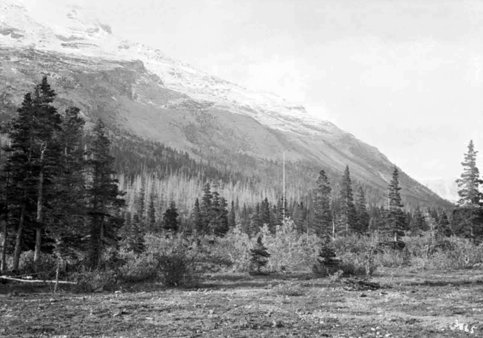
The seldom visited Cariboos are one of the most northerly and extensive mountain chains of interior British Columbia. They are also known — perhaps officially — as the McLennan Range, while the higher peaks are called the Premier Group. In this article the names of the peaks originally given by Allen Carpé and Don Munday are used. The region’s center lies some 15 miles southeast of Tête Jaune, a station on the Prince Rupert line of the Canadian National Railroad, in the triangle of high peaks formed by Mount Titan (Sir Wilfrid Laurier, ca. 11,750 ft.), Mount David Thompson (Sir John Thompson, ca. 11,250 ft.) and Mount Kiwa (Sir John Abbott, ca. 11,200 ft.). The mountains are high and heavily glaciated, but not especially difficult for the alpinist [3].
Many place names in the region were changed by the Premier Range proclimation in 1927.

Mt. Thompson on the Canoe River near Cranberry Lake. Benjamin F. Baltzly, 1871
McCord Stewart Museum
Because of the relative proximity of Canoe Mountain and Mount Thompson at the head of the Canoe River, this name likely refers to explorer David Thompson [1770–1857], who overwintered at the mouth of the Canoe at Boat Encampment in 1811, before beginning his journey down the Columbia River to the Pacific Ocean.
In the reports of Ray Zillmer [1887–1960] on the exploration of the source of the North Thompson River, the “Thompson” mentioned is Sir John Thompson, Canada’s fifth Prime Minister (the name “Mount Sir John Thompson”, about 40 km northwest of here, was adopted in September 1927).

Terry Fox in Toronto during his Marathon of Hope cross-country run (July 1980)
Wikipedia
Terrence Stanley Fox [1958-81], a native of Port Coquitlam, British Columbia, set out in 1980 on a cross-country run to raise money for cancer research. Fox had lost his right leg to cancer in 1977.
At Thunder Bay, after running over 3,300 miles, Fox was forced to stop his “Marathon of Hope,” to which Canadians contributed $22 million. In 1980, Fox became the youngest companion of the Order of Canada.
When the Province of British Columbia made this mountain a memorial to Terry Fox, at 2651 metres in altitude it was the highest unnamed peak in B.C. within sight of a public highway. The dedication ceremony in September 1981 was attended by B.C. premier Bill Bennett.