Alberta. Lake: Athabasca River drainage
E of Jasper Lake
53.0978 N 117.9942 W — Map 083F04 — Google — GeoHack
Name officially adopted in 1956
Topo map from Canadian Geographical Names
E of Jasper Lake
53.0978 N 117.9942 W — Map 083F04 — Google — GeoHack
Name officially adopted in 1956
Topo map from Canadian Geographical Names
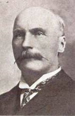
Peter Talbot. Appointed to the Senate of Canada in 1906, served during the premierships of Wilfred Laurier and Robert Borden until he died in 1919
Wikipedia [accessed 31 October 2026]

Named in 1925 after Peter Talbot [1854-1919], of Lacombe, Alberta. Member of the Senate of Canada from 1906 to 1919 [1].
Referred to as Fish Lake on McEvoy’s map of Yellowhead Pass, 1900 [2].
Also see
References:
- 1. Canadian Board on Geographical Names. Place-names of Alberta. Published for the Geographic Board by the Department of the Interior. Ottawa: Department of the Interior, 1928. Hathi Trust [accessed 10 March 2025]
- 2. McEvoy, James E., P.L.S. [1862–1935]. Report on the geology and natural resources of the country traversed by the Yellowhead Pass route from Edmonton to Tête Jaune Cache comprising portions of Alberta and British Columbia. Ottawa: Geological Survey of Canada, 1900. Natural Resources Canada