Akrigg, Helen B., and Akrigg, George Philip Vernon [1913–2001]. British Columbia Place Names. Vancouver: UBC Press, 1997. Internet Archive — [Albreda Lake] [Athabasca Pass] [Brown, Mount] [Caniche Peak] [Cariboo Mountains] [Fort St. James] [Fraser River] [Holmes River] [Intersection Mountain] [Kinbasket Lake] [Lempriere] [Morkill River] [Parsnip River] [Rocky Mountains] [Tête Jaune Cache] [Tonquin Pass] [Torpy River]
Alberta Land Surveyors’ Association. J. L. Cote. 2014. ALSA — [Côté, Mount]
Alberta Legislative Library. Alberta Legislative Library. Edmonton: — [Bess, Mount]
Allan, Hugh Drummond [1887–1917]. “Canoe River Valley.” Report of the Minister of Lands, (1914) — [Hugh Allan Creek] [Ptarmigan Creek (Kinbasket Lake)]
Alpine Club of Canada. “Exploration in the Yellowhead.” Canadian Alpine Journal, Vol. 3 (1911):117. Alpine Club of Canada — [Resplendent Mountain]
Alpine Club of Canada. Banff: Whyte Museum Archives. ACC Minute Book V14/AC 041M/7 (1906–1914). — [George Kinney]
Alpine Club of Canada. Banff: Whyte Museum Archives. Club records (1906–1924). — [George Kinney]
Alpine Club of Canada. Banff: Whyte Museum Archives. Constitution and List of Members. 1906-1930 (1930). — [George Kinney]
Amery, Leopold Charles Maurice Stennett [1873–1955]. “An attempt on Mount Robson.” Alpine Journal, Vol. 25 (1910–1911):293-305 — [George Kinney]
Amery, Leopold Charles Maurice Stennett [1873–1955]. Days of Fresh Air. Being reminiscences of outdoor life. London: Hutchinson Universal Book Club, 1940 — [George Kinney]
Andrews, Gerald Smedley [1903–]. Métis outpost. Memoirs of the first schoolmaster at the Métis settlement of Kelly Lake, B.C. 1923-1925. Victoria: G.S. Andrews, 1985 — [Dora Creek] [Hugh Allan Creek] [Kakwa River] [Morkill River] [Selwyn Range] [Teare, Mount]
Andrews, Gerald Smedley [1903–]. Professional Land Surveyors of British Columbia. Cumulative nominal roll. Victoria: Corporation of Land Surveyors of British Columbia, 1978 — [Driscoll Creek] [Jackman (railway point)] [Jessie, Mount] [McGregor River] [McLennan River] [Walker Creek]
Anon. “List of Members.” Canadian Alpine Journal, Vol. 1 (1907):188. Alpine Club of Canada — [Bridgland, Mount]
Anon. “Place names in the Premier Range, Cariboo Mountains, B.C.” Canadian Alpine Journal, Vol. 46 (1963):20. Alpine Club of Canada — [Chamberlin, Mount] [Hostility Glacier] [Laurier Glacier] [Mackenzie King, Mount] [North Canoe Glacier] [Premier Range] [Withers, Mount] [Zillmer, Mount]
Archives Society of Alberta. Jasper Yellowhead Historical Society Fitzhugh photograph collection. 1911–1927. Alberta on Record — [Fitzhugh]
Archives Society of Alberta. Jasper Yellowhead Historical Society Lucerne Photograph Collection. 1915–1950. Alberta on Record — [Lucerne (CNoR railway point)]
Arrowsmith, Aaron [1750–1823]. A Map Exhibiting All the New Discoveries in the Interior Parts of North America. Engraved by Lowry. Cadell and Davies, 1795. Historical Atlas of Canada — [Athabasca, Lake] [Leather Pass] [Maps and Documents] [Rocky Mountains]
Arrowsmith, John [1790–1873]. “British Columbia, reduced copy of the map referred to in the despatch of Governor Douglas of 16 July 1861.” (1861). University of Victoria — [North Thompson River]
Arrowsmith, John [1790–1873]. Provinces of British Columbia and Vancouver Island; with portions of the United States and Hudson’s Bay Territories. 1859. UVic — [Athabasca Pass] [British Columbia] [Brown, Mount] [Buffalo Dung Lake] [Canoe Encampment] [Canoe River] [Columbia River] [Committee Punch Bowl] [Cow Dung Lake] [Cranberry Lake] [Fraser River] [Hooker, Mount] [John Arrowsmith’s map BC 1859] [Leather Pass] [Miette River] [Moose Lake] [North Fork, Fraser River] [North Thompson River] [Orignal, Lac] [South Fork Fraser River] [Tête Jaune Cache] [Thompson River] [Yellowhead Pass]
Aubrey, Merrily K. Concise Place Names of Alberta. University of Calgary Press, 2006 — [Athabasca River] [Athabasca, Lake]
Aubrey, Merrily K. Place Names of Alberta. Volume IV: Northern Alberta. University of Calgary Press, 1996 — [Athabasca River] [Athabasca, Lake]
Augustine, A. P. Report on surveys on the South Fork of Fraser River. Victoria: Province of British Columbia, 1913. Google Books — [Mica Mountain] [Ptarmigan Creek (Kinbasket Lake)] [Resplendent (GTP railway point)] [Tête Jaune Cache] [Whyte Museum to-do]
BC Archives. John Niven interview. 1960 BC Archives: John Niven interview, 1960s. BC Archives: John Niven interview, 1960s — [Nevin Creek]
Bell, Fred C. “Dr. Tom George Longstaff 1878–1964.” Canadian Alpine Journal, Vol. 48 (1965):161-164. Alpine Club of Canada
— [Longstaff, Mount]
Bell, G. T., and Hinton, William Pittman [1871–1955]. “Grand Trunk Pacific Railway. Mount Robson.” Canadian Alpine Journal, Vol. 2 (1909):136. Alpine Club of Canada — [Mount Robson]
Bennett, Russell H. “The Ski Ascent of Snow Dome.” Canadian Alpine Journal, Vol 20 (1931):100-101. Alpine Club of Canada — [Withers, Mount]
Berton, Pierre Francis deMarigny [1920–]. The national dream: the great railway 1871–1881. Toronto: McLelland and Stewart, 1970 — [Kinbasket Lake]
Bohi, Charles W. Canadian National’s Western Depots. The Country Stations in Western Canada. Railfare Enterprises, 1977 — [Albreda (CNoR railway point)] [Grand Trunk Pacific Railway map 1919] [Jasper] [Lucerne (CNoR railway point)] [Mount Robson (railway point)] [Raush Valley (railway point)] [Red Pass Junction] [Valemount]
Bohi, Charles W., and Kozma, Leslie S. Canadian National’s Western Stations. Don Mills, Ontario: Fitzhenry & Whiteside, 2002 — [Brûlé] [Canadian National Railway map 1925] [Crescent Island] [Decoigne] [Foster ] [Goat River (railway point)] [Grant Brook (GTP railway point)] [Henry House] [Interlaken] [Mount Robson (railway point)] [Prince George] [Rainbow (CNoR railway point)] [Rainbow (GTP railway point)] [Resplendent (CNoR railway point)] [Resplendent (GTP railway point)] [Rider] [Shere] [Snaring] [Swift Creek (railway point)] [Urling] [Yellowhead (railway point)]
Boudreau, Jack. Sternwheelers and canyon cats: Whitewater freighting on the upper Fraser. Qualicum Beach, BC: Caitlin Press, 2006 — [Grand Canyon]
Bowman, Amos B. [1839–1894]. Map of the Cariboo Mining District, British Columbia, to illustrate the report of Amos Bowman. 1895. Cariboo Gold Rush — [Bowman 1895 Map Cariboo district] [Cariboo Mountains] [Cariboo Range] [Maps and Documents]
Bowman, Amos B. [1839–1894]. Maps of the principal auriferous creeks in the Cariboo mining district, British Columbia. Ottawa: Geological Survey of Canada, 1895. Hathi Trust — [Bowman 1895 Map Cariboo district] [Cariboo Mountains] [Cariboo Range] [Maps and Documents]
Bradley, Ben. “Lucerne no longer has an excuse to exist: Mobility and Landscape in the Yellowhead Pass.” BC Studies, No. 189 (2016):59-75 — [Lucerne (CNoR railway point)]
Brewster, Fred [1883–1969]. Fred Brewster fonds. V86/M53. Includes scrapbook titled “Mt. Sir Alexander,” 1912-1967, attributed to Fred Brewster. (1887). Whyte Museum — [Whyte Museum to-do]
Bridgland, Morrison P. [1878–1948]. “Report of the Chief Mountaineer [Paradise Valley camp].” Canadian Alpine Journal, Vol. 1, No. 2 (1908):122. Alpine Club of Canada — [George Kinney]
Bridgland, Morrison P. [1878–1948]. “Report of the Chief Mountaineer [Yoho camp].” Canadian Alpine Journal, Vol. 1 (1907):131. Alpine Club of Canada — [George Kinney] [Interlaken]
British Columbia Geographical Names — [Abrams Creek] [Adolph Creek] [Albreda (CNoR railway point)] [Alpland Ridge] [Alpland station] [Arctic Lake] [Arctic Pacific Lakes Park] [Arrowhead, The] [Avalanche Pass] [Baker Creek] [Barbican Peak] [Beaverpelt Lake] [Bennington Glacier] [Berg Glacier] [Big Bell Mountain] [Blackmore Creek] [Boreal Creek] [Bounding Creek] [British Columbia] [Bryce, Mount] [Bulldog Creek] [Campion Creek] [Cariboo Mountains] [Carpé, Mount] [Casemate Mountain] [Centennial Creek] [Chalco Creek] [Chamberlin, Mount] [Chappell Creek] [Chilkst Peaks] [Clairvaux, Mount] [Cochrane Creek] [Columbia River] [Côté, Mount] [Cottonwood Creek] [Cowdung Lake] [Crescent Spur Creek] [Diamond Willow Creek] [Driscoll Creek] [Dunster Creek] [Edand Creek] [Emperor (railway point)] [Encampment Creek] [Ernest Peak] [Evanoff Park] [Everett Creek] [Extinguisher Tower] [Fort George] [Fort St. James] [Fraser River] [Geikie, Mount] [George Graham, Mount] [Goodell Creek] [Guilford] [Halvorson, Mount] [Hanington Creek] [Hanington Pass] [Hanington, Mount] [Hargreaves Lake] [Holy Cross Mountain] [Ian Monroe, Mount] [Jackpine Creek] [James Creek] [Jarvis Pass] [Jarvis, Mount] [Kakwa Lake] [Kakwa Provincial Park] [Kakwa River] [Kataka Mountain] [Kitchi Mountain] [Knowlton Falls] [Knutson Creek] [La Salle Lakes] [Little Bell Mountain] [Longworth] [Loos] [Louis St-Laurent, Mount] [Lower Raush Protected Area] [Lunn, Mount] [Mackenzie King, Mount] [McGregor River] [McNaughton Lake] [Monashee Mountains] [Monroe, Mount] [Morkill River] [Morkill, Mount] [Mount Robson Park] [North Thompson Oxbows East Park] [North Thompson River] [Overlander Mountain] [Ozalenka Creek] [Ozalenka Lake] [Ozalenka Peak] [P.O.B. Creek] [Paragon Peak] [Parapet Peak] [Parsnip River] [Pauline, Mount] [Peace River] [Pierre Elliott Trudeau, Mount] [Pommel Mountain] [Premier Range] [Prince George] [Raush River] [Rearguard Falls Park] [Rider] [Rocky Mountains] [Saddle Lakes] [Sir Alexander, Mount] [South Fork Fraser River] [Teare Creek] [Terry Fox Creek] [The Beaver] [The Blackwater Tusk] [Thompson River] [Titkana Peak] [Tumbledick Creek] [Upper Raush Protected Area] [Walker Creek] [West Twin Creek] [West Twin Park] [Zillmer Creek] [Zillmer, Mount]
British Columbia Parks — [Ancient Forest / Chun T’oh Whudujut Park] [Arctic Pacific Lakes Park] [Erg Mountain Park] [Evanoff Park] [Holliday Creek Arch Protected Area] [Jackman Flats Park] [Kakwa Provincial Park] [Lower Raush Protected Area] [Mount Robson Park] [Mount Terry Fox Park] [North Thompson Oxbows East Park] [North Thompson Oxbows Manteau Park] [Ptarmigan Creek Park] [Rearguard Falls Park] [Small River Caves Park] [Snowbird Pass] [Sunbeam Creek Ecological Reserve] [Upper Raush Protected Area] [West Twin Park]
Browne, Colin. Motion picture production in British Columbia: 1898–1940. A brief historical background and catalogue. British Columbia Provincial Museum Heritage Record No. 6. Victoria: Province of British Columbia, Ministry of the Provincial Secretary and Government Services, 1979 — [George Kinney]
Bulyea, H. E. “A trip to the Geikie valley.” Canadian Alpine Journal, Vol. 13 (1923):140. Alpine Club of Canada — [Geikie, Mount]
Burpee, Lawrence Johnstone [1873–1946]. Among the Canadian Alps. New York: John Lane, 1914 — [George Kinney]
Canadian Board on Geographical Names. Place-names of Alberta. Published for the Geographic Board by the Department of the Interior. Ottawa: Department of the Interior, 1928. Hathi Trust — [Caledonian Valley] [Colin Range] [McGillivray Ridge] [Peace River] [Robson Pass] [Roche Miette] [Rocky Mountains] [Smoky River] [Snake Indian River] [Snaring River] [Talbot, Mount] [Tatei Ridge] [Tête Roche] [Toponymy] [Twins, The] [Upright Creek] [Upright Mountain] [Upright Pass]
Canadian Federation of University Women. Prince George, British Columbia. Street names. A-Z.. Prince George, B.C.: Canadian Federation of University Women, Prince George branch, 1970 — [La Salle Lakes] [Pierrway, Mount]
Canadian National Railways Historical Association. Timetables. Canadian National Railway, 1977. CNRHA — [CNR Subdivisions]
Canoe Mountain Echo. Weekly newspaper published at Valemount by Pyramid Press of Jasper. Last issue, June 1988.. 1988 — [Kimmel, Mount]
Carpé, Allen [1894–1932]. “Albreda Mountain.” Canadian Alpine Journal, Vol. 16 (1927–1927):177. Alpine Club of Canada — [Albreda, Mount] [Chamberlin Peak] [David Thompson, Mount] [Withers, Mount]
Carpé, Allen [1894–1932]. “Climbs in Cariboo Mts. and Northern Gold Range, Interior Ranges of British Columbia.” Alpine Journal, Vol. 37 (1925):63 — [David Glacier] [David Pass] [Hostility, Mount] [Sir John Thompson, Mount] [Sir Wilfrid Laurier, Mount] [Whyte Museum to-do]
Carr, Stanley Joseph (Windy) [1890–1983]. Stan (Windy) Carr interview (1970). Archives and Library, Whyte Museum of the Canadian Rockies — [Carr Road] [Whyte Museum to-do]
Carr, Stanley Joseph (Windy) [1890–1983]. Stan J. Carr fonds V127/M179 (1910–1976). Archives and Library, Whyte Museum of the Canadian Rockies — [Carr Road] [Whyte Museum to-do]
Cautley, Richard William [1873–1953], and Wheeler, Arthur Oliver [1860–1945]. Report of the Commission Appointed to Delimit the Boundary between the Provinces of Alberta and British Columbia. Part I: From 1913 to 1916. Ottawa: Office of the Surveyor General, 1917. Internet Archive — [Interprovincial Boundary Commission]
Cautley, Richard William [1873–1953]. High lights of memory : incidents in the life of a Canadian surveyor. 1950. Whyte Museum — [Whyte Museum to-do]
Chamberlin, Rollin Thomas [1881–1948]. “Exploration of the Cariboo Mountains of British Columbia.” Bulletin of the Geographical Society of Philadelphia, 25 (1925):59-76 — [Chamberlin Peak]
Chamberlin, Rollin Thomas [1881–1948]. Rollin T. Chamberlin fonds V22. 1910–1927. Whyte Museum — [Chamberlin Peak] [Whyte Museum to-do]
Chamberlin, Rollin Thomas [1881–1948]. Rollin T. Chamberlin fonds. V22 (1910–1927). Archives and Library, Whyte Museum of the Canadian Rockies — [Whyte Museum to-do]
Charles, John Leslie. University of Manitoba Archives & Special Collections. John Leslie Charles fonds (1908–1989). University of Manitoba Archives & Special Collections — [Charles]
Cheadle, Walter Butler [1835–1910]. Cheadle’s Journal of Trip Across Canada 1862-63. Ottawa: Graphic Publishers, 1931. University of British Columbia Library — [Buffalo Dung Lake] [Cheadle, Mount] [Grand Fork] [O’Beirne, Mount]
City of Vancouver Archives. Walker, J. Alexander (2000). City of Vancouver Archives — [Walker Creek]
CN (Canadian National Railway). Transportation planning branch, Edmonton, and historical office, Montréal. 2000 — [Charles] [Foster ] [Guilford] [Jackman (railway point)] [Legrand] [Lubin] [McCabe] [Morey] [Peterson] [Poser] [Shere] [Spicer (railway point)] [Taverna (railway point)] [Urling] [Von Zuben (railway point)]
Cochrane, Myrtle Mae Ishbel (Hargreaves) [1924–]. Cochrane and Hargreaves. 1970. Valemount & Area Museum — [Anne-Alice, Mount] [Hargreaves Glacier]
Cochrane, Myrtle Mae Ishbel (Hargreaves) [1924–]. Jasper-Yellowhead Museum & Archives. Fonds JAS-2636 (1920–1955). Archives Society of Alberta — [Hargreaves Glacier]
Coleman, Arthur Philemon [1852–1939]. “Expedition to Mt. Robson.” Canadian Alpine Journal, Vol. 1, No. 2 (1908):100-103. Alpine Club of Canada — [Coleman Glacier] [Coleman’s map of Mount Robson 1910] [Robson, Mount]
Coleman, Arthur Philemon [1852–1939]. “Geology and glacial features of Mt. Robson.” Canadian Alpine Journal, Vol. 2, No. 2 (1910):73-78. Alpine Club of Canada — [Coleman Glacier] [Coleman’s map of Mount Robson 1910] [Robson Glacier]
Coleman, Arthur Philemon [1852–1939]. “Mount Robson, the Highest Point in the Canadian Rockies.” The Geographical Journal (London), Vol. 36, No. 1 (July 1910). JSTOR — [Coleman Glacier] [Coleman’s map of Mount Robson 1910] [Kinney Lake] [Resplendent Mountain] [Swift (railway point)] [Whyte Museum to-do]
Coleman, Arthur Philemon [1852–1939]. “The Causes of Mountain Forms in the Canadian Rockies.” Canadian Alpine Journal, Vol. 1, No. 2 (1908):23. Alpine Club of Canada — [Coleman Glacier] [Coleman’s map of Mount Robson 1910]
Coleman, Arthur Philemon [1852–1939]. The Canadian Rockies: New and Old Trails. London: T. Fisher Unwin, 1911. Internet Archive — [Adolphus Lake] [Blue Glacier] [Brown, Mount] [Coleman Glacier] [Coleman’s map of Mount Robson 1910] [Extinguisher Tower] [Fitzwilliam, Mount] [George Kinney] [Grand Forks River] [Helmet, The] [Hooker, Mount] [Lynx Mountain] [Maps and Documents] [Moose Pass] [Mount Robson] [Ptarmigan Peak] [Rearguard Mountain] [Robson Glacier] [Swift (railway point)] [The Dome] [Tumbling Glacier] [Yates Trail]
Coleman, John T. “Magnificent Failure.” B.C. Magazine, (1957) — [George Kinney]
Collie, John Norman [1859–1942]. “Early Expeditions of the Rocky Mountains.” Alpine Journal, Vol. 33 (1920–1921):319 — [Collie’s map Yellowhead Pass 1912]
Collie, John Norman [1859–1942]. “Exploration in the Rocky Mountains North of the Yellowhead Pass.” The Geographical Journal (London), 39 (1912):223-233. JSTOR — [Collie’s map Yellowhead Pass 1912] [Mammoth Mountain] [Rainbow Canyon and Falls (Moose River)]
Collie, John Norman [1859–1942]. “On the Canadian Rocky Mountains north of the Yellowhead Pass.” Alpine Journal, Vol. 26 (1912):5-17 — [Bess, Mount] [Collie’s map Yellowhead Pass 1912] [Mount Robson] [Yates Trail] [Yellowhead Mountain] [Yellowhead Pass]
Colombo, John Robert. Canadian Literary Landmarks. Willowdale, Ont.: Hounslow Press, 1984 — [Rider, Mount]
Columbia Basin Institute of Regional History. B.C.’s first registered female trapper. 2020 CBIRH. CBIRH — [Ella Frye Creek]
Connelly, Dolly. “Berg Lake.” The Beaver, 312:3 (1981) — [Anne-Alice, Mount]
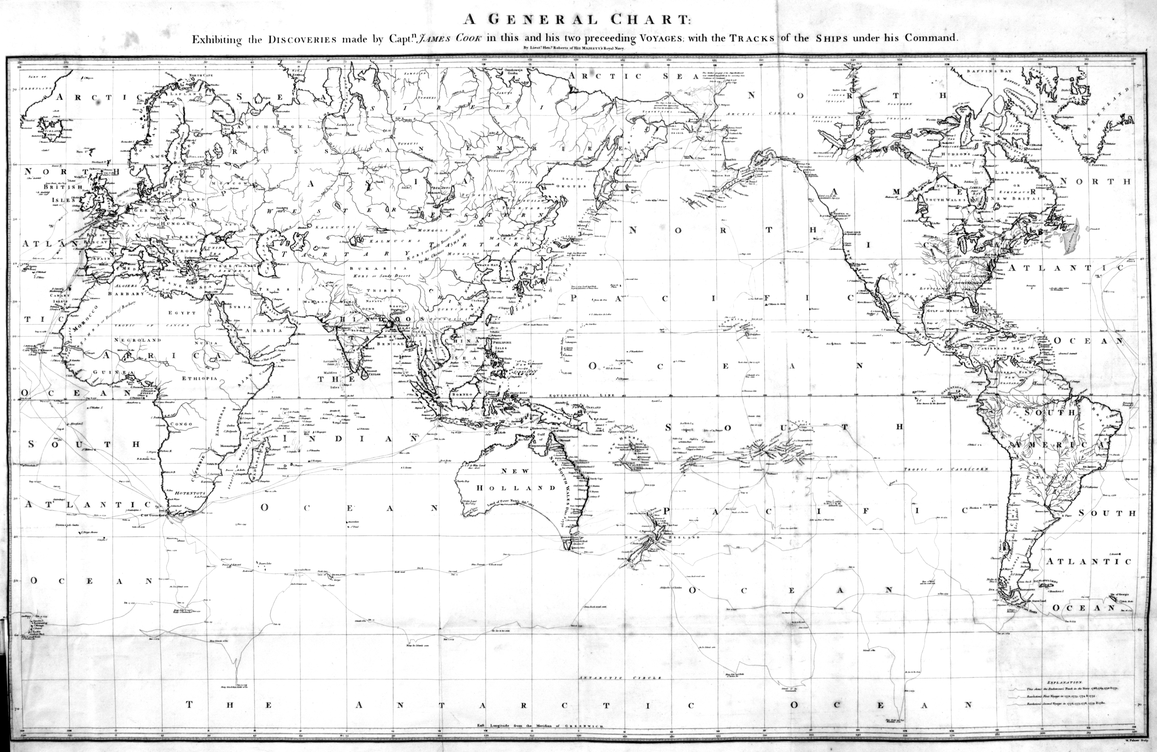
Cook, James [1728–1779]. A Voyage to the Pacific Ocean. Undertaken, by the Command of His Majesty, for Making Discoveries in the Northern Hemisphere, to Determine the Position and Extent of the West Side of North America; Its Distance from Asia; and the Practicability of a Northern Passage to Europe. Performed under the Direction of Captains Cook, Clerke, and Gore, in His Majesty’s Ships the Resolution and Discovery, in the Years 1776, 1777, 1778, 1779, and 1780.. London: G. Nicol, & T. Cadell, 1784. Internet Archive — [Cook’s world map 1874] [Maps and Documents]
Copping, Arthur Edward. Canada. Today and To-morrow. London: Cassell, 1911 — [George Kinney]
Corporation of Land Surveyors of the Province of British Columbia. Annual Reports. — [Hugh Allan Creek] [McGregor River] [Morkill River]
Coryell, John A. Abstracts from reports on Cariboo District made by B.C. Land surveyors, 1891-1927. Victoria: British Columbia Lands Department, 1927 — [Torpy River] [Whyte Museum to-do]
Côté, Jean Gustave. Senator Jean Léon Côté: Pioneer Land Surveyor and Early Legislator. Edmonton: Jean G. Côté, 1992. Whyte Museum — [Côté, Mount] [Whyte Museum to-do]
Davies, David L. “Not ‘A Bridge Too Far’ But One Far Enough or How the G.T.P. Crossed the Fraser at Prince George, British Columbia.” Canadian Rail, No. 476 May-June (2000):67–82. Exporail — [Legrand]
Dawson, George Mercer [1849–1910]. “Notes on the Shuswap people of British Columbia.” Transactions of the Royal Society Canada, Section 2 (1891). University of British Columbia — [Robson, Mount] [Yuh-hai-has-kun]
Dearness, John. “E. W. D. Holway 1853–1923.” Mycologia, 38 (1946):115-230. Mycologia — [Holways Peak]
Deaville, E. “Colonel A. Laussedat. In memoriam.” Canadian Alpine Journal, Vol. 1, No. 2 (1908):98. Alpine Club of Canada — [Colonel, The]
Douglas, David [1799–1834]. Journal kept by David Douglas during his travels in North America 1823-1827, together with a particular description of thirty-three species of American oaks and eighteen species of Pinus, with appendices containing a list of the plants introduced by Douglas and an account of his death in 1834. Royal Horticultural Society, 1914. Internet Archive — [Brown, Mount] [Hooker, Mount]
Dower, John. The western portion of British North America, showing the route followed by Lord Milton & Dr. Cheadle, from the Saskatchewan to British Columbia, 1863-4. 1864. University of British Columbia Library — [Milton and Cheadle’s map 1865]
Annual Report of the Director of the National Park Service to the Secretary of the Interior for the Fiscal Year Ended June 30, 1932, and the Travel Season, 1932. Washington: United States Government Printing Office, 1932. Google Books — [Carpé, Mount]
British Columbia Provincial Archives. 1960. BC Archives — [Goodell Creek]
Historical Atlas of Canada. Historical Atlas online. Historical Atlas online — [Aaron Arrowsmith’s map North America 1795]
Lheidli T’enneh. 2022 Lheidli T’enneh First Nation. Lheidli T’enneh First Nation — [Ancient Forest / Chun T’oh Whudujut Park]
Mount Robson Park management plan. 2011. BC Parks — [Arctomys Cave]
Ermatinger, Edward [1797–1876]. Edward Ermatinger’s York Factory express journal, being a record of journeys made between Fort Vancouver and Hudson Bay in the years 1827–1828. Ottawa: Transactions of the Royal Society of Canada, 1912. Internet Archive — [Ermatinger Mountain] [Fitzhugh]
Fabergé, A. C. “A sketch map of the Cariboo Range.” Canadian Alpine Journal, Vol. 27 (1950):119. Alpine Club of Canada — [Fabergé 1949 map Cariboo] [Maps and Documents]
Fairhall, Charles. “Surveyors of the Past. Roderick M. McLennan, 1805–1908. Civil Engineer, Land Surveyor, Explorer.” Ontario Land Surveyor, Summer (1983):27-28. Krcmar — [McLennan River]
Fay, Charles Ernest [1846–1923]. “Recent Mountaineering in the Canadian Alps.” Geographical Review, Vol. 2, No. 1 (1916):1. JSTOR — [Charles Ernest Fay 1916 map Canadian Alps] [George Kinney] [Maps and Documents]
Fay, Charles Ernest [1846–1923]. “The Canadian Rockies between the Yellowhead Pass and the Peace River.” Appalachia , 13, no. 3 (1915) — [Mumm Peak]
Fay, Samuel Prescott [1884–1971]. “Mount Alexander.” Canadian Alpine Journal, Vol. 6 (1914–1915):121. Alpine Club of Canada — [Ida, Mount] [Kakwa River] [Maps and Documents] [Samuel Prescott Fay 1915 map Mount Sir Alexander] [Sheep Creek] [Sir Alexander, Mount]
Fay, Samuel Prescott [1884–1971]. “Note on Mount Alexander Mackenzie and Mount Ida.” Alpine Journal, Vol. 36 (1924):421 — [Ida, Mount] [Kakwa River] [Kitchi, Mount] [Sir Alexander, Mount]
Fay, Samuel Prescott [1884–1971]. The Forgotten Explorer: Samuel Prescott Fay’s 1914 Expedition to the Northern Rockies. Edited by Charles Helm and Mike Murtha. Victoria, B.C.: Rocky Mountain Books, 2009 — [Kitchi Mountain] [Kitchi, Mount] [Maps and Documents] [Morkill, Mount] [Samuel Prescott Fay 1915 map Mount Sir Alexander] [Sir Alexander, Mount]
Fay, Samuel Prescott [1884–1971]. Jasper-Yellowhead Historical Society. Album of pictures accompanying S.P. Fay journal of trip through Rockies from Yellowhead, Alberta, Pass, to Peace River at Hudsons Hope, B.C, 1914. JYHS No. 84 or 91 (1912–1914). — [Whyte Museum to-do]
Fleming, J. A., editor. Terrestrial Magnetism and Electricity. Physics of the Earth. Vol. 8. New York and London: McGraw-Hill, 1939. Internet Archive — [Rooney]
Fleming, Sandford [1827–1915]. “Memories of the Mountains: The Yellow Head Pass.” Canadian Alpine Journal, Vol. 1 (1907):11. Alpine Club of Canada — [McCord, Mount] [Yellowhead Pass]
Foster, William Wasborough [1875–1954]. “Mount Robson.” Canadian Alpine Journal, Vol. 6 (1914–1915):16-22. Alpine Club of Canada — [George Kinney]
Franchère, Gabriel [1786–1863]. Narrative of a Voyage to the Northwest Coast of America, in the years 1811, 1812, 1813, and 1814, or the First American Settlement on the Pacific. Translated and edited by J. V. Huntington. New York: Bedfield, 1854. Gutenberg — [Athabasca Pass] [Jasper] [McGillivray Ridge] [Miette Pass] [Roche Miette]
Fraser, Esther Augusta [1919–1978]. Wheeler. Banff: Summerthought, 1978 — [George Kinney] [Mount Robson Park] [Toponymy]
Fraser, Simon [1776–1862]. The letters and journals of Simon Fraser, 1806-1808. Edited by W. Kaye Lamb. Toronto: MacMillan, 1960. Internet Archive — [Fraser River] [Tacoutche Tesse] [Thompson River]
Frazer, Leonard. “Caribou Joe and the building of the Grand Trunk Pacific.” Prince George Citizen, 17 May (2011). Prince George Citizen — [Henningville]
Fynn, Val A. “First ascents of Mt. Barbican 10,100 feet and of Mt.Geikie 10,854 feet.” Canadian Alpine Journal, Vol. 14 (1924):60-66. Alpine Club of Canada — [Barbican Peak]
Gainer, Brenda. The human history of Jasper National Park, Alberta. Manuscript report 441. Ottawa: Parks Canada, 1981. Parks Canada — [Adolphus Lake] [Athabasca Pass] [Grand Trunk Pacific Railway] [Jasper National Park of Canada] [McGillivray Ridge]
Gates, Charles Marvin. Five fur traders of the Northwest : being the narrative of Peter Pond and the diaries of John Macdonell, Archibald N. McLeod, Hugh Faries, and Thomas Conner . Minneapolis: University of Minnesota Press, 1933 — [Tête Jaune Cache]
Geographical Names Secretariat. Energy, Mines and Resouces Canada, Ottawa. — [Fetherstonhaugh Pass]
Gilmour, Andrew James [1871–1941]. “Beyond Mount Robson: First Ascent of Mount Sir Alexander.” Canadian Alpine Journal, Vol. 18 (1929):22-32. Alpine Club of Canada — [Samuel Prescott Fay 1915 map Mount Sir Alexander]
Grand Trunk Pacific Railway. Main Line Between Winnipeg, Edmonton, and Prince George. Table 5 — Tête Jaune to Prince George. 1914 — [Grand Trunk Pacific Railway] [Shere]
Grant, George Monro [1835–1902]. Ocean to Ocean: Sanford Fleming’s Expedition through Canada in 1872. Being a Diary Kept During a Journey from the Atlantic to the Pacific with the Expedition of the Engineer-in-Chief of the Canadian Pacific and Intercolonial Railways. Toronto: James Campbell and Son, 1873. Google Books — [Caledonia Mountain] [Cheadle, Mount] [George Monro Grant’s map of Yellowhead Pass 1872] [Grand Fork] [Grand Forks River] [Grant Brook] [Maps and Documents] [McLennan River] [O’Beirne, Mount] [Rocky Mountains] [Scarp Mountain] [Toponymy] [Yellowhead Lake]
Gray, Alexander Torrence. “Lucerne, British Columbia 1913–1924. Notes from a slide show.” (1913–1924). CN Pensioners Association — [Lucerne (CNoR railway point)]
H. P. “Gilmour, Andrew James, 1871 –1941.” American Alpine Journal, (1942). American Alpine Club — [Gilmour Glacier]
Haggard, Henry Rider [1856–1925]. Rider Haggard, A Biography. New York: Stein and Day, 1981 — [Rider, Mount]
Haggard, Henry Rider [1856–1925]. The Private Diaries of Sir Henry Rider Haggard 1914-1925. Higgins, D.S. (ed.). New York: Stein and Day, 1980 — [Rider, Mount]
Haggard, Henry Rider. Days of my life. An Autobiography. London: Longmans, Green, 1926. Internet Archive — [Rider, Mount]
Hall, H. S. (Jr.). “Allen Carpé 1894–1932.” Canadian Alpine Journal, Vol. 21 (1932):163. Alpine Club of Canada — [Carpé, Mount] [Challenger, Mount] [Paragon Peak]
Hall, Henry S. “Samuel Prescott Fay, 1884–1971.” American Alpine Journal, (1972). American Alpine Club — [Samuel Prescott Fay 1915 map Mount Sir Alexander]
Hall, William Lashley. Victoria: Provincial Archives of BC, Robson file (1934). — [George Kinney]
Hamilton, Jacques. Mountain men. Our Alberta Heritage Series II. Calgary: Calgary Power Ltd., 1975 — [George Kinney]
Hanington, Charles Francis [1848–1930]. Journal of Mr. C.F. Hanington from Quesnelle through the Rocky Mountains, during the winter of 1874-5. 1875. Internet Archive — [Hanington’s map Smoky River Pass 1875] [Ida, Mount] [Jarvis Pass] [Maps and Documents]
Haralson, Doris Neely. Northland Echoes. Yarrow, B.C.: Published by the author, Box 31, 1981 — [Croydon] [Davison Creek] [Tindill Creek]
Hart, Edward John. Diamond hitch: the early outfitters and guides of Banff and Jasper. Banff: Summerthought, 1979 — [Bess, Mount] [Hargreaves Glacier] [Harvey] [Phillips, Mount] [Yates Trail]
Harvey, Athelstan G. “The mystery of Mount Robson.” B.C. Historical Quarterly, (1937) — [Cloud Cap Mountain] [Leather Pass] [Robson River] [Robson, Mount]
Hearne, Samuel [1745–1792]. A journey from Prince of Wales’s Fort in Hudson’s Bay to the Northern Ocean, in the years 1769, 1770, 1771, and 1772. Tyrrell, Joseph Burr, 1858-1957. Totonto: Champlain Society, 1911. Internet Archive — [Cook’s world map 1874]
Hearne, Samuel, and Turnor, Phillip. Journals of Samuel Hearne and Philip Turnor between the years 1774 and 1792. Champlain Society, 1934. Internet Archive — [Athabasca, Lake]
Hector, James [1834–1907], and Spry, Irene Mary Biss [1907–1998], editor. Journal. Edited by Irene M. Sprye. Toronto: The Champlain Society, 1968 — [Roche Miette]
Hendricks, Sterling Brown [1902–1981], and Kauffman, Andrew John [1920–2002]. “Cariboo Climbing.” American Alpine Journal, 7:2 (1950). American Alpine Club — [Carpé, Mount] [Chamberlin Peak] [Withers, Mount]
Hickson, J. W. A. [1873–1956]. “Arnold Louis Mumm, 1859–1927.” American Alpine Journal, Volume 1 No. 1 (1929). American Alpine Club — [Mumm Peak]
Hickson, Joseph William Andrew. Banff: Whyte Museum Archives. J. Monroe Thorington fonds (1938). Whyte Museum — [George Kinney]
Hollister, Ned. “Mammals of the Alpine Club Expedition to the Mount Robson Region.” Canadian Alpine Journal, Vol. 4 No. 2 (1912):6-44. Alpine Club of Canada — [Buffalo Dung Lake]
Holmgren, Eric J., and Holmgren, Patricia M. Over 2,000 place names of Alberta. Saskatoon: Western Producer, 1973 — [Bess, Mount] [Forget, Mount] [Jessie, Mount] [Kidd] [Mastodon Peak] [McCord, Mount] [McDonnell Peak] [Tatei Ridge]
Holt, Vera E. The lantern era: a history of Cherhill, Rochfort Bridge, Sangudo, and the surrounding school districts. Sangudo, Alberta: Sangudo and District Historic Society, 1979 — [Bess, Mount]
Holway, Edward Willet Dorland [1853–1923]. “First ascent of Mt. Edith Cavell and explorations in the Mt. Longstaff Region.” Canadian Alpine Journal, Vol. 7 (1916):51-53. Alpine Club of Canada — [Horse Creek] [Small Creek]
Holway, Edward Willet Dorland [1853–1923]. “Mt. Longstaff.” Canadian Alpine Journal, 8 (1917):109. Alpine Club of Canada — [Longstaff, Mount]
Holway, Edward Willet Dorland [1853–1923]. “The Cariboo Mountains.” Canadian Alpine Journal, 8 (1917):36-39. Alpine Club of Canada — [Cariboo Mountains] [Holway Glacier] [Holways Peak] [Penny Mountain]
Hume, Blanche B. “The camp on Robson Pass.” Rod and Gun in Canada, (1913). — [George Kinney] [Helena, Lake]
Interprovincial Boundary Commission. Boundary between Alberta and British Columbia. Index Sheet 3. Ottawa: Office of the Surveyor General, 1924. Internet Archive — [Interprovincial Boundary Commission]
Interprovincial Boundary Commission. Boundary between Alberta and British Columbia. Sheet 35. Ottawa: Office of the Surveyor General, 1924. Internet Archive — [Pauline Creek]
Interprovincial Boundary Commission. Boundary between Alberta and British Columbia. Sheet 36. Ottawa: Office of the Surveyor General, 1924. Internet Archive — [Loren Lake]
Interprovincial Boundary Commission. Boundary between Alberta and British Columbia. Sheet 37. Ottawa: Office of the Surveyor General, 1924. Internet Archive — [Morkill, Mount]
Jackman, S. W. Portraits of the premiers: An informal history of British Columbia. Sidney, B.C.: Grey’s Publishing, 1969 — [John Oliver, Mount] [McBride]
Jasper-Yellowhead Historical Society Archives. J. B. Snape, Dominion Government Engineer, Jasper National Park, 1921–1949 (1921–1949). — [Goodair Peak]
Jasper-Yellowhead Historical Society. Jasper, Alberta: Jasper-Yellowhead Historical Society. Jasper-Yellowhead Museum and Archives . Jasper-Yellowhead Museum and Archives — [Jasper National Park of Canada] [Valemount]
Jobe Akeley, Mary Lenore [1878–1966]. “A winter journey to Mt. Sir Alexander and the Wapiti.” Canadian Alpine Journal, Vol. 9 (1918):58-65. Alpine Club of Canada — [Hargreaves Glacier] [Jobe, Mount] [Sir Alexander, Mount] [Wapiti Pass]
Jobe Akeley, Mary Lenore [1878–1966]. “Mt. Alexander Mackenzie.” Canadian Alpine Journal, Vol. 7 (1916):62–73. Alpine Club of Canada — [Ida, Mount] [Jarvis Pass] [Jobe, Mount] [Kitchi, Mount] [Phillips, Mount] [Sir Alexander, Mount] [Wapiti Pass]
Jobe Akeley, Mary Lenore [1878–1966]. “Mt. Kitchi: A New Peak in the Canadian Rockies.” Bulletin of the American Geographical Society, Volume 47, No. 7 (1915):481-497. JSTOR — [Avalanche Pass] [Bagg, Mount] [Beaver River] [Beaverdam Pass] [Doré River] [Forgetmenot Creek] [Forgetmenot Pass] [Jobe 1915 map Jarvis Pass to Yellowhead Pass] [Jobe, Mount] [Jones Pass] [Kitchi Mountain] [Kitchi, Mount] [Mammoth Mountain] [Sir Alexander, Mount] [The Beaver]
Jobe Akeley, Mary Lenore [1878–1966]. “The expedition to ‘Mt. Kitchi:’ A new peak in the Canadian Rockies.” Canadian Alpine Journal, Vol. 6 (1914–1915):135-143. Alpine Club of Canada
— [Avalanche Pass] [Jackpine Pass] [Jobe, Mount] [Kitchi Mountain] [Kitchi, Mount] [Sir Alexander, Mount]
Johnson, Alfred W. Report on Surveys between Tête Jaune Cache and the North Thompson River, on the route of the Canadian Northern Pacific Railway. December 14, 1912. Victoria: Province of British Columbia, 1913. Google Books — [Cranberry Lake]
Judd, Carol M., and Ray, Arthur J. Old trails and new directions. Papers of the third North American fur trade conference. Toronto: University of Toronto, 1980 — [Kinney Lake]
Kain, Conrad [1883–1934]. “First ascent of Mt. Whitehorn.” Canadian Alpine Journal, Vol. 6 (1914–1915):42-43. Alpine Club of Canada — [Whitehorn Mountain]
Kain, Conrad [1883–1934]. “The first ascent of Mt. Robson, the highest peak of the Rockies.” Canadian Alpine Journal, Vol. 6 (1914–1915):22-. Alpine Club of Canada — [George Kinney]
Kain, Conrad [1883–1934]. Where the clouds can go. J. Monroe Thorington. New York City: American Alpine Club, 1935 — [Kain, Mount]
Kain, Conrad [1883–1934]. Banff: Whyte Museum Archives. Die Erstbesteigung des Höchsten Giflei der Rockies, Mt. Robson (1913). — [George Kinney]
Karamitsanis, Aphrodite. Place names of Alberta. Volume 1: Mountains, Mountain Parks and Foothills. Calgary: University of Calgary Press, 1991 — [Chown, Mount] [Columbia, Mount] [Edward Peak] [Ernest Peak] [Henry House] [Jasper] [Jones Pass] [Kitchener, Mount] [Pauline, Mount] [Rudolf Peak] [Temple, Mount] [Twins Tower] [Twins, The]
Kinney, George R. B. [1872–1961], and Phillips, Donald [1884–1938]. “To the top of Mount Robson.” Canadian Alpine Journal, Vol. 2, No. 2 (1910):21-44. Alpine Club of Canada — [Berg Glacier] [George Kinney] [Kinney Lake] [Swift (railway point)] [Thousand Falls, Valley of]
Kinney, George R. B. [1872–1961]. “Mount Robson.” Canadian Alpine Journal, Vol. 2 (1909):10-16. Alpine Club of Canada — [Berg Lake] [George Kinney] [Robson Glacier]
Kinney, George R. B. [1872–1961]. “Mount Stephen.” Canadian Alpine Journal, Vol. 1 (1907):91. Alpine Club of Canada — [George Kinney]
Kinney, George R. B. [1872–1961]. Canadian Mountain Climbing. Vancouver, B.C.: The Canadian Club of Vancouver, 1913 — [George Kinney]
Kinney, George R. B. [1872–1961]. Banff: Whyte Museum Archives. Alpine Club of Canada fonds, V14, M200 (1907). Whyte Museum — [Swift (railway point)]
Kinney, George R. B. [1872–1961]. Banff: Whyte Museum Archives. Geoge Kinney fonds M241 (1909). — [George Kinney]
Kinney, George R. B. [1872–1961]. London, England: Royal Geographical Society Archives. Letter to Arthur Hinks (1917). — [Berg Lake] [Rearguard Mountain]
Kinney, George R. B. [1872–1961]. Photographs and price lists (M200 / AC 014M) (1907). Whyte Museum — [George Kinney]
Klan, Yvonne Mearns. “That old Rogue, the Iroquois Tête Jaune.” British Columbia Historical News, Vol 34 No. 1 (Winter 2000/2001):19–22. University of British Columbia Archives — [Tête Jaune Cache]
Knight, James [1640–1721]. Life and death by the frozen sea : the York Fort journals of Hudson’s Bay Company governor James Knight 1714–1717. Edited by Arthur J. Ray. Toronto: The Champlain Society, 2018 — [Rocky Mountains]
Kopas, Cliff. Packhorses to the Pacific. Sidney, B.C.: Gray’s, 1976 — [Goat River]
Kruszyna, Robert, and Putnam, William Lowell. The Rocky Mountains of Canada north. 7th Edition.. New York and Banff: The American Alpine Club and the Alpine Club of Canada, 1985 — [Emperor Ridge]
Lacombe, Albert [1827–1916]. Dictionnaire de la langue des Cris. Montréal: C. O. Beauchemin & Valois, 1874. Internet Archive — [Athabasca, Lake]
Lewis, Meriwether, and Clark, William. The Journals of the Lewis and Clark Expedition. Edited by Gary E. Moulton. 1803–1806. The Journals of the Lewis and Clark Expedition Online — [Tacoutche Tesse]
Library and Archives Canada. Sir Arthur Conan Doyle Tour of Western Canada – Visit to Jasper National Park. 2015. Library and Archives Canada — [Seven Sisters]
Longstaff, Tom George [1875–1964]. This My Voyage. London: John Murray, 1950 — [Longstaff, Mount] [Tête Jaune Cache]
MacCarthy, Albert H. “William Wasborough Foster. In Memoriam.” Canadian Alpine Journal, Vol. 38 (1955):58. Alpine Club of Canada — [Foster Creek]
MacDonald, Ervin Austin. The Rainbow Chasers. Vancouver: Douglas & McIntyre, 1982 — [Spittal Creek] [Starvation Flats] [Tête Jaune Cache]
MacGregor, James Grierson. Overland by the Yellowhead. Saskatoon: Western Producer, 1974. Internet Archive — [Adolphus Lake] [Big Bell Mountain] [Camp Creek] [Deadmans Island] [Goat River] [Henningville] [Lucerne (CNoR railway point)] [McLennan River] [Mica Mountain] [Moose City] [Overlander Falls] [Rearguard Falls] [Red Pass Junction] [Renshaw, Mount] [Selwyn Range] [Shale Hill] [Swift (railway point)] [Swiftcurrent Creek] [Teare, Mount] [Yellowhead Lake]
MacGregor, James Grierson. Pack Saddles to Tête Jaune Cache. Edmonton: Hurtig, 1962 (reprint 1973) — [Adolphus Lake] [Driscoll Creek] [Fetherstonhaugh Pass] [Harvey] [Moose Lake] [Tête Jaune Cache]
Mackenzie, Alexander [1764–1820]. A map of America, between latitudes 40 and 70 North, and longitudes 45 and 180 West, exhibiting Mackenzie’s Track from Montreal to Fort Chipewyan and from thence to the North Sea in 1789 & to the West Pacific Ocean in 1793. London: T. Cadell, Jun., and W. Davies, 1803. Internet Archive — [Athabasca, Lake] [Mackenzie’s map North America 1803] [Maps and Documents]
Mackenzie, Alexander [1764–1820]. Voyages from Montreal on the River St. Lawrence through the Continent of North America to the Frozen and Pacific Oceans in the years 1789 and 1793. London: T. Cadell, Jun., and W. Davies, 1803. Internet Archive — [Athabasca, Lake] [Bad River (James Creek)] [Fraser River] [Little Lake] [Mackenzie’s map North America 1803] [Maps and Documents] [Portage Lake] [Sir Alexander, Mount] [Tacoutche Tesse]
McBride Cemetary. Grave markers. 2000 — [Bevier Creek] [Brownlee Road] [Channell Road] [Dawson Road] [Frear Road] [Garrett Road] [Martinson Creek] [McKale River] [Monroe, Mount] [Nevin Creek] [Stag Ranch] [Tityrn Lane]
McBride Courier. Weekly newspaper published by Leonard Sonneson from March to September, 1968. 1968 — [Jervis Road]
McBride, Sam. “Edward Worrell Jarvis in Western Canada.” Manitoba History, Number 78 (Summer 2015). Manitoba Historical Society — [Jarvis Pass]
McCaw, R. D. “Report of the Alberta and British Columbia Boundary Survey, Part I., 1913 to 1916 [review].” Canadian Alpine Journal, Vol. 10 (1919):77-79. Alpine Club of Canada — [Interprovincial Boundary Commission]
McDonald, Angus, and McDonald, Ervin. “Crossing Yellowhead Pass, 1907, with father Archie and brother Dan.” [Yellowhead Pass and its People, 1969], (1907) — [Swift (railway point)]
McElhanney, William Gordon. “Report on surveys on the Upper Fraser River below Yellowhead Pass. March 12, 1912.” Report of the Minister of Lands, (1913) — [Tête Jaune Cache] [Whyte Museum to-do]
McEvoy, James [1862–1935]. “Map Showing Yellowhead Pass Route From Edmonton To Tête-Jaune Cache.” (1900). Natural Resources Canada — [Albreda Lake] [Albreda River] [Avalanche Creek] [Cranberry Lake] [Dominion Prairie] [Geikie, Mount] [Grand Fork] [Grant Brook] [Maps and Documents] [McEvoy’s map Yellowhead Pass 1900] [McLennan River] [Mica Creek] [Moose Lake] [Moose River] [Mount Robson] [Price Creek] [Rainbow Range] [Robson, Mount] [Sand Creek] [Selwyn Range] [Swift Creek] [Swiftcurrent Creek] [Tête Jaune Cache] [Yellowhead Lake] [Yellowhead Pass]
McEvoy, James [1862–1935]. Report on the geology and natural resources of the country traversed by the Yellowhead Pass route from Edmonton to Tête Jaune Cache comprising portions of Alberta and British Columbia. Ottawa: Geological Survey of Canada, 1900. Natural Resources Canada — [Albreda River] [Collie’s map Yellowhead Pass 1912] [Dominion Prairie] [George Kinney] [Grant Brook] [Kinney Lake] [Maps and Documents] [McEvoy’s map Yellowhead Pass 1900] [Mount Robson] [Rainbow Range] [Robson, Mount] [Selwyn Range] [Shale Hill] [Swift (railway point)] [Swiftcurrent Creek] [Yellowhead Mountain]
McFarlane, Betty. Personal correspondence (1989). — [George Kinney]
McKirdy, Fern. “The early history of the Yellowhead and Tête Jaune.” Canoe Mountain Echo, (2 & 9 September 1987) — [Henningville] [McKirdy Creek] [Mile 53] [Nevin Creek]
McMillan, James. Winnipeg: Hudson’s Bay Company archives. Portion of letter James McMillan to William Connelly HBCA B.188/b/4 fo. 9-10 (1825). — [Buffalo Dung Lake] [Miette River] [Moose Lake] [Tête Jaune Cache]
McNaughton, Margaret [1856–1915]. Overland to Cariboo: An eventful journey of Canadian Pioneers to the gold fields of British Columbia in 1862. Toronto: Willliam Briggs, 1896. Internet Archive — [McNaughton, Mount] [Overlander Falls]
Mike von Zuben (son). Personal correspondence. 2001 — [Von Zuben (railway point)]
Milton, William Wentworth Fitzwilliam [1839–1877], and Cheadle, Walter Butler [1835–1910]. The North-West Passage by Land. Being the narrative of an expedition from the Atlantic to the Pacific, undertaken with the view of exploring a route across the continent to British Columbia through British territory, by one of the northern passes in the Rocky Mountains. London: Cassell, Petter and Galpin, 1865. Internet Archive — [Albreda Lake] [Bingley Peak] [Bucephalus Peak] [Buffalo Dung Lake] [Cheadle, Mount] [Colin Range] [Cow Dung Lake] [Fitzwilliam, Mount] [Grand Forks River] [Mahomet’s Bridge] [Malton Range] [Maps and Documents] [Milton and Cheadle] [Milton and Cheadle’s map 1865] [Milton, Mount] [Moose Lake] [Moose River] [O’Beirne, Mount] [Rockingham Falls] [Shale Hill] [Tête Jaune Cache] [Yellowhead Lake]
Milton, William Wentworth Fitzwilliam [1839–1877], and Cheadle, Walter Butler [1835–1910]. Voyage de l’Atlantique au Pacifique, à travers le Canada, les montagnes Rocheuses et la Colombie anglaise. Paris: Hachette, 1872. Internet Archive — [Milton and Cheadle] [Milton and Cheadle’s map 1865]
Mitchell, Charles Hamilton [1872–1941]. “Mt. Resplendent and the routes of ascent.” Canadian Alpine Journal, Vol. 6 (1914–1915):50–58. Alpine Club of Canada — [Resplendent Mountain]
Mitchell, Stanley Hamilton [1863–1940]. Banff: Whyte Museum Archives. AC 0 M 141. Stanley H. Mitchell scrapbook (1907–1914). Whyte Museum — [George Kinney]
Moberly, Walter [1832–1915]. The rocks and rivers of British Columbia. London: Blacklock, 1885. Faded Page — [Kinbasket Lake]
Morice, Adrien-Gabriel [1859–1939]. The Carrier Language (Déné Family): A Grammar and Dictionary Combined. Anthropos. St. Gabriel-Mödling near Vienna, Austria: 1932. WorldCat — [Tacoutche Tesse]
Morice, Adrien-Gabriel [1859–1939]. The history of the Northern Interior of British Columbia (formerly New Caledonia). Toronto: William Briggs, 1904. Internet Archive — [New Caledonia] [Overlander Falls] [Tacoutche Tesse]
Morkill, Dalby Brooks [1880–1955]. “Report on survey on the south fork of the Fraser River, between Horsey Creek and Holmes River. December 28, 1912.” Report of the Minister of Lands, (1913). Google Books — [Holmes River] [McBride]
Morkill, Dalby Brooks [1880–1955]. Report on Survey of the south fork of Fraser River from Horse Creek to Beaver River, Cariboo District. December 28, 1912. Victoria: Government of British Columbia, 1913. Google Books — [Holliday Creek]
Mortimore, G. E. “The preacher who climbed Mount Robson Peak.” Daily Colonist [Victoria, BC], (9 April 1950) — [George Kinney]
“Mount Robson Climbed.” Banff Crag and Canyon, 13 (11 September 1909) — [George Kinney]
Mumm, Arnold Louis [1859–1927]. “A trip up the Whirlpool River.” Alpine Journal, Vol. 28 (1914):355 — [Whyte Museum to-do]
Mumm, Arnold Louis [1859–1927]. “An attempt on Mount Robson.” Alpine Journal, Vol. 25 (1910–1911):90 — [Mumm Peak] [Whyte Museum to-do]
Mumm, Arnold Louis [1859–1927]. “An expedition to Mount Robson.” Canadian Alpine Journal, Vol. 2, No. 2 (1910):10-20. Alpine Club of Canada — [Helmet, The] [Mount Robson] [Mumm Peak] [Yates Trail]
Mumm, Arnold Louis [1859–1927]. “Mount Robson District. Mumm and Collie’s 1910 Journey.” Alpine Journal, Vol. 25 (1910–1911):466 — [Collie’s map Yellowhead Pass 1912] [Whyte Museum to-do]
Munday, Walter Alfred Don [1890–1950]. “In the Cariboo Range – Mt. David Thompson.” Canadian Alpine Journal, Vol. 15 (1925):130-136. Alpine Club of Canada — [Carpé, Mount] [David Glacier] [David Pass] [Hostility, Mount] [Kiwa Creek] [Little Shuswap Creek] [Mackenzie King, Mount] [Maps and Documents] [McLennan River] [Mica Creek] [Munday 1925 map Cariboos] [Raush River] [Shuswap River] [Sir John Thompson, Mount]
Munday, Walter Alfred Don [1890–1950]. “River Sources in Cariboo Mountains.” Canadian Alpine Journal, Vol. 17 (1928):76. Alpine Club of Canada — [David Thompson, Mount] [Sir John Thompson, Mount]
Munday, Walter Alfred Don [1890–1950]. “That terrible snow-peaked range.” Canadian Alpine Journal, Vol. 31 (1948):77-80. Alpine Club of Canada — [Cariboo Range] [McLennan Range]
Munday, Walter Alfred Don [1890–1950]. “The Cariboo range. Canadian pacific railway surveyors and modern climbers.” Canadian Alpine Journal, Vol. 28 (1940). Alpine Club of Canada — [Whyte Museum to-do]
Munro, Iain R. Canada and the World Wars. Toronto: Wiley, 1979 — [Loos]
Neave, Roger [1906–1991]. “By Boat to the Premier Group.” Canadian Alpine Journal, Vol. 45 (1963):19-26 — [Whyte Museum to-do]
Newell, George R. “To the top of Mt. Robson.” Pioneer Days in B.C., 3 (1977) — [George Kinney] [Kinney Lake] [Phillips, Mount]
O’Hagan, Howard [1902–1982]. Roundhouse before the mountain. 1949. Whyte Museum — [South Pass] [Whyte Museum to-do]
Olson, Raymond W. From Liaboe to Loos and Beyond. Prince George, B.C.: Raymond W. Olson, 2011 — [Crescent Spur] [Grand Trunk Pacific Railway map [ca. 1912]] [Loos]
Olson, Raymond W. Ghost Towns on the East Line. Prince George, B.C.: Raymond W. Olson, 2017 — [Grand Trunk Pacific Railway map [ca. 1912]] [Knole] [Legrand] [Lindup] [Maps and Documents] [Rider Tunnel] [Rooney]
“P. H. Goodair.” Canadian Alpine Journal, Vol. 18 (1929):106. Alpine Club of Canada — [Goodair Peak]
Palmer, Howard. Edward W.D. Holway. A pioneer of the Canadian Alps. Minneapolis: University of Minnesota Press, 1931. Google Books — [Holways Peak]
Parker, Elizabeth [1856–1944]. “A new field for mountaineering.” Scribner’s Magazine, 55 (1914) — [Extinguisher Tower] [George Kinney] [Whitehorn Mountain]
Parker, Elizabeth [1856–1944]. “Early Explorers of the West (Part 3).” Canadian Alpine Journal, Vol. 31 (1948):95–105. Alpine Club of Canada — [Colin Range]
Patterson, Raymond Murray [1898–1984]. Finlay’s River. [Reprint Touch Wood 2006], 1968. Google Books — [Parsnip River]
Penny Reunion Committee 1995. A Penny for Your Thoughts. Prince George: 1995 — [Grand Trunk Pacific Railway map [ca. 1912]] [Penny]
Personal correspondence. — [Doré River]
Personal correspondence. Ron Thornton. Ron Thornton (grand-nephew), Edmonton, 2001 — [Goslin, Mount]
Pettijohn, F. J. “Rollin Thomas Chamberlin: a Biographical Memoir.” (1970). National Academy of Sciences — [Chamberlin Peak]
Phillips, Donald [1884–1938]. “Athabaska Pass to Tonquin Valley via Goat and Fraser Rivers.” Canadian Alpine Journal, Vol. 13 (1923):153. Alpine Club of Canada — [Goat River (former name)] [Mazama Creek]
Phillips, Donald [1884–1938]. “Fitzhugh to Laggan. Report by Donald Phillips to A. O. Wheeler, Director of the Alpine Club,Canada.” Canadian Alpine Journal, Vol. 4 (1912):83-86. Alpine Club of Canada — [Fitzhugh]
Phillips, Donald [1884–1938]. “Winter conditions north and west of Mt. Robson.” Canadian Alpine Journal, Vol. 6 (1914–1915):128-135. Alpine Club of Canada — [Beaver River] [George Kinney] [Jones Pass] [Maps and Documents] [Phillips, Mount] [Phillips’s map NW of Robson 1915]
Prince George Citizen. “Prince George Citizen.” Prince George Citizen, (1950) — [Steve Kolida Village Park]
Putnam, William Lowell; Boles, Glen W.; Laurilla, Roger W. Placenames of the Canadian Alps. Revelstoke, B.C.: Footprint, 1990 — [Clemenceau, Mount]
Roberts, Henry. London: A General Chart exhibiting the Discoveries made by Capn. James Cook in this and his two preceeding Voyages; with the Tracks of the Ships under his Command (1784). Princeton Library — [Athabasca, Lake] [Cook’s world map 1874] [Maps and Documents]
Robson Valley Courier. Weekly newspaper published by Pyramid Press of Jasper from 1968–88 (1968–1988). — [Bevier Creek] [Bill Johnson Road] [Channell Road] [Dave Henry Creek] [Ella Frye Creek] [Garrett Road] [Gordon Road] [Holdway Street] [Holliday Creek] [Jeck Road] [Jessie, Mount] [John Oliver, Mount] [Johnson Pit] [Kimmel, Mount] [Knutson Creek] [L’Heureux Road] [Lamming Mills] [Lonsdale Street] [McBride Community Park] [McKirdy Creek] [Mintz Road] [Morgan Road] [Morkill River] [Museum Road] [Oakley Island] [Oscar’s Wildlife Museum] [Phil and Jennie Gaglardi Park] [Renshaw, Mount] [Shelby Road] [Shere] [Stag Ranch] [Viking Road] [Westlund Road] [Wheeler Road] [William Olexiuk Continuing Care Ward] [Woodley Creek] [Zeidler Drive]
Robson Valley Echo. Weekly newspaper published in McBride. 1962–1967 — [L’Heureux Road]
Rooney, W. J. “The significance and accuracy of measurements of Earth-current potentials.” Terrestrial Magnetism and Atmospheric Electricity, Vol 32, No, 3 (1932):363-374. American Geophysical Union — [Rooney]
Ross, Alexander [1783–1856]. Fur Hunters of the Far West. Vol II. London: Smith, Elder, 1855. Internet Archive — [Committee Punch Bowl]
Runnalls, Francis Edwin. A history of Prince George. Prince George: Fraser-Fort George Museum, 1946 — [Evans Creek]
Sarjeant, William A. S. private correspondence. 2000 — [Rider, Mount]
Schäffer Warren, Mary T. S. [1861–1939]. Old Indian trails. Incidents of camp and trail life, covering two years’ exploration through the Rocky Mountains of Canada. [1907 and 1908]. New York: Putnam, 1911. Internet Archive — [Moose Lake] [Mount Robson] [Shale Hill] [Tête Jaune Cache] [Yellowhead Lake] [Yellowhead Pass]
Schäffer Warren, Mary T. S. [1861–1939]. Mary Schaffer fonds M79 / V527 (1907–1911). Whyte Museum — [Swift (railway point)]
Schauffelberger, Walter [1881–1915]. “Whitehorn (1913).” Canadian Alpine Journal, Vol. 6 (1914–1915):43-44. Alpine Club of Canada — [Whitehorn Mountain]
Schukov, Victor. “Meet Frederick Talbot, one of Pointe-Claire’s long forgotten celebrities.” Montreal Gazette, November 17 (2014). Montreal Gazette — [Talbot’s GTP map 1910]
Scott, Chic. “Jasper to Banff on skis.” Mountain Heritage Magazine, Vol. 2, No. 1 (1999). Whyte Museum — [Whyte Museum to-do] [Withers, Mount]
Scott, Chic. Pushing the Limits: The Story of Canadian Mountaineering. Calgary: Rocky Mountain Books, 2000. Internet Archive — [George Kinney]
Shand Harvey, James [1880–1968]. Jasper-Yellowhead Historical Society. James Shand-Harvey interview (1967). — [Adolphus Lake]
Sherwood, Jay. Surveying Northern British Columbia. A Photo Journal of Frank Swannell. Qualicum Beach, BC: Caitlin Press, 2004 — [Whyte Museum to-do]
Sherwood, Jay. Surveying the Great Divide. The Alberta/BC Boundary Survey, 1913-1917. Qualicum Beach, BC: Caitlin Press, 2017 — [Toponymy]
Sibbald, A. S. “North of Mount Robson.” Canadian Alpine Journal, Vol. 16 (1927):147. Alpine Club of Canada — [Beaver River]
Simpson, George [1792–1860]. Fur trade and empire. George Simpson’s journal entitled Remarks connected with fur trade in consequence of a voyage from York Factory to Fort George and back to York Factory 1824-25. Frederick Merk, editor. Cambridge, Mass.: Harvard University Press, 1931. University of British Columbia Library — [Athabasca River] [Athabasca, Lake] [Committee Punch Bowl] [Cow Dung Lake] [Cranberry Lake] [McGillivray Ridge] [Moose Lake] [Moose River] [Yellowhead Lake]
Sissons, Charles Bruce [1879–1965]. “In Memoriam: Arthur Philemon Coleman 1852–1939.” Canadian Alpine Journal, Vol. 26 (1938):125-129. Alpine Club of Canada — [Coleman Glacier] [Coleman’s map of Mount Robson 1910]
Sissons, Charles Bruce [1879–1965]. “Morrison P. Bridgland. In Memoriam.” Canadian Alpine Journal, Vol. 31 (1948):162-164. Alpine Club of Canada — [Bridgland, Mount]
Smith, Cyndi. Off the Beaten Track. Women adventurers and mountaineers in western Canada. Jasper: Coyote Books, 1989 — [Jobe, Mount]
Smyth, David. “Jasper National Park: some fur trade place names of the Yellowhead Pass.” Canoma, Vol. 11, No. 1 (1985) — [Miette River]
Smyth, David. “Some fur trade place names of the Yellowhead Pass: west of the summit to Tête Jaune Cache.” Canoma (journal of the Canadian Permanent Committee on Geographical Names), Vol. 11, No. 2 (1985) — [Leather Pass] [Miette River] [Moose Lake] [Yellowhead Pass]
Smyth, David. “Tête Jaune.” Alberta History, 32, no. 1 (1984) — [Sheep Creek] [Tête Jaune Cache]
Smyth, David. “The Yellowhead Pass and the fur trade.” BC Studies, 64 (1984). BC Studies — [Leather Pass]
Spadavecchia, N. W. “Mt. Bennington.” Canadian Alpine Journal, Vol. 16 (1927):58-62. Alpine Club of Canada — [Bennington Peak]
Stephens, Fred [1897–1920]. Whyte Museum Archives. Fred Stephens fonds M221 / V364 (1897–1920). Whyte Museum — [Whyte Museum to-do]
Stewart, Maryalice Harvey. Brewster family and Stanley Carr research. 1967. Archives and Library, Whyte Museum of the Canadian Rockies — [Carr Road] [Whyte Museum to-do]
Stone, Winthrop E. [1862–1921]. “A day and night on Whitehorn.” Canadian Alpine Journal, Vol. 6 (1914–1915):45-50. Alpine Club of Canada — [Whitehorn Mountain]
Story, Norah. The Oxford Companion to Canadian History and Literature. Toronto: Oxford University Press, 1967 — [Cheadle, Mount] [Fraser River] [Gosnell (railway point)] [Grant Brook] [Laurier Glacier] [McGillivray Ridge] [Robson River] [Robson, Mount] [Sir John Abbott, Mount] [Sir John Thompson, Mount] [Sir Mackenzie Bowell, Mount] [Sir Wilfrid Laurier, Mount] [Waddington Peak]
Strumia, Max M. “The first ascent of Mt. Oubliette.” Canadian Alpine Journal, Vol. 21 (1932):74. Alpine Club of Canada — [Ramparts, The]
Stutfield, Hugh Edward Millington [1858–1929]. Climbs and Explorations in the Canadian Rockies. London: Longmans, Green, 1903 — [Brown, Mount] [Hooker, Mount] [Toponymy]
Swanson, James L. [1947–]. George Kinney and the first ascent of Mount Robson. Banff: 1999 Spiral Road. Spiral Road — [Coleman Glacier] [Kinney Lake] [Robson, Mount]
Talbot, Frederick Arthur Ambrose [1880–1924]. The making of a great Canadian railway. The story of the search for and discovery of the route, and the construction of the nearly completed Grand Trunk Pacific Railway from the Atlantic to the Pacific with some account of the hardships and stirring adventures of its constructors in unexplored country. London: Seely, 1912. Internet Archive — [Cloud Cap Mountain] [Grand Canyon] [Jones Pass] [Main Street] [Talbot’s GTP map 1910] [Tête Jaune Cache]
Talbot, Frederick Arthur Ambrose [1880–1924]. The new garden of Canada. By pack-horse and canoe through undeveloped new British Columbia. London: Cassell, 1911. Internet Archive — [Dominion Prairie] [Helena, Lake] [Lucerne (CNoR railway point)] [Maps and Documents] [Mica Mountain] [Mount Robson] [Rainbow Canyon] [Talbot’s GTP map 1910] [Tête Jaune Cache]
Taylor, William C. Tracks across my trail. Donald “Curly” Phillips, guide and outfitter. Jasper: Jasper-Yellowhead Historical Society, 1984 — [George Kinney] [Jobe, Mount] [Kain, Mount] [Phillips, Mount]
Teit, James Alexander [1864–1922]. The Jesup North Pacific Expedition. Memoir of the American Museum of Natural History. Volume 2, Part 7. The Shuswap. New York: Stechert, 1909. American Museum of Natural History — [Maps and Documents] [Teit’s map of Shuswap Territory 1909]
Thompson, David [1770–1857]. David Thompson’s Narrative of his explorations in western America, 1784-1812. Joseph Burr Tyrrell, editor. Toronto: Champlain Society, 1916. University of British Columbia — [Athabasca Pass] [Athabasca River] [Boat Encampment] [Canoe River] [Flat Heart River] [Fraser River] [Wood River]
Thorington, James Monroe [1895–1989]. “Canada, Cariboo Range.” American Alpine Journal, Vol. 7, No. 2 (1949). American Alpine Club — [Cariboo Mountains] [Cariboo Range] [Gilmour Glacier] [McLennan Range] [Zillmer, Mount]
Thorington, James Monroe [1895–1989]. “Conrad Kain, In memoriam.” Canadian Alpine Journal, Vol. 22 (1933):184-187. Alpine Club of Canada — [Kain, Mount]
Thorington, James Monroe [1895–1989]. “Raymond T. Zillmer, 1887-1960.” American Alpine Journal, 12:2 (1961). American Alpine Club — [Zillmer, Mount]
Thorington, James Monroe [1895–1989]. A Climber’s Guide to the Interior Ranges of British Columbia. New York: American Alpine Club, 1937 — [Fabergé 1949 map Cariboo]
Thorington, James Monroe [1895–1989]. The glittering mountains of Canada. A record of exploration and pioneering ascents in the Canadian Rockies 1914-1924. Philadelphia: Lea, 1925. Internet Archive — [Kain, Mount] [Robson, Mount]
Thorington, James Monroe [1895–1989]. Banff: Whyte Museum Archives. Days remembered AC 106M/6 (1974). — [George Kinney]
Tolmie, William Fraser [1812–1886], and Dawson, George Mercer [1849–1910]. Comparative Vocabularies of the Indian Tribes of British Columbia, with a Map Illustrating Distribution. Ottawa: Geological and Natural History Survey of Canada, 1884. Toronto Public Library — [Maps and Documents] [Tolmie and Dawson map Indian Tribes of BC 1884]
Topping, William. A checklist of British Columbia post offices. Vancouver: published by the author, 7430 Angus Drive, 1983 — [Albreda Lake] [Bend] [Cranberry Lake] [Crate Road] [Croydon] [Dunster] [Eddy Creek] [Goat River] [Goat River (railway point)] [Gosnell (railway point)] [Henningville] [Lamming Mills] [Lempriere] [Loos] [Lucerne (CNoR railway point)] [Mount Robson Park] [Raush River] [Red Pass Junction] [Shere] [Snowshoe] [Swift Creek] [Swift Creek (railway point)] [Tête Jaune Cache] [Valemount]
Trutch, Joseph William [1826–1904]. Map of British Columbia to the 56th Parallel North Latitude. Victoria, B.C.: Lands and Works Office, 1871. University of Victoria — [Albreda Lake] [Athabasca Pass] [Boat Encampment] [Brown, Mount] [Canoe River] [Cariboo Mountains] [Committee Punch Bowl] [Cowdung Lake] [Cranberry Lake] [Fraser River] [Grand Fork] [Hooker, Mount] [Leather Pass] [Maps and Documents] [Miette River] [Moose Lake] [Moose River] [North Fork, Fraser River] [North Thompson River] [Rau’ Shuswap] [Snake Indian River] [Tête Jaune Cache] [Thompson River] [Trutch’s map of BC 1871] [Whirlpool Pass] [Yellowhead Pass]
Underhill, Robert L. M. “An attempt on Mt. Robson by the N. W. (Emperor Falls) ridge.” Canadian Alpine Journal, Vol. 19 (1930):66-68. Alpine Club of Canada — [George Kinney]
Unsworth, Walt. Encyclopaedia of Mountaineering. Hodder & Stoughton, 1992 — [Mumm Peak]
Valemount Historic Society. Yellowhead Pass and its People. Valemount, B.C.: 1984 — [Abernathy Road] [Albreda Lake] [Anne-Alice, Mount] [Barrett Creek] [Blackman, Mount] [Clemina] [Craig Brook] [Cranberry Lake] [Dave Henry Creek] [Davison Creek] [Dawson Road] [Dennison Pit] [Dora Creek] [Driscoll Creek] [Ella Frye Creek] [Garrett Road] [Gordon Road] [Gosnell (railway point)] [Hargreaves Glacier] [Henningville] [Hogan Creek] [Holmes River] [Jervis Road] [Kimmel, Mount] [Knutson Creek] [Koeneman Park] [L’Heureux Road] [Lee Road] [Lucerne (CNoR railway point)] [Martinson Creek] [McKirdy Creek] [Mintz Road] [Nevin Creek] [Rockingham Falls] [Spittal Creek] [Starratt Wildlife Sanctuary] [Starvation Flats] [Swift (railway point)] [Taverna (railway point)] [Tinsley Road] [Whiskey Fill Road] [Woodley Creek]
Valley Echo. Weekly newspaper published in McBride. 1957–1962 — [Bailey Road] [McPhee Road] [Shovar Road]
Valley Museum & Archives Society. Valley Museum & Archives Society (McBride) . Valley Museum — [Steve Kolida Village Park]
Vreeland, Frederick K. “Early Visits to Mount Sir Alexander.” American Alpine Journal, Vol. 1, No. 2 (1930). American Alpine Club — [Ida, Mount] [Jarvis Pass] [Sir Alexander, Mount]
Waffl, Newman D. “Mount Sir Alexander.” American Alpine Journal, Vol. 1, No. 2 (1930). American Alpine Club — [Waffl, Mount]
Walcott, Charles Doolittle [1850–1927]. “The monarch of the Canadian Rockies.” National Geographic Magazine, (1913):626. Internet Archive — [Billings Butte] [Blue Glacier] [Chushina Glacier] [Chushina Ridge] [Emperor Falls] [Extinguisher Tower] [Hunga Glacier] [Iyatunga Mountain] [Moose Pass] [Mount Robson] [Phillips, Mount] [Robson Glacier] [Tumbling Glacier]
Walker, James Alexander [1887–1959]. “South fork of Fraser River, Dore River to Clearwater River. December 15, 1913.” Report of the Minister of Lands, (1914). Google Books — [Knole] [Mile 49] [Mile 53] [Torpy River] [Walker Creek] [Whyte Museum to-do]
Walker, James Alexander [1887–1959]. “South fork of Fraser River, vicinity of McBride. November 11, 1914.” Report of the Minister of Lands for the Province of British Columbia for the Year Ending 31st December 1914, (1915). Google Books — [Holmes River] [Horseshoe Lake] [Walker Creek] [Whyte Museum to-do]
Wallace, Paul Anthony Wilson [1891–1967]. “Climbing the big peaks. An account of Alpine Climbing, 1913, by A.O. Wheeler’s camp secretary, Paul A. W. Wallace.” Banff Crag and Canyon, 3 (1913) — [George Kinney]
Wallace, Paul Anthony Wilson [1891–1967]. Whyte Museum Archives. MSS of Paul A.W. Wallace (M200 / AC 27) (1913). Alpine Club of Canada — [George Kinney]
Wallace, Paul Anthony Wilson [1891–1967]. Photograph collection V14/AC 027P 11. Banff: 1912–1916. Whyte Museum — [George Kinney]
Wallace, W. Stewart. MacMillan Dictionary of Canadian biography. Toronto: MacMillan, 1978 — [Burns Landing] [Ermatinger Mountain] [Gosnell (railway point)] [McNaughton Lake] [Selwyn Range]
Washburn, Stanley [1878–1950]. Whyte Museum Archives. Stanley Washburn papers M350 (1912–1923). Whyte Museum — [Whyte Museum to-do]
Washburn, Stanley [1878–1950]. Trails, trappers and tenderfeet in the new empire of Western Canada. London: A. Melrose, 1912. Hathi Trust — [Baker Creek] [Beaver River] [Brûlé Hill] [Cottonwood River] [George Kinney] [Holmes River] [Horsey Creek] [King Creek] [Small Creek] [Smoky River (Morkill)] [Teare, Mount] [The Beaver]
Waterman, Frank N. “In memoriam: Newman D. Waffl.” Canadian Alpine Journal, Vol. 19 (1930):117. Alpine Club of Canada — [Waffl, Mount]
Waterman, Frank N. “The tragedy on Mt. Robson [Waffl].” Canadian Alpine Journal, Vol. 19 (1930):69-71. Alpine Club of Canada — [Waffl, Mount]
Wates, Cyril G. [1883–1946]. “Mount Geikie.” Canadian Alpine Journal, Vol. 13 (1923):47-53. Alpine Club of Canada — [Geikie, Mount]
Wates, Cyril G. [1883–1946]. “The Eremite and beyond.” Canadian Alpine Journal, Vol. 22 (1933):64-70. Alpine Club of Canada — [Elephas Mountain] [Parapet Peak] [Ramparts, The]
Wates, Cyril G. [1883–1946]. “The Geikie Valley in 1923.” Vol. 14 (1924):51-59. Alpine Club of Canada — [Geikie, Mount] [Minotaur Peak] [Parapet Peak]
Wates, Cyril G. [1883–1946]. “The Ramparts in 1927.” Canadian Alpine Journal, Vol. 16 (1927):85-95. Alpine Club of Canada — [Bennington Glacier] [Casemate Mountain] [Postern Mountain]
Waugh, Jeff. The Mountain of the Spiral Road. — [Shuswap River]
Wexler, Arnold. “Ascents in the Cariboo Mountains.” Canadian Alpine Journal, Vol. 27 (1950):41-50. Alpine Club of Canada — [Carr Road] [Fabergé 1949 map Cariboo] [Maps and Documents] [Penny Mountain] [Withers, Mount]
Wheeler, Arthur Oliver [1860–1945], and Cautley, Richard William [1873–1953]. Report of the Commission appointed to delimit the boundary between the Provinces of Alberta and British Columbia. Part II. 1917 to 1921. From Kicking Horse Pass to Yellowhead Pass.. Ottawa: Office of the Surveyor General, 1924. Whyte Museum — [Avalanche Pass] [Barbican Peak] [Bastion Peak] [Beaverdam Pass] [Bennington Glacier] [Bennington Peak] [Blackrock Mountain] [Brûlé Hill] [Bucephalus Peak] [Campion Mountain] [Carcajou Pass] [Casemate Mountain] [Casket Pass] [Cube Ridge] [Drawbridge Peak] [Dungeon Peak] [Elephas Mountain] [Fetherstonhaugh Pass] [Glacis Ridge] [Icefall Lake] [Interpass Ridge] [Interprovincial Boundary Commission] [Jackpine Pass] [Machray, Mount] [Maps and Documents] [Mastodon Mountain] [Mastodon Peak] [McCord, Mount] [McDonnell Peak] [Moat Pass] [Morkill River] [Pauline, Mount] [Portcullis Peak] [Postern Mountain] [Ptomaine Creek] [Ramparts, The] [Razorback Mountain] [Redoubt Peak] [Renshaw, Mount] [Reunion Peak] [Rufus Peak] [Salient Mountain] [Scarp Mountain] [Simon Peak] [Tonquin Pass] [Treadmill Ridge] [Turret Mountain] [Vista Peak] [Whirlpool Pass] [Whitecrow Mountain] [Whiteshield Mountain] [Whyte Museum to-do] [Wolverine Pass] [Yellowhead Pass]
Wheeler, Arthur Oliver [1860–1945], and Cautley, Richard William [1873–1953]. Report of the Commission Appointed to Delimit the Boundary between the Provinces of Alberta and British Columbia. Part iii-a. topographical surveys of the watershed. 1922, 1923, 1924. Ottawa: Office of the Surveyor General, 1925. Whyte Museum — [Avalanche Pass] [Bastion Peak] [Bennington Peak] [Blackrock Mountain] [Boundary Commission 1924 Maps] [Brûlé Hill] [Bucephalus Peak] [Campion Mountain] [Casemate Mountain] [Casket Pass] [Cube Ridge] [Drawbridge Peak] [Dungeon Peak] [Elephas Mountain] [Fetherstonhaugh Pass] [Glacis Ridge] [Icefall Lake] [Interpass Ridge] [Machray, Mount] [Maps and Documents] [Mastodon Mountain] [Mastodon Peak] [McCord, Mount] [McDonnell Peak] [Moat Pass] [Morkill River] [Pauline, Mount] [Portcullis Peak] [Postern Mountain] [Ptomaine Creek] [Razorback Mountain] [Renshaw, Mount] [Reunion Peak] [Rufus Peak] [Salient Mountain] [Scarp Mountain] [Simon Peak] [Talbot, Mount] [Tonquin Pass] [Treadmill Ridge] [Turret Mountain] [Vista Peak] [Whirlpool Pass] [White Falls] [Whitecrow Mountain] [Whiteshield Mountain] [Whyte Museum to-do]
Wheeler, Arthur Oliver [1860–1945], and Cautley, Richard William [1873–1953]. Report of the Commission Appointed to Delimit the Boundary between the Provinces of Alberta and British Columbia – Part III – from 1918 to 1924. Ottawa: Office of the Surveyor General, 1925 — [Boundary Commission 1924 Maps] [Interprovincial Boundary Commission] [Morkill, Mount]
Wheeler, Arthur Oliver [1860–1945]. “A. L. Mumm — An Appreciation.” Canadian Alpine Journal, Vol. 16 (1927–1927):173-175. Alpine Club of Canada — [Holliday Creek] [Holways Peak] [Kain, Mount] [Kendall Creek] [Kinney Lake] [Mumm Peak] [Phillips, Mount] [Redoubt Peak] [Robson River] [Robson, Mount]
Wheeler, Arthur Oliver [1860–1945]. “In Memorian: ‘Curly’ Phillips.” Canadian Alpine Journal, Vol. 25 (1937):117. Alpine Club of Canada — [Phillips, Mount]
Wheeler, Arthur Oliver [1860–1945]. “Passes of the Great Divide.” Canadian Alpine Journal, Vol. 16 (1927–1927):117-135. Alpine Club of Canada — [Bess Pass] [Carcajou Pass] [George Kinney] [Jackpine Pass] [Robson Pass]
Wheeler, Arthur Oliver [1860–1945]. “Professor Charles E. Fay, Litt. D.” Canadian Alpine Journal, Vol. 19 (1930):113. Alpine Club of Canada — [Charles Ernest Fay 1916 map Canadian Alps]
Wheeler, Arthur Oliver [1860–1945]. “Report of Mt. Robson camp (1913).” Canadian Alpine Journal, Vol. 6 (1914–1915):179–180. Alpine Club of Canada — [George Kinney]
Wheeler, Arthur Oliver [1860–1945]. “Report of Ptarmigan Lake Camp.” Canadian Alpine Journal, Vol. 7 (1916):89-96. Alpine Club of Canada — [Redoubt Peak]
Wheeler, Arthur Oliver [1860–1945]. “Report on Mountaineering [1910 camp, Consolation Valley].” Canadian Alpine Journal, Vol. 3 (1911):134-139. Alpine Club of Canada — [Longstaff, Mount]
Wheeler, Arthur Oliver [1860–1945]. “Robson Glacier.” Canadian Alpine Journal, Vol. 6 (1914–1915):104-107. Alpine Club of Canada — [Robson Glacier]
Wheeler, Arthur Oliver [1860–1945]. “The Alpine Club of Canada’s expedition to Jasper Park, Yellowhead Pass and Mount Robson region, 1911.” Canadian Alpine Journal, Vol. 4 (1912):9-80. Alpine Club of Canada — [Adolphus Lake] [Arctomys Cave] [Arctomys Valley] [Beaver River] [Campion Mountain] [Carcajou Pass] [Craigmont Creek] [Emperor Falls] [Fitzhugh] [Gendarme Mountain] [George Kinney] [Moose City] [Moose Pass] [Mount Robson] [Mowat, Mount] [Mumm Peak] [Phillips, Mount] [Rainbow Canyon] [Rainbow Canyon and Falls (Moose River)] [Resplendent Mountain] [Resplendent Valley] [Robson Glacier] [Snowbird Pass] [Summit City] [Thousand Falls, Valley of] [Titkana Peak] [Trio Mountain] [Wheeler’s map Mount Robson 1912] [White Falls] [Whitehorn Mountain] [Yates Trail] [Yellowhead Pass]
Wheeler, Arthur Oliver [1860–1945]. “The camps of the Alpine Club of Canada in 1913 and Mr. A.O. Wheeler’s exploratory work.” Alpine Journal, Vol. 28, No.198 (1914):78 — [George Kinney]
Wheeler, Arthur Oliver [1860–1945]. “The location of Mts. Brown and Hooker.” Canadian Alpine Journal, Vol. 12 (1921–1922):123-129. Alpine Club of Canada — [Athabasca Pass] [Brown, Mount] [Committee Punch Bowl] [Hooker, Mount] [Jeffrey Creek]
Wheeler, Arthur Oliver [1860–1945]. “The Mount Robson Camp of the Alpine Club of Canada.” Alpine Journal, 27 (1913) — [George Kinney]
Wheeler, Arthur Oliver [1860–1945]. “The mountains of the Yellowhead Pass.” Alpine Journal, Vol. 26, No.198 (1912):382 — [Berg Lake] [Cinnamon Peak] [Colonel, The] [Emperor Falls] [Falls of the Pool] [George Kinney] [Helmet, The] [Kinney Lake] [Lazuli Lake] [Longstaff, Mount] [Maps and Documents] [Mumm Peak] [Rainbow Range] [Razor Peak] [Rearguard Mountain] [Red Pass] [Reef Icefield] [Resplendent Mountain] [Robson Pass] [Steppe Glacier] [The Dome] [Tumbling Glacier] [Upright Mountain] [Wheeler’s map Mount Robson 1912] [Yellowhead Lake]
Wheeler, Arthur Oliver [1860–1945]. “Topographical Map Showing Mount Robson and Mountains of the Continental Divide North of Yellowhead Pass to accompany the Report of the Alpine Club of Canada’s Expedition 1911. From Photographic Surveys by Arthur O. Wheeler; A.C.C. Director.” Canadian Alpine Journal, Vol. 4 (1912):8-81. Victoria Library, University of Toronto — [Geikie, Mount] [Grand Fork] [Maps and Documents] [Moose Pass] [Mount Robson] [Rainbow (GTP railway point)] [Rainbow Canyon] [Rainbow Canyon and Falls (Moose River)] [Rainbow Range] [Red Pass Junction] [Reef Icefield] [Resplendent (GTP railway point)]
Wheeler, Arthur Oliver [1860–1945]. Whyte Museum Archives. Letter to Kinney (1910). — [George Kinney]
Wheeler, Arthur Oliver [1860–1945]. Boundary survey between the provinces of British Columbia and Alberta. Victoria: Government of British Columbia, 1914 — [Interprovincial Boundary Commission]
Wheeler, Arthur Oliver [1860–1945]. Boundary survey between the provinces of British Columbia and Alberta. Victoria: Government of British Columbia, 1915 — [Interprovincial Boundary Commission]
Wheeler, Arthur Oliver [1860–1945]. Boundary survey between the provinces of British Columbia and Alberta. Victoria: Government of British Columbia, 1913 — [Interprovincial Boundary Commission]
Wheeler, Arthur Oliver [1860–1945]. Survey of the boundary between the provinces of Alberta and British Columbia. Victoria: Government of British Columbia, 1916 — [Interprovincial Boundary Commission]
Wheeler, Arthur Oliver [1860–1945]. Survey of the boundary between the Provinces of Alberta and British Columbia.. Victoria: Government of British Columbia, 1917 — [Interprovincial Boundary Commission]
Wheeler, Arthur Oliver [1860–1945]. Banff: Whyte Museum Archives. M106/47 (1938). — [George Kinney]
Wheeler, Marilyn. The Robson Valley Story. McBride, B.C.: Robson Valley Story Group, 1979 — [Barnes Road] [Barnett Road] [Barrett Creek] [Black Spur] [Blackwater River] [Brownlee Road] [Channell Road] [Craibenn Creek] [Croydon] [Daam Road] [Dennison Pit] [Doran Road] [Doré River] [Dunster] [Evans Creek] [Frear Road] [Ghita Creek] [Goat River] [Goodell Creek] [Grasdal Road] [Groeneveld trail] [Haan Road] [Hankins Creek] [Hargreaves Glacier] [Hinkelman Road] [Hogan Creek] [Jeck Road] [Jervis Road] [Knutson Creek] [Koeneman Park] [La Salle Lakes] [Lamco Road] [Lamming Mills] [Lee Road] [Lucille, Mount] [Marten Creek] [McBride] [McKale River] [McNaughton Road] [McPhee Road] [Mintz Road] [Moccasin Flats] [Moose City] [O’Dwyer Road] [Oakley Island] [Pepper Pit Road] [Pitney Road] [Raush River] [Read Road] [Rearguard (railway point)] [Renshaw, Mount] [Robson Valley] [Russell Meadow Creek] [Sansom Road] [Shelby Road] [Snowshoe] [Stag Ranch] [Teare, Mount] [Tête Roche] [Tityrn Lane] [Tumbledick Creek] [Westlund Road] [Woodley Creek]
Wheeler, Marilyn. The Robson Valley Story. McBride, B.C.: Sternwheeler Press, 1983 — [Wheeler Road]
Wheeler, Marilyn. The Robson Valley Story. McBride, B.C.: Sternwheeler Press, 2008 — [Abrams Creek] [Ella Frye Creek] [Knutson Creek]
White, Clifford. Fonds M159 / V682 (1935–1992). Whyte Museum of the Canadian Rockies — [Withers, Mount]
White, James [1863–1928]. “Place names in the vicinity of Yellowhead Pass.” Canadian Alpine Journal, Vol. 6 (1914–1915):107-114. Alpine Club of Canada — [Albreda Lake] [Dominion Prairie] [Geikie, Mount] [Malton Range] [Miette River] [Rockingham Falls] [Selwyn Range] [St. Anne, Mount]
Whyte, Jon [1941–1992], and Cavell, Edward [1948–]. Rocky Mountain Madness: a Bittersweet Romance. Banff: Altitude, 1982 — [Forget, Mount] [Lucerne (CNoR railway point)]
Wikipedia. Wikipedia — [Arctomys Cave] [Arctomys Falls] [Arthur Meighen, Mount] [Athabasca Pass] [Athabasca River] [Athabasca, Lake] [Bend] [Boat Encampment] [Bryce, Mount] [Canadian Northern Railway] [Chamberlin, Mount] [Charles] [Charles Ernest Fay 1916 map Canadian Alps] [Cheadle, Mount] [Chown, Mount] [Columbia Department] [Columbia River] [Côté, Mount] [Ermatinger Mountain] [Fraser River] [Geikie, Mount] [Grant Brook] [Haggard Glacier] [Henry House] [Highway 16] [Highway 5] [Jasper House National Historic Site of Canada] [Jasper National Park of Canada] [Kain, Mount] [Kettle Lakes] [Kinbasket Lake] [Lempriere] [Longstaff, Mount] [McBride] [McGillivray Ridge] [McNaughton, Mount] [Milton, Mount] [Mount Robson] [Mount Robson Park] [Penny] [Phil and Jennie Gaglardi Park] [Rider, Mount] [Robson Valley] [Rocky Mountain Trench] [Rocky Mountains] [Shuswap River] [Sir John Thompson, Mount] [Smoky River] [Snake Indian River] [Snaring River] [Tacoutche Tesse] [Talbot, Mount] [Terry Fox, Mount] [Trutch’s map of BC 1871] [Valemount] [Yellowhead Highway] [Zillmer, Mount]
Wikipédia (Fr.) — [Colonel, The]
Wilkins, Bert. Jasper: Jasper Yellowhead Archives. “What Curlie told me regarding his climb of Mt. Robson” (1909). — [Fitzhugh] [George Kinney] [Jackpine River]
Woodward, Francis M. “Influence of the Royal Engineers in the development of British Columbia.” BC Studies, (1974) — [Lempriere]
Woollacott, Arthur P. Mackenzie and his voyageurs. By canoe to the Artic and the Pacific 1789-93. London and Toronto: J. M. Dent & Sons, Ltd., 1927. University of British Columbia Library — [Bad River (James Creek)]
Wright, Richard. “Tales of a trail [Goat River].” BC Outdoors, (1985) — [Goat River] [Indianpoint Lake] [Macleod Creek] [Mahood Lake] [Spittal Creek]
Wright, Richard. Overlanders. Williams Lake, B.C.: 2000 — [Overlander Falls]
Wrigley Directories, Limited. Wrigley’s British Columbia Directory. Vancouver: 1918. Internet Archive — [Cariboo (railway point)] [Eddy ] [Holmes River] [Loos] [Martinson Creek] [Rooney] [Tête Jaune station]
Yates, John [1880–]. John Yates fonds V65. 1905–1924. Whyte Museum — [Whyte Museum to-do]
Young, T. C. “Lewis James Swift : first white man to settle in Jasper National Park.” Alberta Historical Review, Vol. 2 No. 1 (1954):31-32. Whyte Museum — [Swift (railway point)]
Zillmer, Raymond T. [1887–1960]. “Cariboo Range.” Canadian Alpine Journal, Vol. 27 (1950):120. Alpine Club of Canada — [Cariboo Range] [McLennan Range] [Zillmer, Mount]
Zillmer, Raymond T. [1887–1960]. “Exploration of the McLennan completed.” Canadian Alpine Journal, Vol. 30 (1947):85-95. Alpine Club of Canada — [Maps and Documents] [McLennan Range] [Zillmer 1939-1948 maps of Cariboo] [Zillmer, Mount]
Zillmer, Raymond T. [1887–1960]. “Explorations in the Southern Cariboos.” Canadian Alpine Journal, Vol. 27 (1939):48-61. Alpine Club of Canada — [Cariboo Mountains] [Cariboo Range] [Carpé, Mount] [Castle Creek] [Holways Peak] [Maps and Documents] [Sir Wilfrid Laurier, Mount] [Thompson, Mount] [Zillmer 1939-1948 maps of Cariboo] [Zillmer, Mount]
Zillmer, Raymond T. [1887–1960]. “The exploration of the Cariboo Range from the east.” American Alpine Journal, 5:2 (1944):261-274. American Alpine Club — [Cariboo Mountains] [Cariboo Range] [Chamberlin Peak] [Ella Frye Creek] [Holways Peak] [Thompson, Mount] [Withers, Mount] [Zillmer, Mount]
Zillmer, Raymond T. [1887–1960]. “The exploration of the source of the Thompson River in British Columbia.” American Alpine Journal, Vol. 4, No. 1 (1940):69–81. American Alpine Club — [Blackstone Creek] [Blackstone Glacier] [Thompson, Mount]
Zillmer, Raymond T. [1887–1960]. “The first crossing of the Cariboo Range.” Canadian Alpine Journal, Vol. 31 (1948):26–37. Alpine Club of Canada — [Cariboo Range] [Carr Road] [Maps and Documents] [Thompson, Mount] [Zillmer 1939-1948 maps of Cariboo] [Zillmer, Mount]
Zillmer, Raymond T. [1887–1960]. “The location of Mt. Milton and the restoration of the names ‘Mt. Milton and Mt. Cheadle’.” American Alpine Journal, Vol. 5, No. 1 (1943). American Alpine Club — [Cheadle, Mount] [Milton and Cheadle] [Milton, Mount]