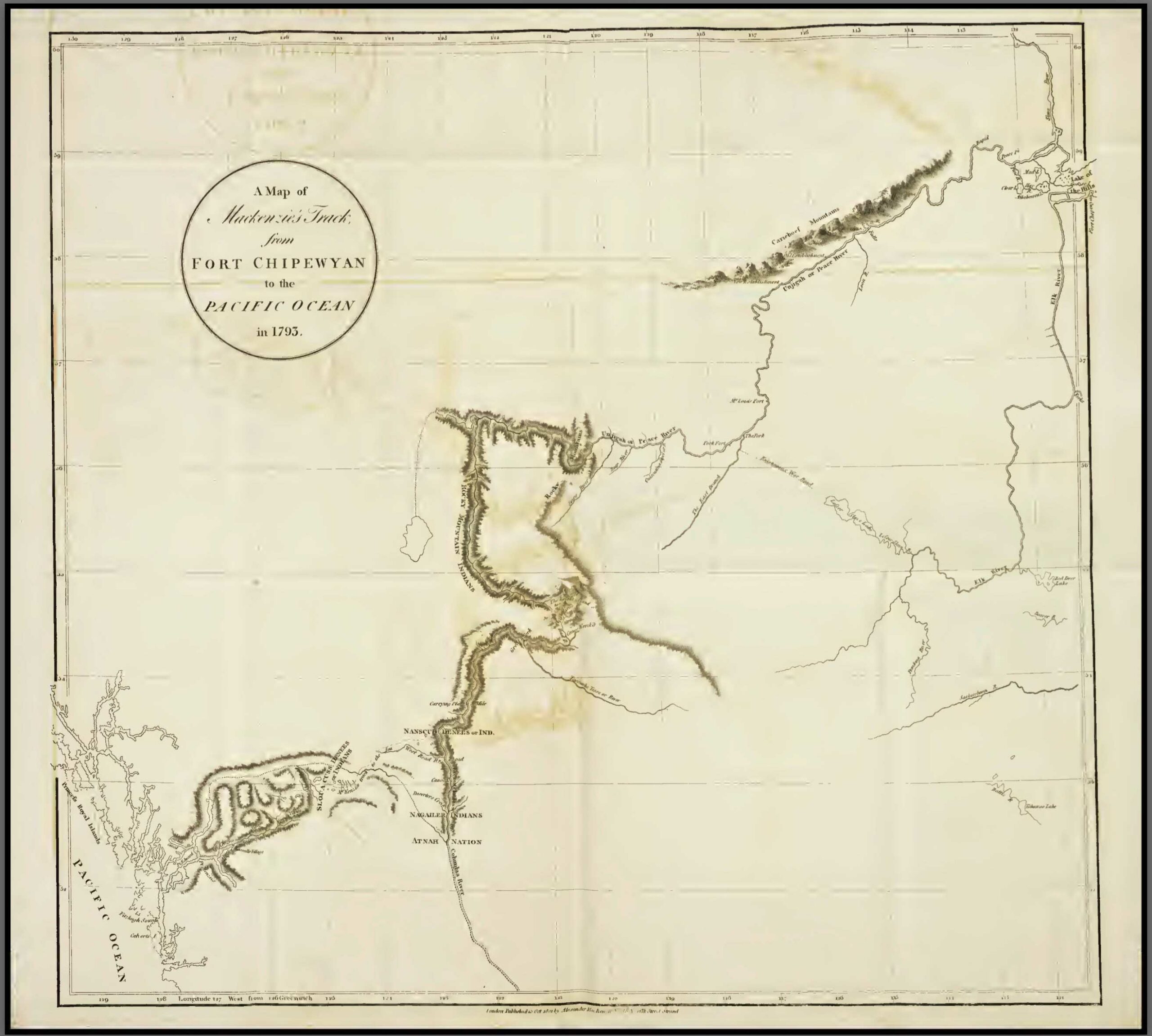
A map of Mackenzie’s track from Fort Chipewan to the Pacific Ocean in 1793. p. 579 Internet Archive [accessed 20 February 2026]
This map includes:
A map of Mackenzie’s track from Fort Chipewan to the Pacific Ocean in 1793. p. 579 Internet Archive [accessed 20 February 2026]
On Peace River.
Ernest Voorhis [1859–1933] fort number 326 [1].
North West Co. fort on left bank of Peace river just below mouth of Smoky river, a few miles below Fort of the Forks. Was well-built- with a stockade and 5 bastions. After the union of 1821 the Hudson’s Bay Co. operated this fort for some time. It appears on their 1857 map No.8 also map No. 3. Built in 1791. An X.Y. Co. fort was built nearby.
Listed as fort number 275 in Ernest Voorhis [1859–1933], Historic Forts [1] :
A small North West Co. post west of Yellowhead Pass on present Moose lake near Tête Jaune Cache, enlargement of Fraser river.
Western North America
An accurate map of North America.
Bowen 1763
Library of Congress [accessed 19 January 2026]
Listed as post no. 227 in Ernest Voorhis [1859–1933], “Historic Forts” [1] :
Originally this was a North West Co. fort on the north bank of Peace river at the mouth of Middle river. Built by Simon Fraser 1805 as a base for his British Columbia explorations. It was known as “Rocky Mountain House, or Fort”, also as “Old Hudson’s Hope”, and “Rocky Mountain Portage Fort”. This post was operated by the Hudson’s Bay Go. after the coalition of 1821. I was abandoned for a time in 1825 to punish the Indians for the massacre at St. John in 1823. New Hudson’s Hope was built about 1875 on the south bank about 12 miles further upstream from Old Hudson’s Hope, at the east end of the portage, near east end of Cañon at its foot. Sometime after 1880 this post was again moved to its present location on the north side. Harmon in his journal 1810, October 15th, calls Hudson’s Hope the “Rocky Mountain Portage Fort”. Cust’s House and an old Hudson’s Bay Co. post are shown on Arrowsmith map 1832 (No. 100) at the west end of the portage from Rocky Mountain House. The location of the original fort is shown on the Dawson map 1879 (No. 81) and marked “abandoned”.
Post no. 3 in “Historic forts and trading posts” by Ernest Voorhis [1859–1933]:
The Hudson Bay Co. house adjoining the North West Co. house called Rocky Mountains House, on North Saskatchewan river near mouth of Clearwater river. Name Acton house was given to distinguish it from the North West Co. house, but it was generally called Rocky Mt. House [1].