De L’Isle’s map 1752
The Great Company [accessed 17 January 2026]
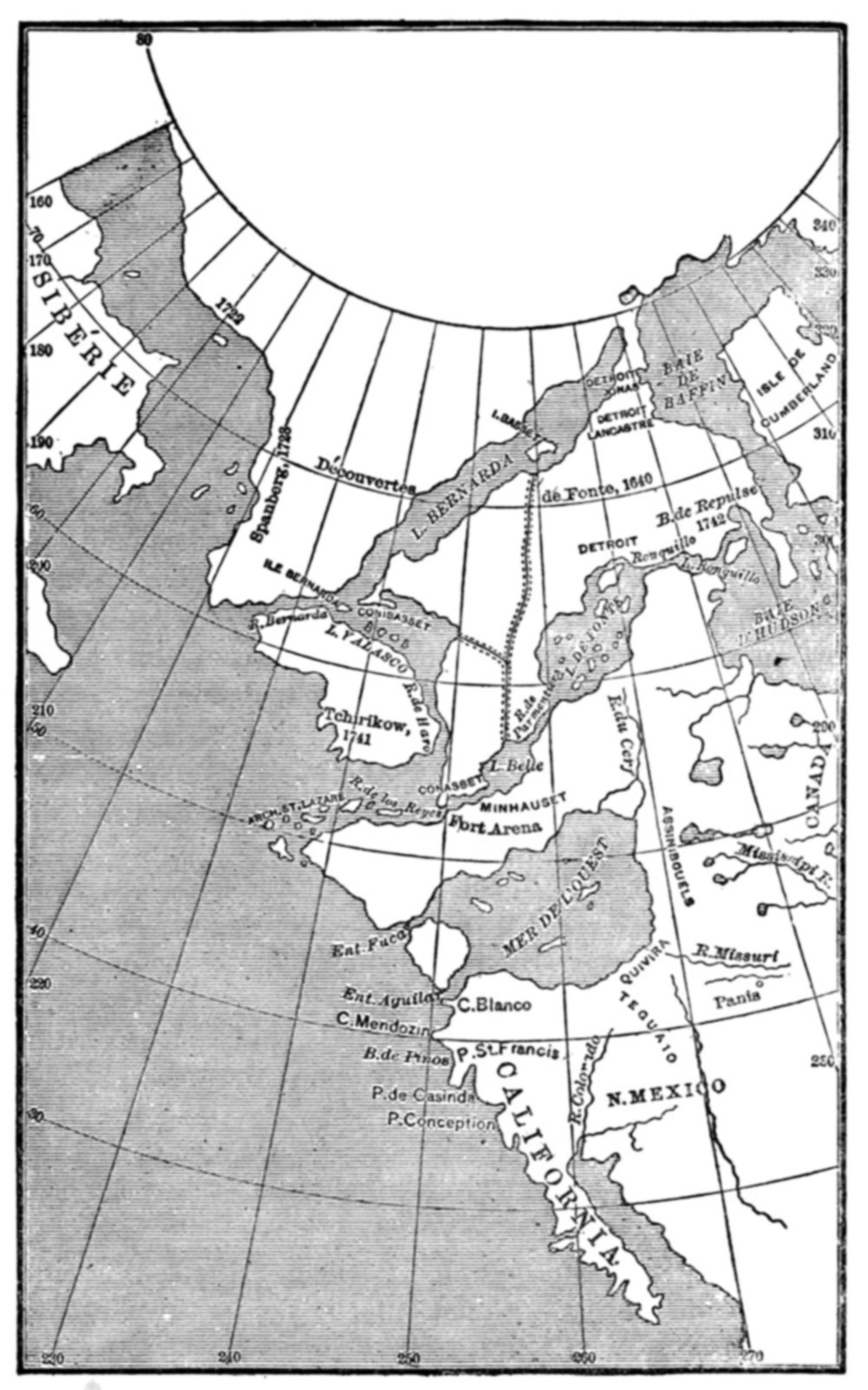
The far northwest area showing a “L. Bernarda” is labelled “Découvertes de Fonte, 1640.” The hatched lines presumably indicate mountains chains.
FONTE, BARTHOLOMEW DE, reputed to have made a voyage to the northwest coast of America in the course of which a passage from the Pacific to the Atlantic oceans was discovered; fl. 1640.
The account of this voyage, first published in the Monthly Miscellany or Memoirs for the Curious, April and June 1708, took the form of a letter by de Fonte in which he described himself as “then Admiral of New Spain and Peru, and now Prince of Chili.” This apocryphal account is now attributed to the editor or owner of the London magazine, James Petiver. There is no reliable evidence to authenticate either the existence of de Fonte himself or of the voyage. The publication of this highly imaginative account led to a lively controversy in the mid-18th century in which Arthur Dobbs, the Irish challenger of the exclusive charter rights of the HBC and a proponent of the discovery of the northwest passage by de Fonte, was joined by Henry Ellis and Theodorus Swaine Drage in arguing in favour of the authenticity of the account. Of even greater interest was the manner in which two prominent French geographers, Joseph-Nicolas Delisle and Phillipe Buache, attempted to interpret de Fonte’s imaginary geography in maps, notably the “Carte générale des découvertes de l’Amiral de Fonte et autres navigateurs espagnols, anglois et russes, pour la recherche du Passage à la Mer du Sud” published in November 1752 (see J.-N. Delisle, Nouvelles cartes des découvertes de l’Amiral de Fonte (Paris, 1753) ) [2].
Rocky Mountains [?]
- 1. Willson, Henry Beckles [1869–1942]. The Great Company. Being a History of the Honourable Company of Merchants-Adventurers Trading Into Hudson’s Bay. 1900. Gutenberg [accessed 17 January 2026]
- 2. Ireland, Willard E. Fonte, Bartholomew De. University of Toronto, 2003. Dictionary of Canadian Biography Vol. 1 [accessed 15 February 2026]