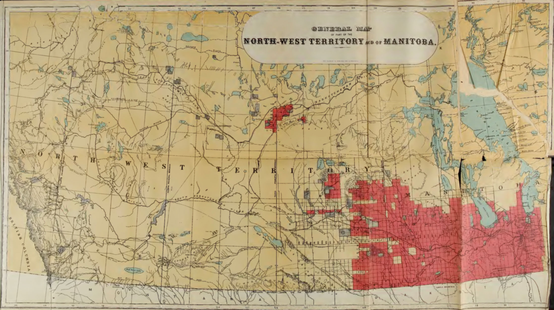
General Map of Part of the North-West Territory and of Manitoba.
Macoun p. 16
Archive.org [accessed 25 October 2026]
General Map of Part of the North-West Territory and of Manitoba
From Manitoba and the Great North West by John Macoun [1831–1920], 1882 [1]. Cited by Vooris as map number 13 showing “Fork Fort” [2].
This map includes:
Fork Fort
Fork Fort
References:
- 1. Macoun, John [1831–1920]. Manitoba and the Great North West. The Field for Investment, The Home of the Emigrant, Being a Full and Complete History of the Country. Guelph, Ont.: World Publishing, 1882, p. 16. Internet Archive [accessed 25 October 2026]
- 2. Voorhis, Ernest [1859–1933]. Historic Forts and Trading Posts of the French Régime and of the English Fur Trading Companies. Ottawa: Department of the Interior, 1930. University of British Columbia Library [accessed 12 October 2026]