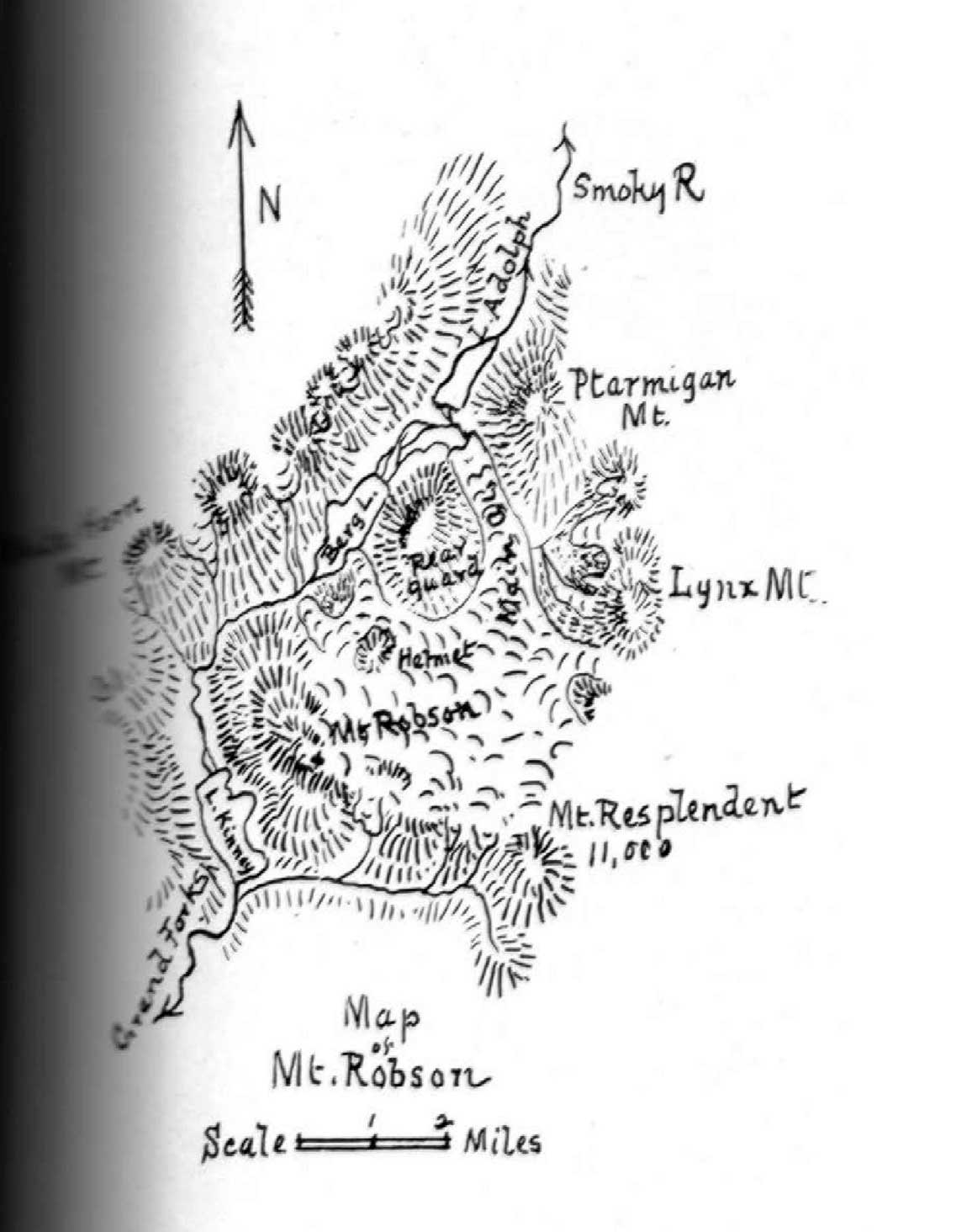
Map of Mount Robson based on expeditions in 1907 and 1908. By A. P. Coleman.
Canadian Alpine Journal, 1910
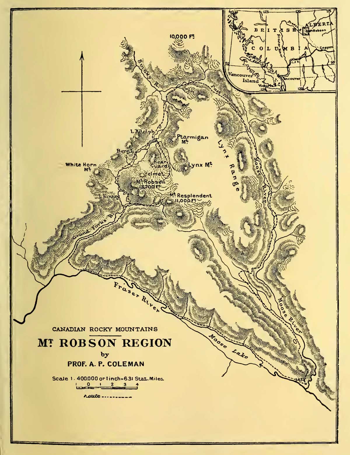
Mt. Robson Region map by A. P. Coleman, 1911
The Canadian Rockies : new and old trails, p. 264
Canadian geologist Arthur Philomen Coleman [1852–1939] made extensive early explorations of the Canadian Rockies, including the first attempts to climb Mount Robson in 1907 and 1908.
References:
- Coleman, Arthur Philemon [1852–1939]. “Expedition to Mt. Robson.” Canadian Alpine Journal, Vol. 1, No. 2 (1908):100-103
- Coleman, Arthur Philemon [1852–1939]. “Geology and glacial features of Mt. Robson.” Canadian Alpine Journal, Vol. 2, No. 2 (1910):73-78
- Coleman, Arthur Philemon [1852–1939]. “Mount Robson, the Highest Point in the Canadian Rockies.” The Geographical Journal (London), Vol. 36, No. 1 (July 1910). JSTOR
- Coleman, Arthur Philemon [1852–1939]. The Canadian Rockies: New and Old Trails. London: T. Fisher Unwin, 1911. Internet Archive
Also see: