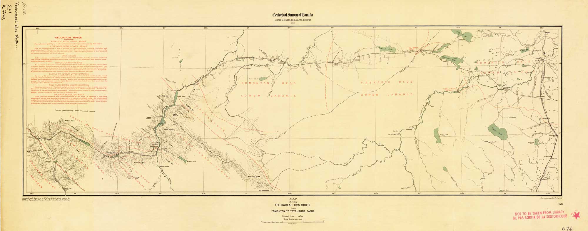
Map Showing Yellowhead Pass Route From Edmonton To Tête-Jaune Cache. James McEvoy, 1900.
Natural Resources Canada
Map Showing Yellowhead Pass Route From Edmonton To Tête-Jaune Cache.
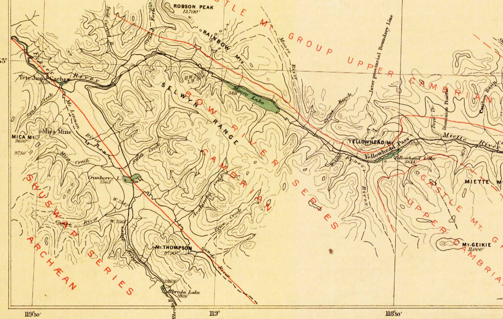
James McEvoy, 1900. (Detail of Yellowhead Pass to Tête Jaune Cache)
Natural Resources Canada
In 1898 McEvoy surveyed the Athabasca River valley for about 240 kilometres east of the Yellowhead Pass, and down the Fraser River on the west side of the pass for another 120 kilometres.
The splendid report of James McEvoy, published by the Geological Survey of Canada in 1900, dealing with the geology and natural history resources of the country traversed by the Yellowhead Pass route from Edmonton to Tête-Jaune Cache, contains the most comprehensive and reliable geographical information that has yet been published, and also contains the only geographical map published of that route on a sufficiently large scale to be of value.
— Arthur Oliver Wheeler [1860–1945], 1912
Albreda Lake
Albreda River
Athabasca River
Avalanche Creek
Brûlé Lake
Buffalo Prairie
Caledonian Valley [as “Caledonia Valley”]
Colin Range
Cranberry Lake
Dominion Prairie
Mount Geikie
Grand Fork
Grant Brook
Jasper Lake
McLennan River
Mica Mountain
Mica Creek
Miette Hill [as “Miette Mts.”]
Miette River
Moose Lake
Moose River
Price Creek
Rainbow Range
Mount Robson [as “Robson Peak 13,700’”]
Roche Suette
Roche Miette
Sand Creek
Selwyn Range
Snaring River
Stoney River [as “Stony River”]
Swift Creek
Swiftcurrent Creek
Tête Jaune Cache
Whirlpool River
Yellowhead Lake
Yellowhead Pass
- McEvoy, James [1862–1935]. Report on the geology and natural resources of the country traversed by the Yellowhead Pass route from Edmonton to Tête Jaune Cache comprising portions of Alberta and British Columbia. Ottawa: Geological Survey of Canada, 1900. Natural Resources Canada
- McEvoy, James [1862–1935]. “Map Showing Yellowhead Pass Route From Edmonton To Tête-Jaune Cache.” (1900). Natural Resources Canada
- Wheeler, Arthur Oliver [1860–1945]. “The Alpine Club of Canada’s expedition to Jasper Park, Yellowhead Pass and Mount Robson region, 1911.” Canadian Alpine Journal, Vol. 4 (1912):9-80