Expansion of Fraser River, Mount Robson Park
52.95 N 118.9167 W — Map 83D/15 — Google — GeoHack
Earliest known reference to this name is 1824 (Simpson)
Name officially adopted in 1933
Official in BC – Topo map from Canadian Geographical Names
John Arrowsmith’s map BC 1859
Milton and Cheadle’s map 1865
Trutch’s map of BC 1871
George Monro Grant’s map of Yellowhead Pass 1872
Tolmie and Dawson map Indian Tribes of BC 1884
BC Lands Central BC 1892
Brownlee’s map Province of BC 1893
McEvoy’s map Yellowhead Pass 1900
Coleman’s map of Mount Robson 1910
Schäffer map of visits in 1907 and 1908
Collie’s map Yellowhead Pass 1912
Cram’s map British Columbia 1913
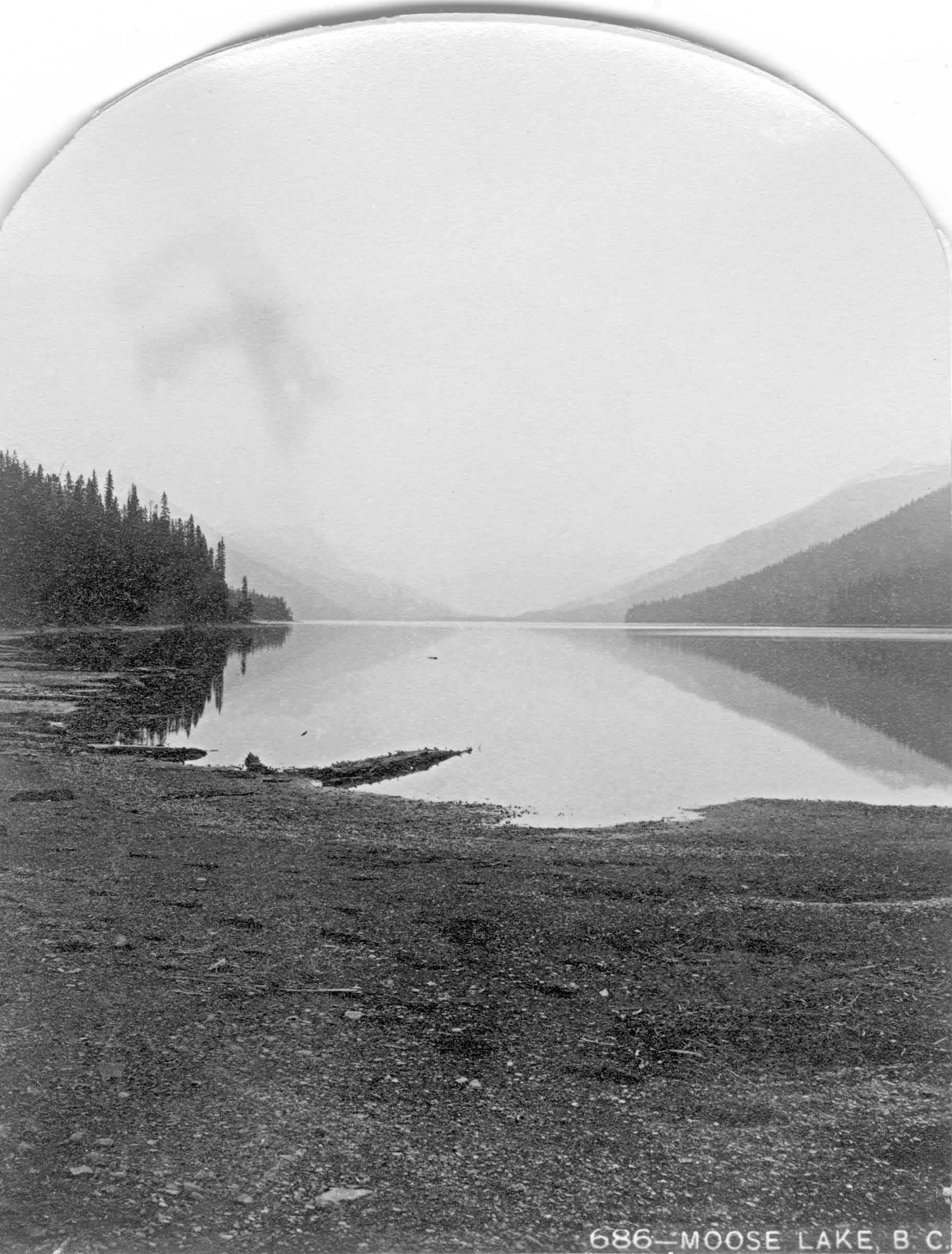
Moose Lake. Benjamin F. Baltzly, 1871
McCord Stewart Museum
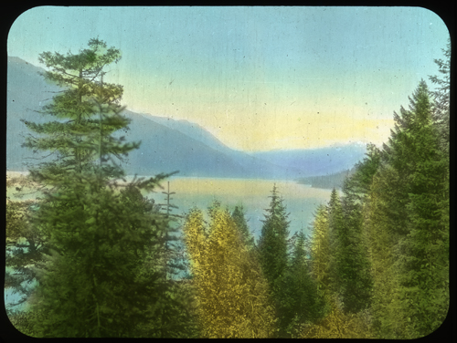
Moose Lake. Photo: Mary Schäffer, 1908
Whyte Museum of the Canadian Rockies
Among the 180 or so Moose Lakes in Canada, the Moose Lake in Mount Robson Park was mentioned by Hudson’s Bay Company governor George Simpson [1792–1860] in 1824 when, “to draw the Freemen further into the Mountain than they had been in the habit of going,” he proposed to establish a winter fur trading post at “Moose or Cranberry Lake.” (Cranberry Lake is south of Tête Jaune Cache.) In the fall of that year, chief trader Joseph Felix LaRocque set out to establish the post as a replacement for the post at Smoky River, but was stopped by ice in the Athabasca River and built a post above Jasper House. No fur-trade establishment was ever built at Moose Lake.
“Orignal” is Canadian French for “moose. ” On John Arrowsmith’s 1859 map of British Columbia, Moose Lake appears as “Lac L’Original” [sic].
British tourists Milton and Cheadle passed by the lake in 1863:
Moose Lake is a fine sheet of water, about 15 miles in length, and not more than three miles in breadth at the widest point, The scenery was very wild and grand, and forcibly reminded us of Wast Water. On the south side, the hills rose perpendicularly out of the water for perhaps 2,000 feet, beyond which was the usual background of rocky and hoary peaks. Over the edge of this mighty precipice a row of silver streams poured with unbroken fall, the smaller ones dissipated in mist and spray ere they reached the lake below.
During the construction of the Grand Trunk Pacific Railway around 1910, “Mile 28’’ was the camp at the west end of Moose Lake, close to the current Red Pass Junction.
BC Parks has bathymetric maps of Moose Lake showing a maximum depth of about 80 m (275 feet): east and west (PDFs).
- Simpson, George [1792–1860], and Merk, Frederick [1887–1977], editor. Fur trade and empire. George Simpson’s journal entitled Remarks connected with fur trade in consequence of a voyage from York Factory to Fort George and back to York Factory 1824-25. Cambridge, Mass.: Harvard University Press, 1931. University of British Columbia Library
- McMillan, James [1783–1858]. Winnipeg: Hudson’s Bay Company archives. Portion of letter James McMillan to William Connelly HBCA B.188/b/4 fo. 9-10 (1825).
- Arrowsmith, John [1790–1873]. Provinces of British Columbia and Vancouver Island; with portions of the United States and Hudson’s Bay Territories. 1859. UVic
- Milton, William Wentworth Fitzwilliam [1839–1877], and Cheadle, Walter Butler [1835–1910]. The North-West Passage by Land. Being the narrative of an expedition from the Atlantic to the Pacific, undertaken with the view of exploring a route across the continent to British Columbia through British territory, by one of the northern passes in the Rocky Mountains. London: Cassell, Petter and Galpin, 1865. Internet Archive
- Trutch, Joseph William [1826–1904]. Map of British Columbia to the 56th Parallel North Latitude. Victoria, B.C.: Lands and Works Office, 1871. University of Victoria
- McEvoy, James E., P.L.S. [1862–1935]. “Map Showing Yellowhead Pass Route From Edmonton To Tête-Jaune Cache.” (1900). Natural Resources Canada
- Schäffer Warren, Mary T. S. [1861–1939]. Old Indian trails. Incidents of camp and trail life, covering two years’ exploration through the Rocky Mountains of Canada. [1907 and 1908]. New York: Putnam, 1911, p. 339. Internet Archive
- MacGregor, James Grierson [1905–1989]. Pack Saddles to Tête Jaune Cache. Edmonton: Hurtig, 1962 (reprint 1973)
- Smyth, David. “Some fur trade place names of the Yellowhead Pass: west of the summit to Tête Jaune Cache.” Canoma (journal of the Canadian Permanent Committee on Geographical Names), Vol. 11, No. 2 (1985)