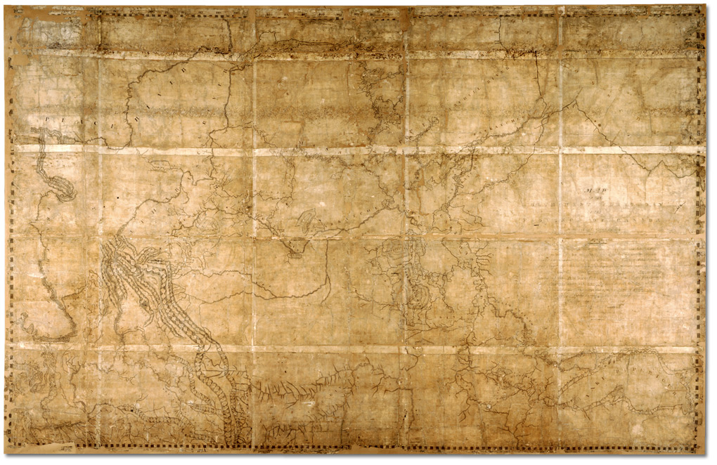
Map of the North-West Territory of the Province of Canada.David Thompson, 1814 Archives of Ontario
Map of the North-West Territory of the Province of Canada from actual Survey during the years 1792-1812. This map made for the North West Company in 1813 and 1814 and delivered to the Honorable William McGillivray then agent Embraces the Region lying between 45 and 60 degrees North Latitude and 84 and 124 degrees West Longitude comprising the Survey’s and Discoveries of 20 years namely the Discovery and Survey of the Oregon Territory to the Pacific Ocean the Survey of the Athabasca Lake Slave River and Lake from which flows Mackenzie’s River to the Arctic Sea by Mr. Philip Turner the Route of Alexander Mackenzie in 1792 down part of Fraser’s river together with the Survey of this River to the Pacific Ocean by the late John Stuart of the North-West Company by David Thompson Astronomer and Surveyor.
Surveying for the North West Company, David Thompson [1770–1857] located the headwaters of the Mississippi River, crossed the Rocky Mountains and mapped the entire length of the Columbia River.
Thompson retired from the fur trade in 1812 and moved his family to Terrebonne near Montreal. He was given a special assignment to plot all the Company’s posts on a comprehensive map of the Canadian West using the astronomical observations he had carefully recorded.
Thompson’s map is approximately 213 centimetres (84″) high by 328 centimetres (129″) long. It gave an accurate depiction of the vast territory traversed by the fur trade and location of Company posts. [1]
Athabasca River
Canoe River
Columbia River
Fraser River
Peace River
Smoky River
Snaring River [as “Snare Indian River”]
- 1. Nesbit, Jack [1949–]. Mapmaker’s Eye: The Mapmaker’s Eye: David Thompson on the Columbia Plateau. Pullman: Washington State University Press, 2006