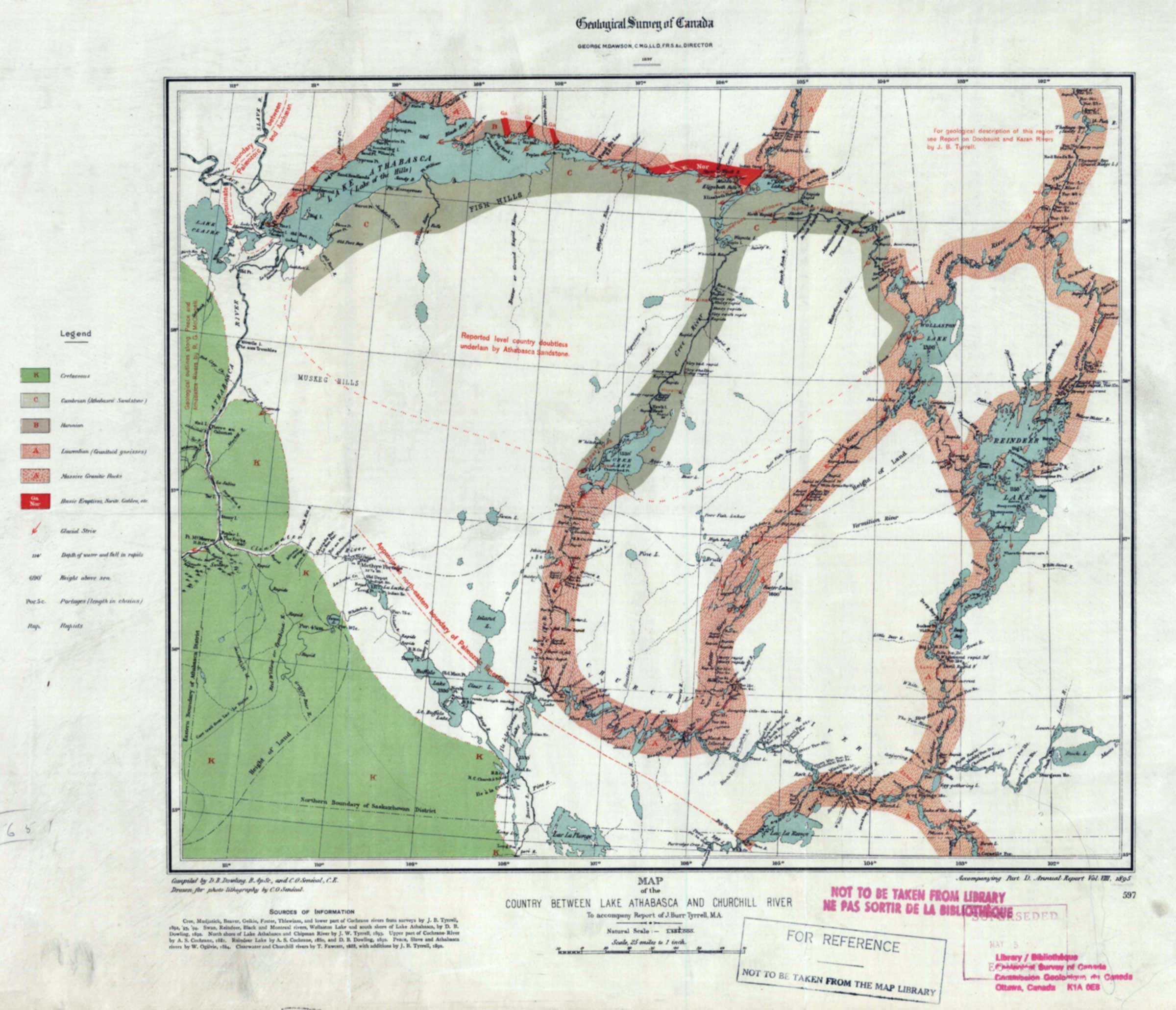
Country Between Lake Athabasca and Churchill River, to accompany report of Tyrrell
Internet Archive [accessed 27 October 2026]
Geological Survey of Canada
GEORGE M. DAWSON, C.M.G, LL.D, F.R.S. &c., DIRECTOR
MAP of the
COUNTRY BETWEEN LAKE ATHABASCA AND CHURCHILL RIVER
To accompany Report of J. Burr Tyrrell, M.A.
Accompanying Part D. Annual Report Vol: VII, 1895
The map accompanies Report on the country between Athabasca Lake and Churchill River by Joseph Burr Tyrrell [1858–1957]
[1].
Map number 41 in Vooris [2].
This map includes:
Fort Chipewyan
Fort Chipewyan
References:
- 1. Tyrrell, Joseph Burr [1858–1957]. Report on the country between Athabasca Lake and Churchill River: With notes on two routes travelled between the Churchill and Saskatchewan rivers. Ottawa: Geological Survey of Canada, 1896. Internet Archive [accessed 26 October 2026]
- 2. Voorhis, Ernest [1859–1933]. Historic Forts and Trading Posts of the French Régime and of the English Fur Trading Companies. Ottawa: Department of the Interior, 1930. University of British Columbia Library [accessed 12 October 2026]