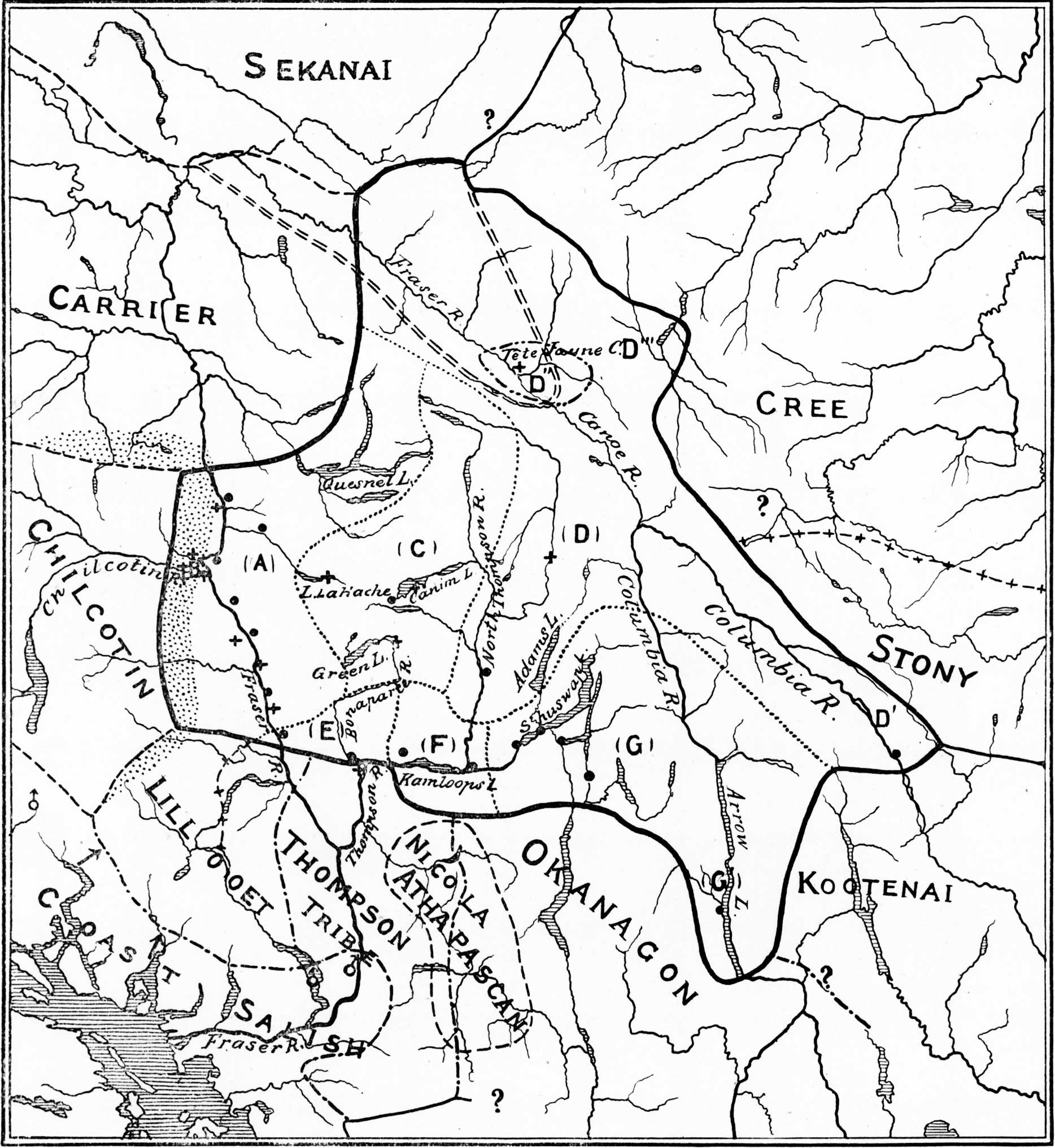
Map showing the Shuswap Territory.
Teit 1909, p. 450
American Museum of Natural History
Fig. 199. Map showing the Shuswap Territory
A – Fraser River Division
B – Cañon Division, territory now largely occupied by the Chilcotin
C – Lake Division
D – North Thompson Division
D’ – Kinbasket
D” – Former territory of the Iroquois Band
D”’ – Shuswap, Cree, and Iroquois mixed
E – Bonaparte Division
F – Kamloops Division.
G – Shuswap Lake Division.
G’ – Arrow Lake Band.
• – Villages.
+ – Former villages
Dotted area, territory recently occupied by the Chilcotin.
Area at head of Fraser River, enclosed by broken double lines, temporarily occupied by the Sekanai.
———
James Alexander Teit [1864 —1922] was an anthropologist, photographer and guide who was born in Lerwick, Shetland, Scotland, immigrated to Canada, and married a Nlaka’pamux woman named Susanna Lucy Antko.
Teit worked with Franz Boas to study Interior Salish First Nations peoples in the late 19th and early 20th centuries. Accompanying Boaz, he was a member of the Jesup North Pacific Expedition, a major anthropological expedition to Siberia, Alaska, and the northwest coast of Canada, whose purpose was to investigate the relationships among the peoples at each side of the Bering Strait.
I am looking for the first part of James Teit on the Shuswap. From pages 1 to page page 446 ? These pages are the first part of the book and I am unable to find it.Can you please send me these pages, I sure would appreciate it.
According the the Wikipedia page on the Jesup North Pacific Expedition, Volume 2 had seven parts, and Teit’s chapter on the Shuswap was part seven. The previous parts, pages 1-446, were not about the Shuswap.
I am not aware of any place you can find these previous parts.