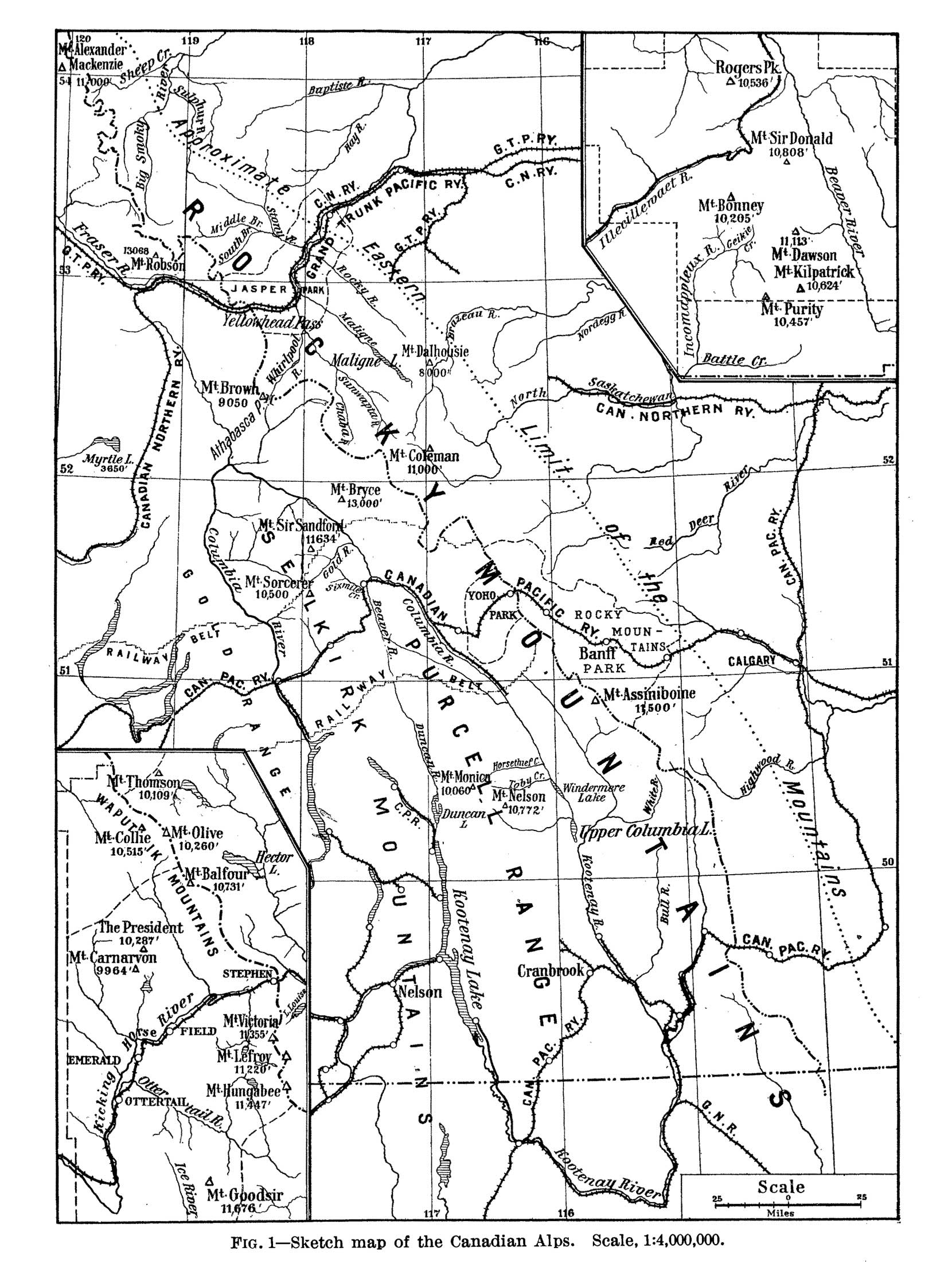
Sketch map of the Canadian Alps. Scale, 1:4,000,000.
The insets show in greater detail the Selkirks (upper right) and the Rocky Mountains (lower left) where they are crossed by the Canadian Pacific Railway.
Note. The altitudes of the following peaks should read thus: Mt. Bryce (52° N. and 117⅜° W.), 11,800 ft.; Mt. Sorcerer (51½° N. and 118° W.), 10,410 ft.; Mt. Assiniboine (51° N. and 115⅔° W.), 11,860 ft.; Mt. Collie (lower left inset), 10,315 ft.
The following changes should also be made: Upper Columbia L.” (50¼° N. and 116° W.) to Columbia L.; Mt. Thomson” (lower left inset) to Mt. Thompson.
Charles Ernest Fay [1846–1931] was an American alpinist and educator. Professor Fay first visited the Canadian Rockies in 1890, and was a pioneer in the development of mountaineering in the Canadian Rockies and the Selkirks. He was a founder of the Appalachian Mountain Club, and served as president in 1878, 1881, 1893, and 1905; he was also a founder and the first president of the American Alpine Club (1902-1904).
Sheep Creek
Sir Alexander, Mount (as Mt. Alexander Mackenzie)
Smoky River
Stoney River (as Stony River)
- Fay, Charles Ernest [1846–1923]. “Recent Mountaineering in the Canadian Alps.” Geographical Review, Vol. 2, No. 1 (1916):1. JSTOR
- Wheeler, Arthur Oliver [1860–1945]. “Professor Charles E. Fay, Litt. D.” Canadian Alpine Journal, Vol. 19 (1930):113. Alpine Club of Canada
- Wikipedia. Charles Ernest Fay