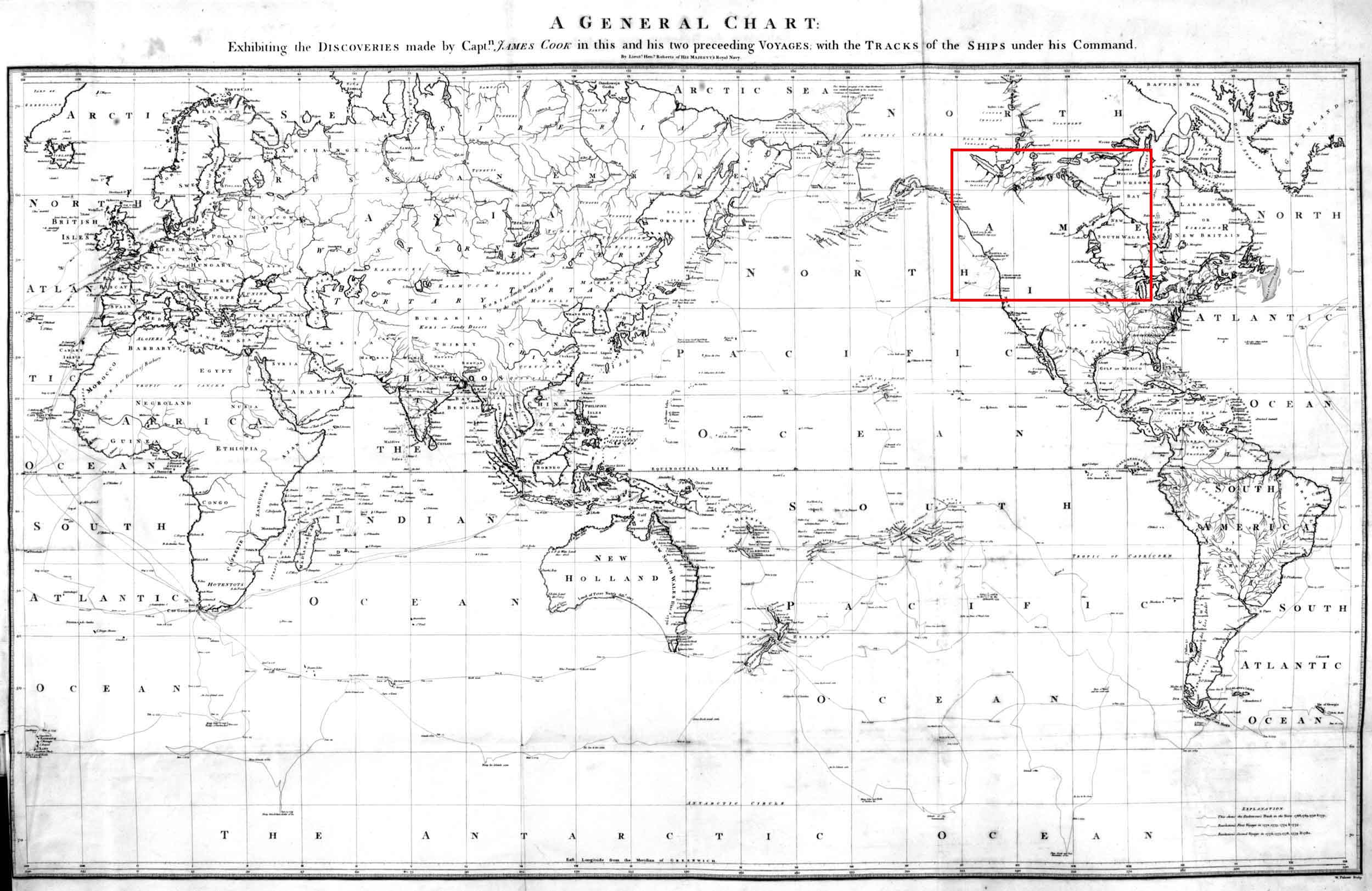
Map of the world in Cook’s “Third Voyage,” 1784.
By Henry Roberts, Lieutenant in His Majesty’s Navy
Princeton University Library
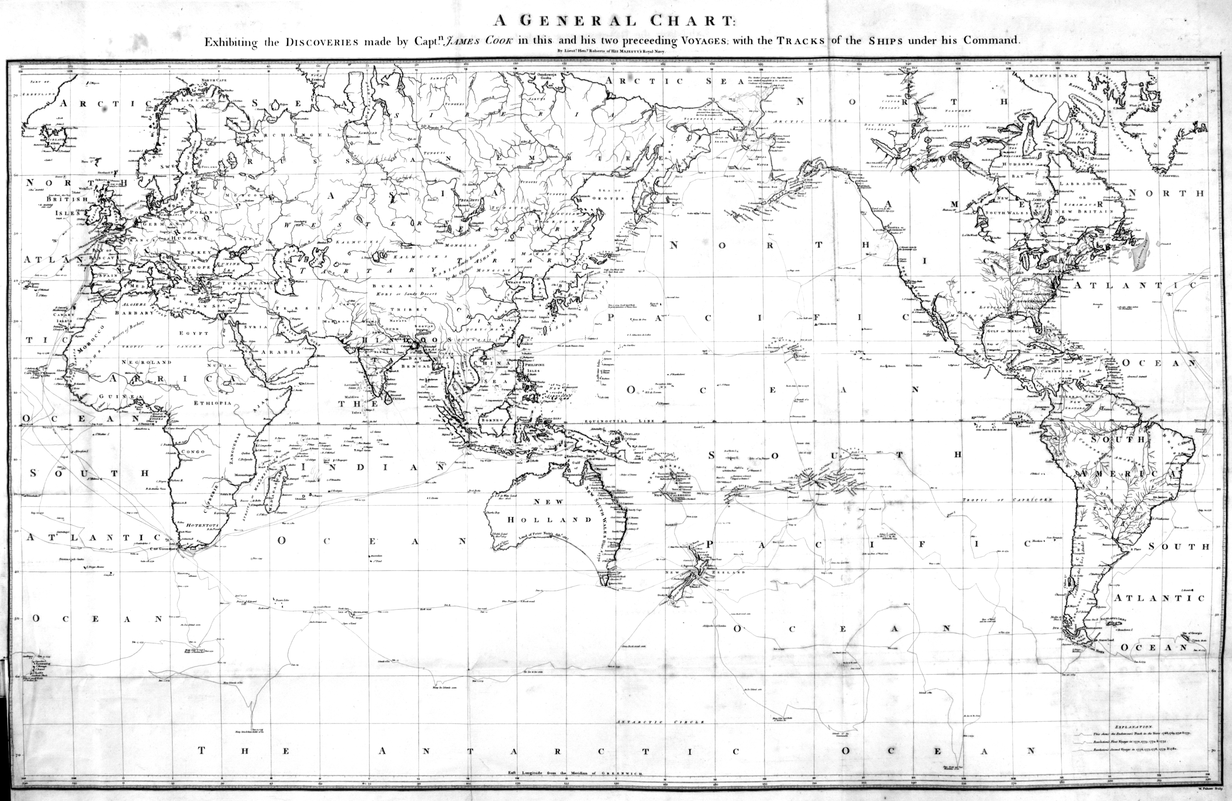
Detail of map of the world in Cook’s “Third Voyage,” 1784.
By Henry Roberts, Lieutenant in His Majesty’s Navy
UBC Library Digital Collections
A General Chart:
Exhibiting the Discoveries made by Captn. James Cook in this and his two preceeding Voyages with the Tracks of the Ships under his Command
.
The map was drawn by Henry Roberts [1756–1796], a native to Shoreham, Sussex, who was an officer in the Royal Navy who served with James Cook [1728–1779] on Cook’s last two voyages [1].
According to the Champlain Society edition of Samuel Hearne’s journeys, this map was the first to show Cook’s route [2].
The map does not seem to appear in the 1796 Cook’s Voyage to the Pacific Ocean [3].
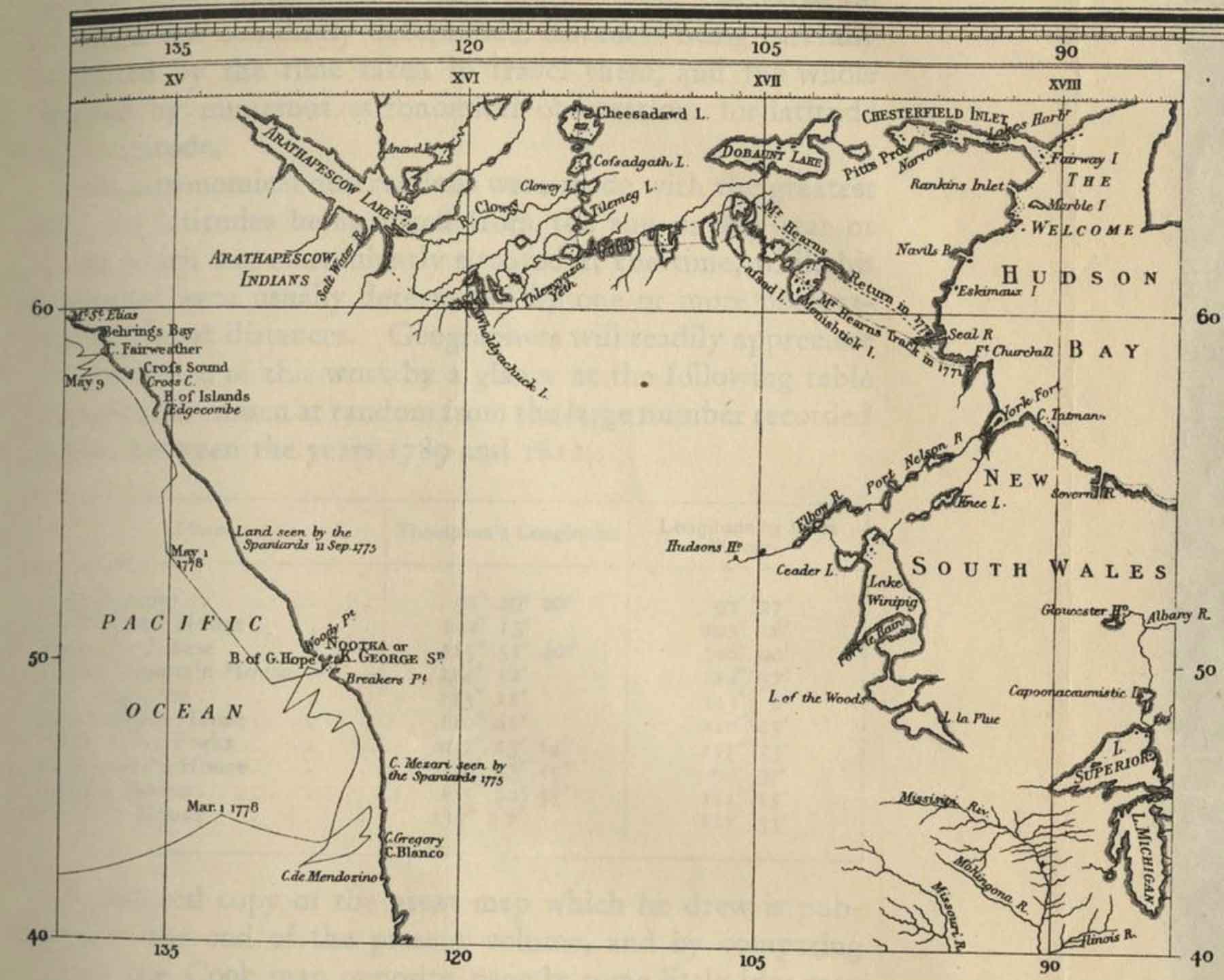
Lake Athabasca [as Arathapescow Lake]
Tribes
Athapescow Indians [as “Arathapescow Indians”]
- 1. Roberts, Henry [1756–1796]. London: A General Chart exhibiting the Discoveries made by Capn. James Cook in this and his two preceeding Voyages; with the Tracks of the Ships under his Command (1784). Princeton Library
- 2. Hearne, Samuel [1745–1792]. A journey from Prince of Wales’s Fort in Hudson’s Bay to the Northern Ocean, in the years 1769, 1770, 1771, and 1772. Tyrrell, Joseph Burr, 1858-1957. Totonto: Champlain Society, 1911. Internet Archive
- 3. Cook, James [1728–1779]. A Voyage to the Pacific Ocean. Undertaken, by the Command of His Majesty, for Making Discoveries in the Northern Hemisphere, to Determine the Position and Extent of the West Side of North America; Its Distance from Asia; and the Practicability of a Northern Passage to Europe. Performed under the Direction of Captains Cook, Clerke, and Gore, in His Majesty’s Ships the Resolution and Discovery, in the Years 1776, 1777, 1778, 1779, and 1780. Vol III. London: G. Nicol, & T. Cadell, 1796. University of British Columbia Library [accessed 18 February 2026]