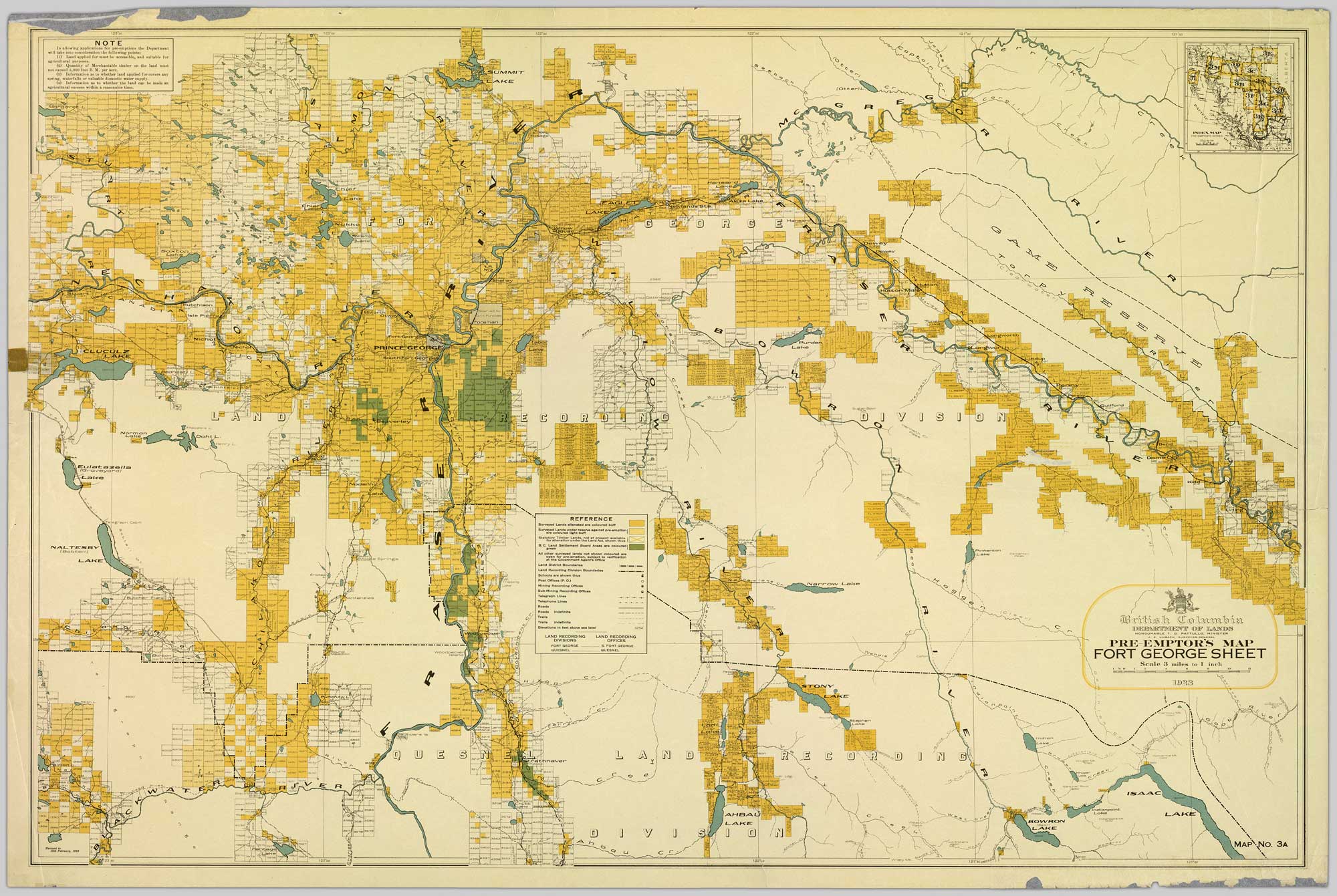
Colour-coded map depicting lands surveyed as alienated, reserved, Statutory Timber Lands, B.C. Land Settlement Board Area, or open for pre-emption. Depicts land districts, land recording divisions, communities, game reserves, bodies of water, transport routes, and communication lines.
Northern British Columbia Archives [accessed 5 July 2026]
British Columbia Department of Lands
Honourable T. D. Pattullo, Minister
J. E. Umbach, Surveyor-General
Pre-Emptor’s Map — Fort George Sheet 1923
Honourable T. D. Pattullo, Minister
J. E. Umbach, Surveyor-General
Pre-Emptor’s Map — Fort George Sheet 1923
Colour-coded map depicting surveyed lands respectively open and closed to preemption. Depicts land recording divisions, game reserves, communities, bodies of water, and transport routes.
This map includes:
Dome Creek (community)
Dome Creek (community)