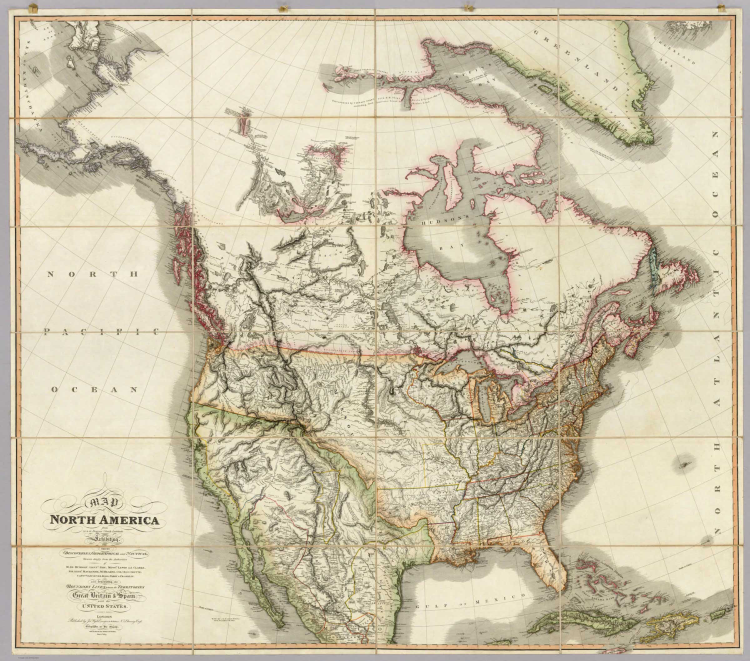
Map of North America from 20 to 80 Degrees North Latitude
James Wyld, 1823
David Rumsey Map Collection [accessed 13 February 2026]
![Map of North America from 20 to 80 Degrees North Latitude [detail]](/wp-content/uploads/2026/02/Wyld-map-North-America-1823-detail.jpg)
Map of North America from 20 to 80 Degrees North Latitude [detail]
David Rumsey Map Collection [accessed 13 February 2026]
![Map of North America from 20 to 80 Degrees North Latitude [title]](/wp-content/uploads/2026/02/Wyld-map-North-America-1823-legend.jpg)
Map of North America from 20 to 80 Degrees North Latitude [title]
David Rumsey Map Collection [accessed 13 February 2026]
Map of North America from 20 to 80 Degrees North Latitude
Exhibiting the recent Discoveries, Geographical and Nautical;
Drawn chiefly from the Authorities of M. de Humbolt, Lieut. Pike, Messrs. Lewis and Clarke, Sir Alexr. Mackenzie, Mr. Hearne, Coll. Bouchette, Captns. Vancouver, Ross, Parry & Franklin.
also describing the Boundary Lines between the
Territories of Great Britain & Spain with the United States.
London
Published by Ja. Wyld, successor to W. Faden, No.5 Charing Cross.
Geographer to His Majesty; and to H.R.H. the Duke of York.
June 1st. 1823.
James Wyld [1812–1887] was a British geographer and map-seller.
Athabasca River
Lake Athabasca
Canoe River
Columbia River
Finlay River [as “Finlay’s Branch”]
Finlay Forks [as “The Fork”]
Fork Fort
Fraser River [as “Tacoutche Tesse or Frazer’s R.”]
McLoud’s Fort
New Establishment
Old Fort [as “Old Establishment”]
Peace River [as “Unjigah or Peace R.”]
Rocky Mountains
Tacoutche Tesse
Unjigah River [as “Unjigah or Peace R.”]
Tribes
Athapescow Indians
Atnah Indians [as “Nagail Indians Atnalh Nation”]
Beaver Indians [as “Tza-dene or Beaver Indians”]
Kootana Indians [as “Kootanie Indians”]
Nanscud Denees [as “Nanscud Denees or Indians”]
Rocky Mountain Indians
Snake Indians