British Columbia. Peak
S of Tonquin Creek
52.7167 N 118.4 W — Map 83D/9 — Google — GeoHack — Bivouac
Name officially adopted in 1951
Official in BC – Canada
Elevation: 3086 m
S of Tonquin Creek
52.7167 N 118.4 W — Map 83D/9 — Google — GeoHack — Bivouac
Name officially adopted in 1951
Official in BC – Canada
Elevation: 3086 m
This peak appears on:
Boundary Commission Sheet 28 (surveyed in 1921)
Boundary Commission Sheet 28 (surveyed in 1921)
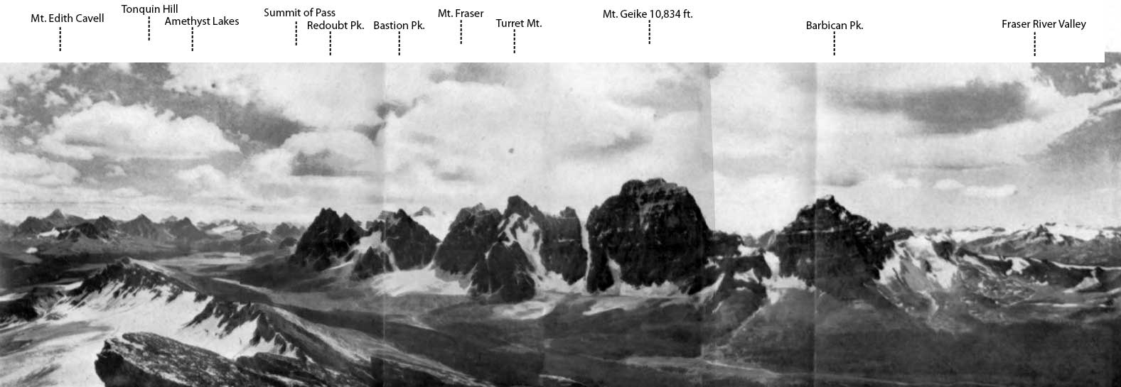
Tonquin Pass and Geikie Range from the North (Vista Peak).
Photo, A.0. Wheeler
Canadian Alpine Journal1922
A barbican is an outer fortification or defense to a city or castle, especially a double tower erected over a gate or bridge. The feature was named by Alberta-British Columbia Boundary Commission surveyors in 1921.
Adopted in 1951 on Jasper Park (North) as labelled on BC-Alberta Boundary sheet 28, 1921, and as identified in Canadian Alpine Journal, Vol XIII, 1923, pp.53-63.
References:
- Wates, Cyril G. [1883–1946]. “Mount Geikie.” Canadian Alpine Journal, Vol. 13 (1923):47-53
- Cautley, Richard William [1873–1953], and Wheeler, Arthur Oliver [1860–1945]. Report of the Commission appointed to delimit the boundary between the Provinces of Alberta and British Columbia. Part II. 1917 to 1921. From Kicking Horse Pass to Yellowhead Pass.. Ottawa: Office of the Surveyor General, 1924. Whyte Museum
- Fynn, Val A. “First ascents of Mt. Barbican 10,100 feet and of Mt.Geikie 10,854 feet.” Canadian Alpine Journal, Vol. 14 (1924):60-66
- British Columbia Geographical Names. Barbican
Also see: