Fraser River, between Hansard Bridge and Longworth
53.9333 N 121.65 W — Map 93H/13 — Google — GeoHack
Earliest known reference to this name is 1912 (Talbot)
Name officially adopted in 1960
Official in BC – Canada
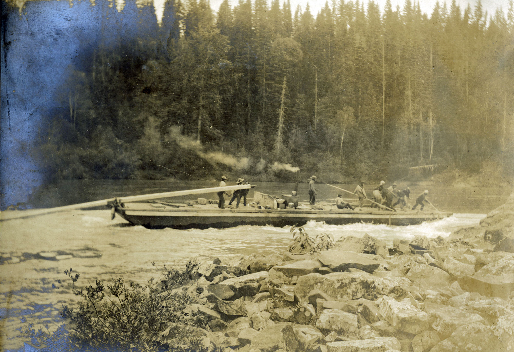
Grand Trunk Pacific survey supplies being freighted through the Grand Canyon of the Fraser River. Arthur H. Holland, 1907
Northern British Columbia Archives
Owing to the vicious character of the river this task was one beset with innumerable difficulties. Forty miles outside of Fort George is a furious rush of water over 9 miles in length — the Giscombe Rapids — where the water bubbles, froths, and speeds along at a terrific pace over a shallow bed littered with chisel-pointed rocks. Some 60 miles beyond is the Grand Canyon of the Upper Fraser, which is a veritable death-trap, where the inexpert, as well as the dexterous water-dog, often has met his end. Even the Indians for the most part regard it with a certain awe, especially during certain periods of the year, when it is little better than a maelstrom, and wherein several members of their tribe have met their Waterloo. The third danger is the Goat Rapids, a little west of the Goat River, where the river tumbles downhill very suddenly, and where, in order to negotiate the boiling water, skilful navigation is imperative to manoeuvre the boat from one side to the other of the river in order to avoid terrible obstacles.
— Talbot 1912
From Mile 53 — this mileage is reckoned from the Summit at Yellowhead Pass along the railway — the [Fraser] river is navigable in high water as far as Soda Creek, a distance of nearly 500 miles. The Fraser has proved to be invaluable to the building of the Grand Trunk Pacific Railway, despite the fact that so many lives and so much property have been lost in its waters. These accidents have happened mostly through carelessness and ignorance. The chief obstacles to navigation are due to the existence of shifting sand and gravel bars, the Goat Rapids, the Grand Canyon, and the Giscome Rapids, all above Fort George. High water minimizes this danger for the larger craft, but presents sometimes greater dangers for the smaller ones.…
— Walker 1914
- Talbot, Frederick Arthur Ambrose [1880–1924]. The making of a great Canadian railway. The story of the search for and discovery of the route, and the construction of the nearly completed Grand Trunk Pacific Railway from the Atlantic to the Pacific with some account of the hardships and stirring adventures of its constructors in unexplored country. London: Seely, 1912, p. 210. Internet Archive
- Walker, James Alexander [1887–1959]. “South fork of Fraser River, Dore River to Clearwater River. December 15, 1913.” Report of the Minister of Lands, (1914). Google Books
- Boudreau, Jack [1933–]. Sternwheelers and Canyon Cats: Whitewater Freighting on the Upper Fraser. Qualicum Beach, BC: Caitlin Press, 2006