N of headwaters of Lebher Creek
52.6833 N 119.5333 W — Map 83D/12 — Google — GeoHack
Earliest known reference to this name is 1949 (Hendricks)
Name officially adopted in 1963
Official in BC – Canada
Fabergé map Cariboo 1949
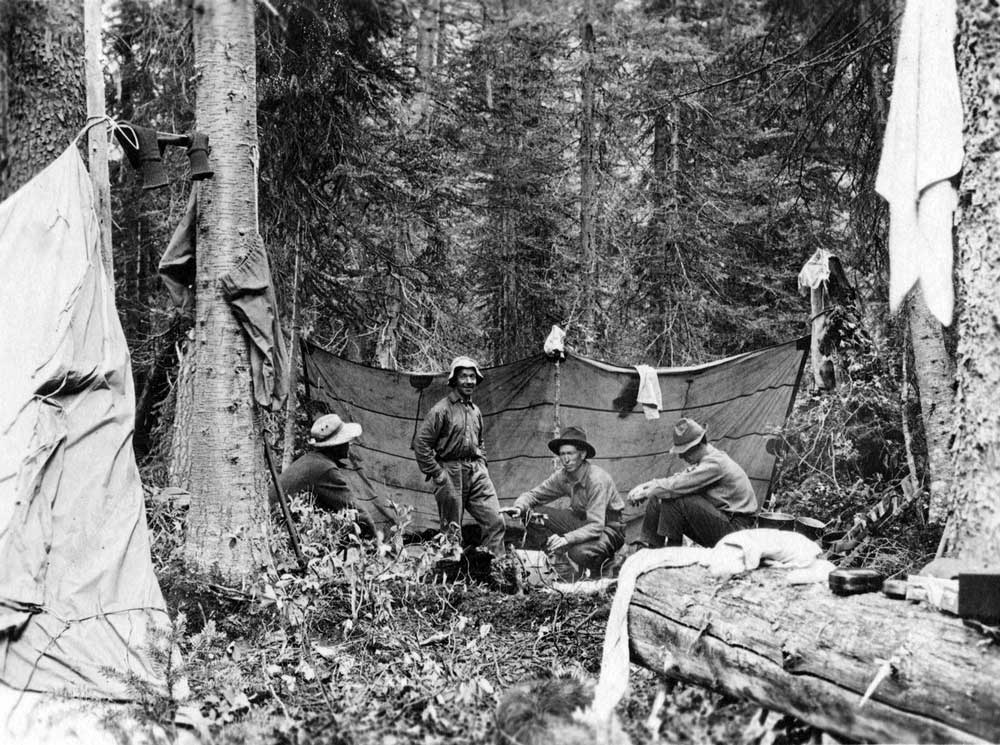
Rollin T. Chamberlin, L. E. “Slim” Goodell, Allen Carpe, A. L. Withers, George Burns
University of Chicago
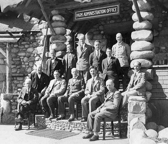
Jasper National Park employees pictured in front of the Park Administration Building in 1931. Group includes (sitting): E.A. Sullivan (instrument man), J.B. Snape (res. engineer), Col. S. Maynard Rogers (superintendent), H.G. Carlton (accountant), R.W. Langford (superintendent, warden). Standing: C.E. Burrows (steno), H.E. Sullivan (steno), W.R. Evans (foreman), J.R. Heckley (cashier), A.J Dube (timekeeper) W.Booth (clerk), H.S. Davis (game warden) and A.L. Withers (clerk). JYMA PA 18-110.
Jasper-Yellowhead Museum and Archives
Named in 1963 in honor of A. L. (Pete) Withers , a Jasper resident who was a pioneer climber in the area. The name was proposed by the 1949 mountaineering party of Sterling Brown Hendricks [1902–1981] and Andrew John Kauffman [1920–2002].
In 1924 Withers, Allen Carpé [1894–1932], and Rollin Thomas Chamberlin [1881–1948] went up Tête Creek “and made some fine climbs, among them Sir Wilfrid Laurier.”
In 1932, Withers accompanied Clifford White [1902–1964] of Banff, Russell H. Bennett of Minneapolis, and J. A. Weiss of Jasper, on a 480 kilometer ski trek from Jasper to Lake Louise in a 20 day period.
Withers is identified as a clerk in a photograph of Jasper National Park employees in 1931.
- Carpé, Allen [1894–1932]. “Albreda Mountain.” Canadian Alpine Journal, Vol. 16 (1927–1927):177
- Bennett, Russell H. “The Ski Ascent of Snow Dome.” Canadian Alpine Journal, Vol 20 (1931):100-101
- White, Clifford. Fonds M159 / V682 (1935–1992). Whyte Museum of the Canadian Rockies
- Zillmer, Raymond T. [1887–1960]. “The exploration of the Cariboo Range from the east.” American Alpine Journal, 5:2 (1944):261-274. American Alpine Club
- Hendricks, Sterling Brown [1902–1981], and Kauffman, Andrew John [1920–2002]. “Cariboo Climbing.” American Alpine Journal, 7:2 (1950). American Alpine Club
- Wexler, Arnold. “Ascents in the Cariboo Mountains.” Canadian Alpine Journal, Vol. 27 (1950):41-50
- Anon. “Place names in the Premier Range, Cariboo Mountains, B.C.” Canadian Alpine Journal, Vol. 46 (1963):20
- Scott, Chic. “Jasper to Banff on skis.” Mountain Heritage Magazine, Vol. 2, No. 1 (1999). Whyte Museum