Premier Range, W of Tête Jaune Cache
52.8014 N 119.7317 W — Map 083D13 — Google — GeoHack
Earliest known reference to this name is 1927
Name officially adopted in 1927
Official in BC – Topo map from Canadian Geographical Names
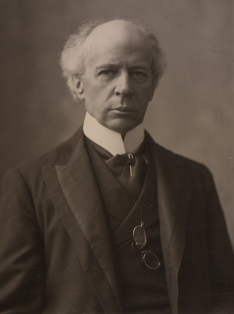
The Honourable Sir Wilfrid Laurier.
Photo: William James Topley, 1906 Wikipedia
Mount Sir Wilfrid Laurier, part of the Premier Range, is the highest peak of the Cariboo Mountains (3580 m, 11,750 feet). Originally named “Mount Titan’” by American mountaineer Allen Carpé [1894–1932] in 1924, in 1929 it was officially renamed in the Premier commemorations to honour Wilfred Laurier [1841-1919], prime minister of Canada from 1896 to 1911.
Born at Saint-Lin, Canada East, Laurier was elected to the Québec legislature in 1871. In 1874, he was elected to the House of Commons, of which he was a member until his death. When the Liberal party won the 1896 election, Laurier became prime minister.
Laurier visited British Columbia in 1910. Learning that Laurier was in favour of larger reserves and recognition of aboriginal title, the chiefs of the Shuswap, Okanagan, and Thompson tribes presented him with a petition condemning BC land policies and game laws and rejecting BC’s takeover of their lands. Believing that the Queen’s laws would guarantee their rights, they requested treaties with the federal government.
The decision by Laurier’s government to expand the railway system by building two new railways, the Grand Trunk Pacific and the National Transcontinental, caused a serious rift within the party. The Liberal’s were defeated in the 1911 general elections.
The first ascent of Mount Sir Wilfrid Laurier was made in 1924 by Carpé, Rollin Thomas Chamberlin [1881–1948] , and A. L. (Pete) Withers , when the mountain was still known as “Mount Titan.”
- Carpé, Allen [1894–1932]. “Climbs in Cariboo Mts. and Northern Gold Range, Interior Ranges of British Columbia.” Alpine Journal, Vol. 37 (1925):63
- Zillmer, Raymond T. [1887–1960]. “Explorations in the Southern Cariboos.” Canadian Alpine Journal, Vol. 27 (1939):48-61
- Story, Norah. The Oxford Companion to Canadian History and Literature. Toronto: Oxford University Press, 1967
- Wikipedia. Mount Sir Wilfrid Laurier