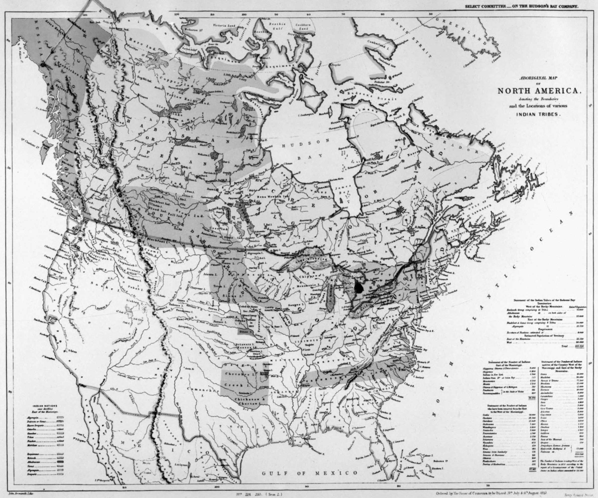
Aboriginal map of North America, denoting the boundaries and the locations of various Indian tribes.
John Arrowsmith, 1857
Library and Archives Canada [accessed 10 February 2026]

Aboriginal map of North America [detail]
Library and Archives Canada [accessed 10 February 2026]
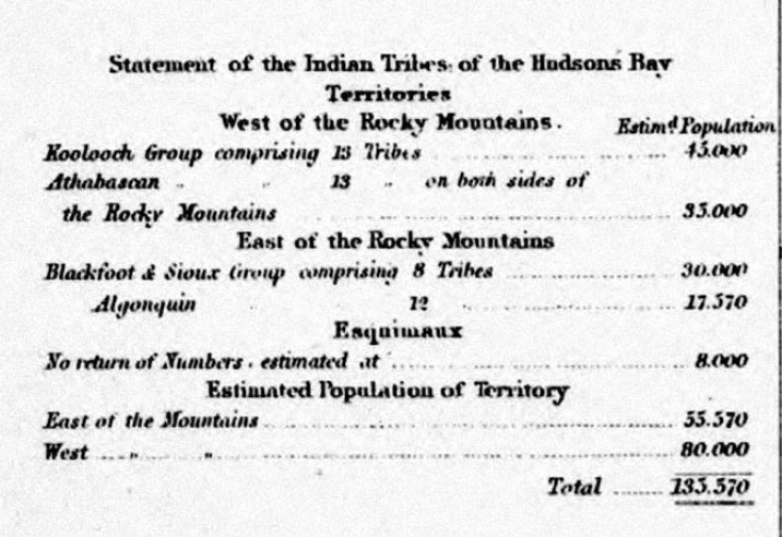
Statement of the Indian Tribes of the Hudsons Bay Territories
Aboriginal map
of
North America,
denoting the boundaries
and the locations of various Indian tribes.
Select Committee … on the Hudson’s Bay Company.
Ordered by the House of Commons to be Printed 31st July & 11th August 1857.
John Arrowsmith, 1857
This map includes:
Lake Athabasca
Athabasca River [as “Athabasca or Elk R.”]
Canoe River
Columbia River
Fraser River
McLoud’s Fort [as “McLeod’s Ft.”]
Peace River
Tribes
Athapescow Indians [as “Athabascan or Chipewan
Ind.”]
Beaver Indians
Blackfoot Indians
Blood Indians
Carrier (Dakelh)
Chipewyan Indians [as “Athabascan or Chipewan
Ind.”]
Shuswap (Secwépemc) Indians [as “Shouahwap Ind.”]
Tacully Indians [as “Takall Ind.”]
Lake Athabasca
Athabasca River [as “Athabasca or Elk R.”]
Canoe River
Columbia River
Fraser River
McLoud’s Fort [as “McLeod’s Ft.”]
Peace River
Tribes
Athapescow Indians [as “Athabascan or Chipewan
Ind.”]
Beaver Indians
Blackfoot Indians
Blood Indians
Carrier (Dakelh)
Chipewyan Indians [as “Athabascan or Chipewan
Ind.”]
Shuswap (Secwépemc) Indians [as “Shouahwap Ind.”]
Tacully Indians [as “Takall Ind.”]