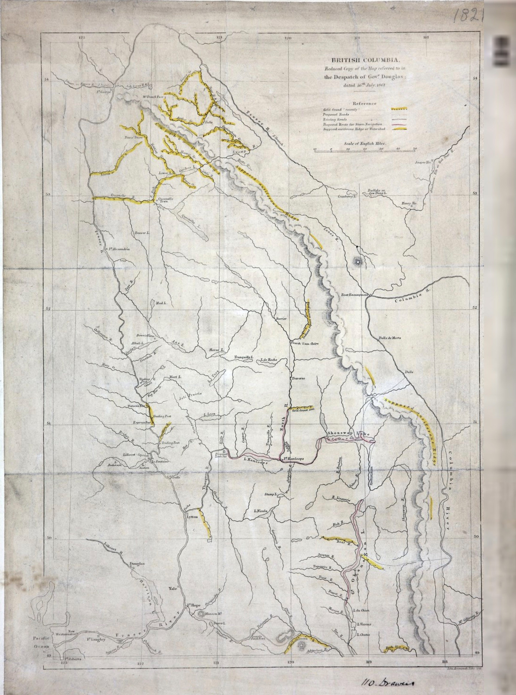
British Columbia.Reduced copy of the map referred to in the Despatch of Governor Douglas
John Arrowsmith, 1861
Colonial Dispatches, Uvic [accessed 10 February 2026]

British Columbia.Reduced copy of the map referred to in the Despatch of Governor Douglas [detail]
Colonial Dispatches, Uvic [accessed 10 February 2026]
British Columbia.
Reduced copy of the map referred to in
the Despatch of Governor Douglas
Dated 16 July 1861.
Showing roads, proposed route for steam navigation and supposed Auriferous Ridge or Watershed. 24 miles to one inch. John A. Arrowsmith [1790–1873], London. Lithographed.
The latest accounts from Cariboo confirm the former reports of its vast auriferous wealth. About 1500 men are supposed to be congregated in those Mines, and the number is continually augmented by the arrival of fresh bodies of Miners [1].
Upstream of the big bend on the Fraser are indicated these places: Canon Creek, McDonnell Pass, Antler Creek, Cunningham Creek, Swamp River, Brate (?) Creek.
Buffalo Dung Lake is shown in the Athabasca drainage.
Athabasca River [as “Athabasca, Elk, or Red Deer R.”]
Bear River
Boat Encampment
Buffalo Dung Lake [as “Buffalo or Cow Dung L.”]
Canoe River
Columbia River
Cranberry Lake
Fort George
Fraser River [as “Fraser R (S. Branch)”]
Henry House (2)
Jasper House
- 1. Douglas, James [1803–1877]. The Colonial Despatches of Vancouver Island and British Columbia. Douglas to Pelham-Clinton [Duke of Newcastle]. 16 July 1861, CO 60:10, no. 8719, 301. (1861). University of Victoria [accessed 11 February 2026]