Alberta-BC boundary. Glacier
Athabasca River and Fraser River drainages
Headwaters of Geikie Creek and Penstock Creek
52.675 N 118.3167 W — Map 83D/9 — Google — GeoHack
Earliest known reference to this name is 1924 (Boundary Survey)
Name officially adopted in 1951
Official in BC – Canada
Athabasca River and Fraser River drainages
Headwaters of Geikie Creek and Penstock Creek
52.675 N 118.3167 W — Map 83D/9 — Google — GeoHack
Earliest known reference to this name is 1924 (Boundary Survey)
Name officially adopted in 1951
Official in BC – Canada
This glacier appears on:
Boundary Commission Sheet 28 (surveyed in 1921)
Boundary Commission Sheet 28 (surveyed in 1921)
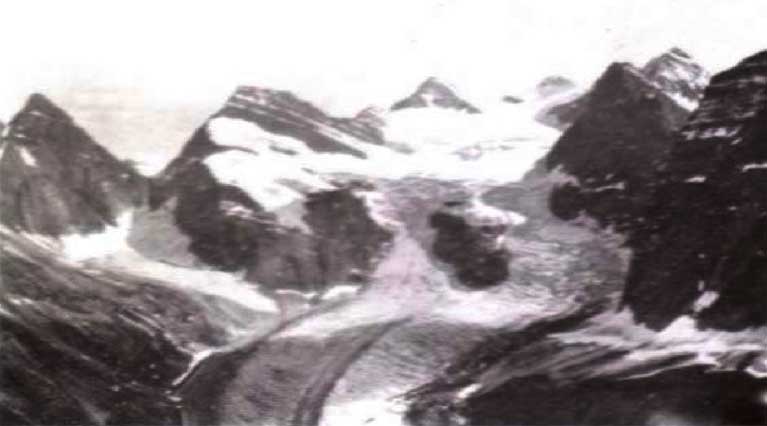
Great amphitheatre at the head of Bennington Glacier.
Photo: Cyril Wates, 1926
Canadian Alpine Journal 1927
Named in association with Bennington Peak.
References:
- Cautley, Richard William [1873–1953], and Wheeler, Arthur Oliver [1860–1945]. Report of the Commission appointed to delimit the boundary between the Provinces of Alberta and British Columbia. Part II. 1917 to 1921. From Kicking Horse Pass to Yellowhead Pass.. Ottawa: Office of the Surveyor General, 1924. Whyte Museum
- Wates, Cyril G. [1883–1946], and Gibson, E. Rex [1892–1957]. “The Ramparts in 1927.” Canadian Alpine Journal, Vol. 16 (1927):85-95
- British Columbia Geographical Names. Bennington Glacier