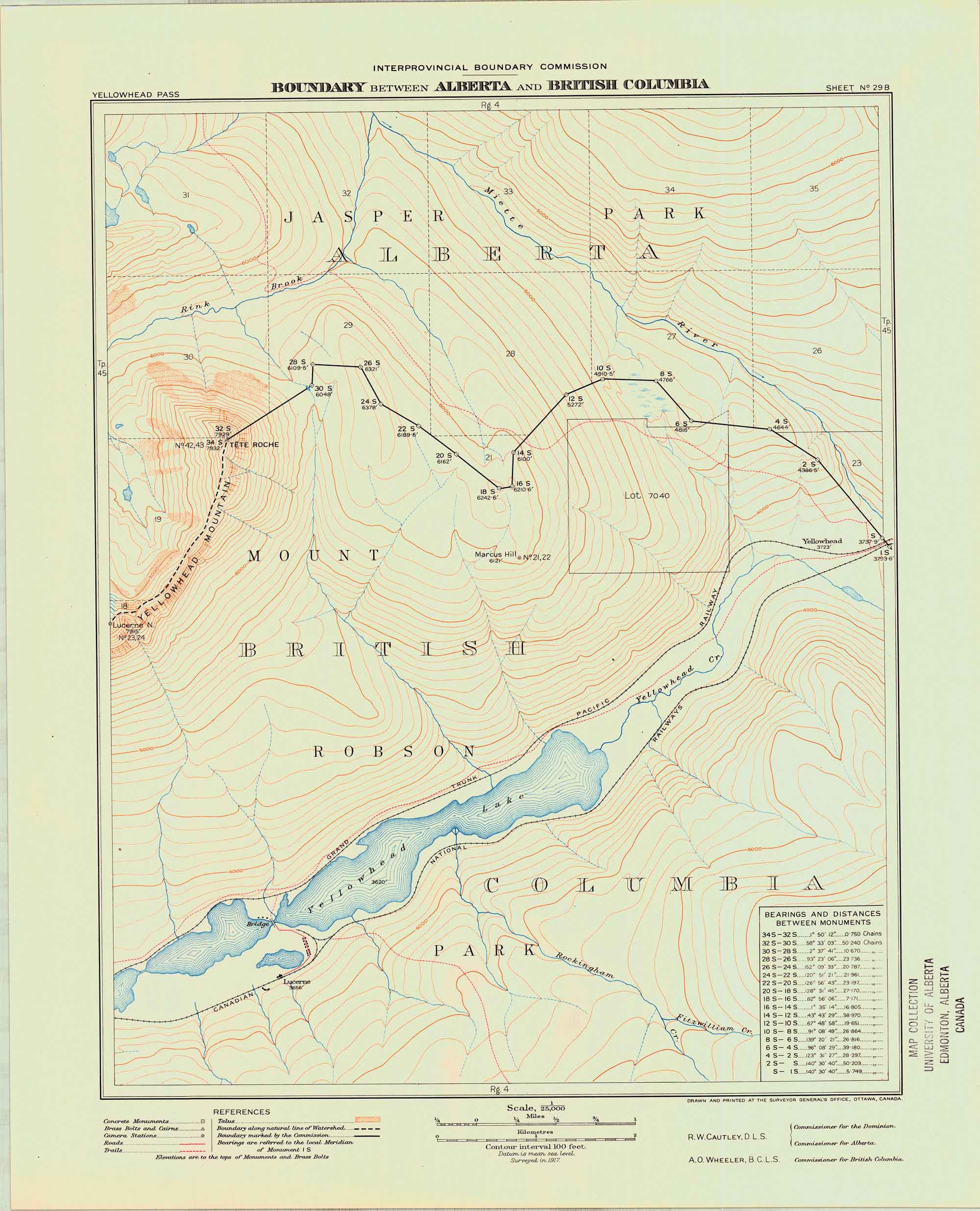
Boundary between Alberta and British Columbia. Office of the Surveyor-General, 1924
Internet Archive
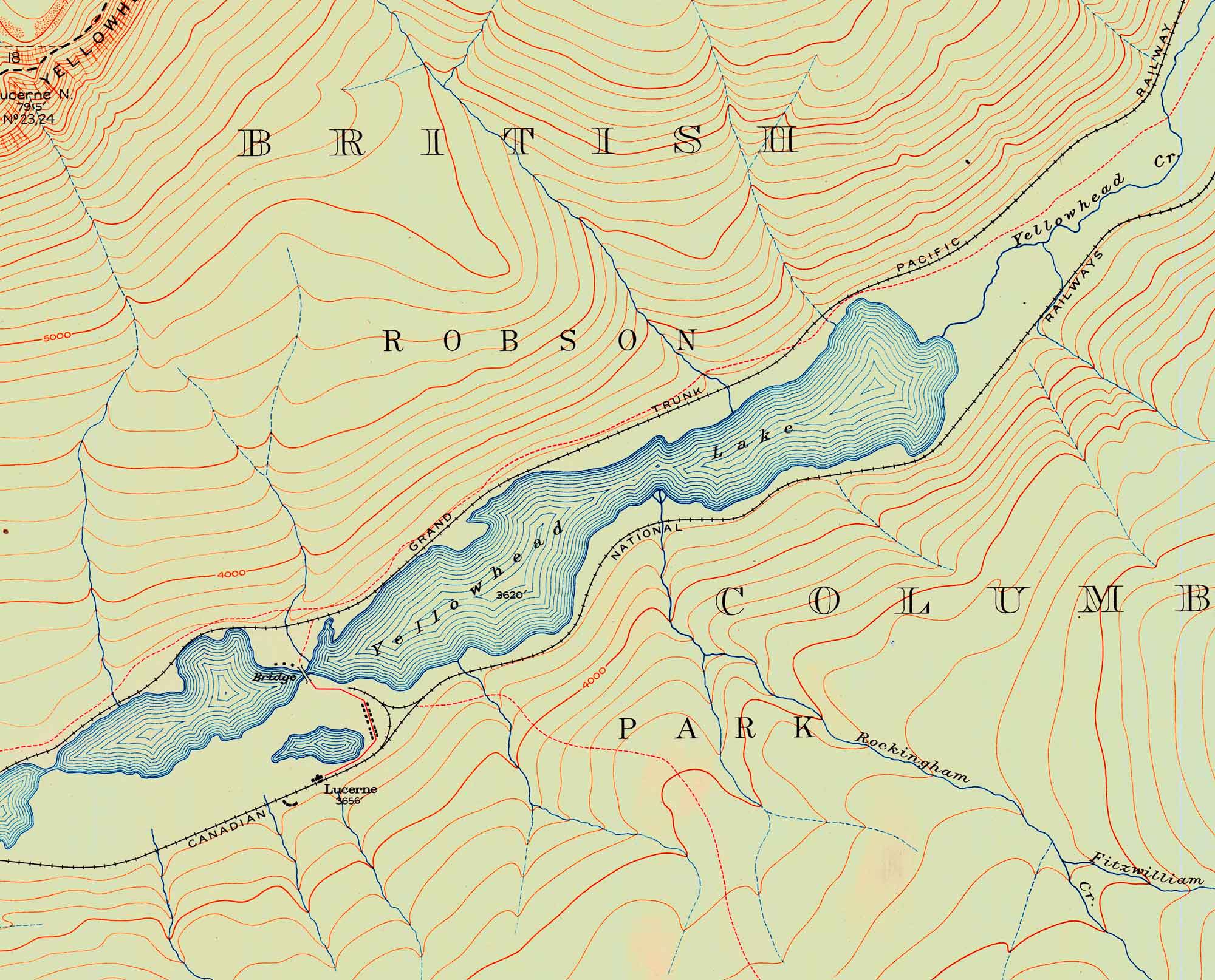
Yellowhead Lake. Surveyed in 1917. Boundary between Alberta and British Columbia. Detail.
Internet Archive
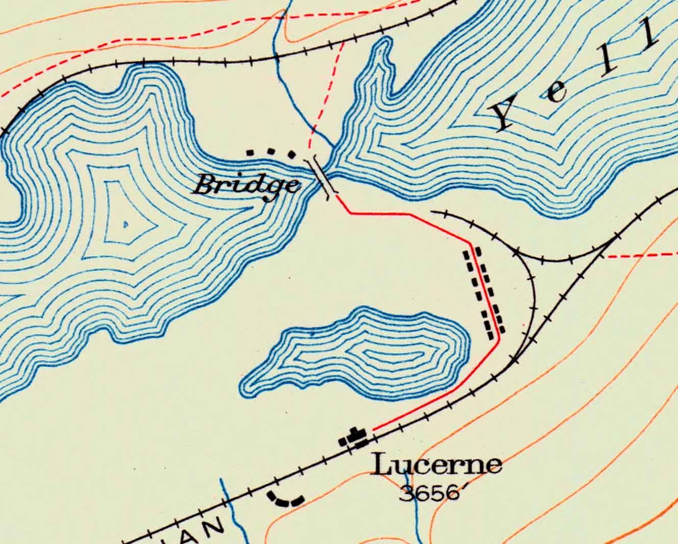
Lucerne. Surveyed in 1917. Boundary between Alberta and British Columbia. Detail.
Internet Archive
Alberta-British Columbia Boundary Commission maps 1924
Sheet 29 B — Yellowhead Pass to Tête Roche. Surveyed in 1917
This map includes:
Canadian National Railway
Fitzwilliam Creek
Grand Trunk Pacific Railway
Lucerne (CNoR railway point)
Miette River
Rink Brook
Rockingham Creek
Tête Roche
Yellowhead Pass
Yellowhead Mountain
Yellowhead Lake
Canadian National Railway
Fitzwilliam Creek
Grand Trunk Pacific Railway
Lucerne (CNoR railway point)
Miette River
Rink Brook
Rockingham Creek
Tête Roche
Yellowhead Pass
Yellowhead Mountain
Yellowhead Lake
References:
- Cautley, Richard William [1873–1953], and Wheeler, Arthur Oliver [1860–1945]. Report of the Commission Appointed to Delimit the Boundary between the Provinces of Alberta and British Columbia – Part III – from 1918 to 1924. Atlas. Ottawa: Office of the Surveyor General, 1925
- Cautley, Richard William [1873–1953], and Wheeler, Arthur Oliver [1860–1945]. Report of the Commission Appointed to Delimit the Boundary between the Provinces of Alberta and British Columbia. Parts IIIA & IIIB, 1918 to 1924. From Yellowhead Pass Northerly. Ottawa: Office of the Surveyor General, 1925. Whyte Museum