British Columbia. Former unofficial name: Fraser River drainage
Yellowhead Lake
52.8667 N 118.5333 W Google — GeoHack
Earliest known reference to this name is 1871 (Trutch)
Not currently an official name.
Yellowhead Lake
52.8667 N 118.5333 W Google — GeoHack
Earliest known reference to this name is 1871 (Trutch)
Not currently an official name.
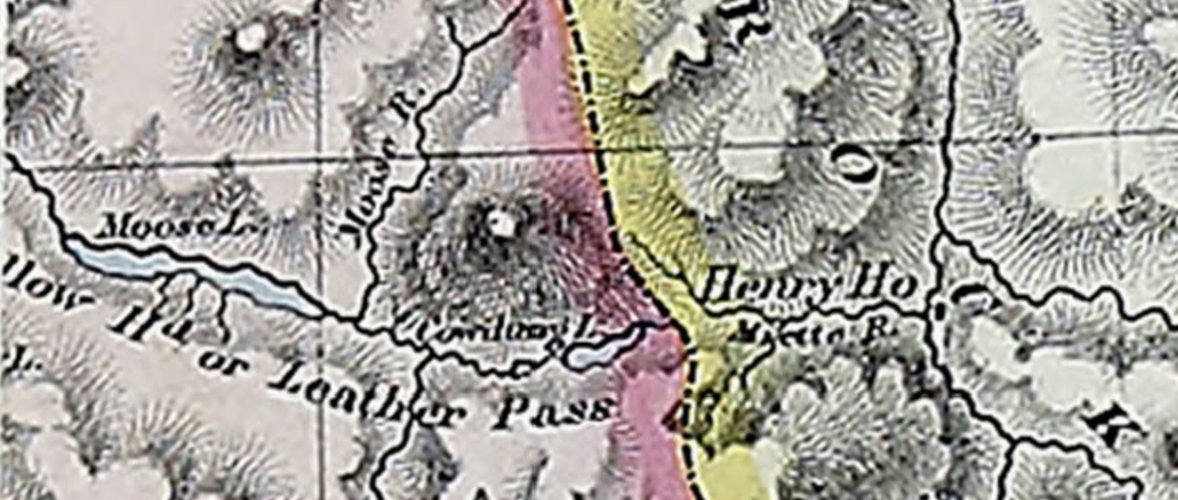
Detail of Trutch 1871 showing “Cowdung L.”
The name “Cowdung L.” appears on B.C. Surveyor General Joseph Trutch’s 1871 map of British Columbia, between Moose Lake and the Yellowhead or Leather Pass.
The name appeared as “Cow dung L.” on John Arrowsmith’s 1859 map.
References:
- Trutch, Joseph William [1826–1904]. Map of British Columbia to the 56th Parallel North Latitude. Victoria, B.C.: Lands and Works Office, 1871. University of Victoria
- British Columbia Geographical Names. Yellowhead Lake
Also see: