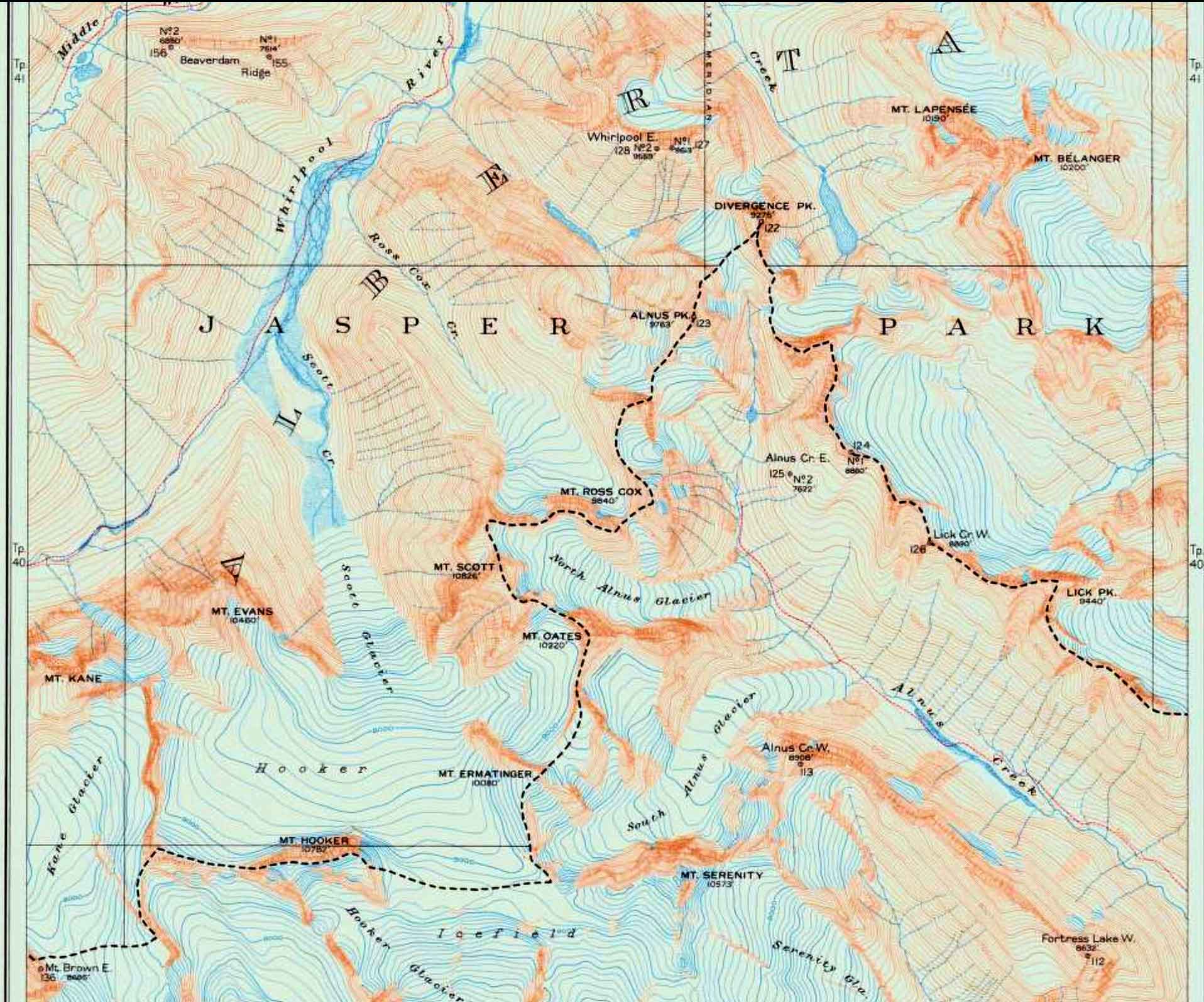
Alberta-BC boundary. Peak
N of Mount Hooker near head of Wood River and Whirlpool River
52.5 N 117.9917 W — Map 083C12 — Google — GeoHack
Name officially adopted in 1921
Official in BC – Canada
N of Mount Hooker near head of Wood River and Whirlpool River
52.5 N 117.9917 W — Map 083C12 — Google — GeoHack
Name officially adopted in 1921
Official in BC – Canada
This peak appears on:
Boundary Commission Sheet 26 (surveyed in 1920)
Boundary Commission Sheet 26 (surveyed in 1920)
Boundary between Alberta and British Columbia. Sheet 26. Surveyed in 1920
Internet Archive
The altitude of Divergence Peak is 9275 feet. The watershed line does not reach the summit, but at an altitude of 8920 feet is deflected sharply from a little west of north to southwest, for which reason the name has been given to the peak.
So wrote surveyor Arthur Oliver Wheeler [1860–1945] of the Alberta-British Columbia Boundary Commission regarding surveys done in 1920.
References:
- Cautley, Richard William [1873–1953], and Wheeler, Arthur Oliver [1860–1945]. Report of the Commission appointed to delimit the boundary between the Provinces of Alberta and British Columbia. Part II. 1917 to 1921. From Kicking Horse Pass to Yellowhead Pass.. Ottawa: Office of the Surveyor General, 1924. Whyte Museum
Also see: