Alberta-BC boundary. Mount
Headwaters of Simon Creek and Astoria River
52.6564 N 118.3192 W — Map 083D09 — Google — GeoHack — Bivouac
Name officially adopted in 1917
Official in BC – Canada
Elevation: 3313 m
Headwaters of Simon Creek and Astoria River
52.6564 N 118.3192 W — Map 083D09 — Google — GeoHack — Bivouac
Name officially adopted in 1917
Official in BC – Canada
Elevation: 3313 m
This mount appears on:
Boundary Commission Sheet 28 (surveyed in 1921)
Boundary Commission Sheet 28 (surveyed in 1921)
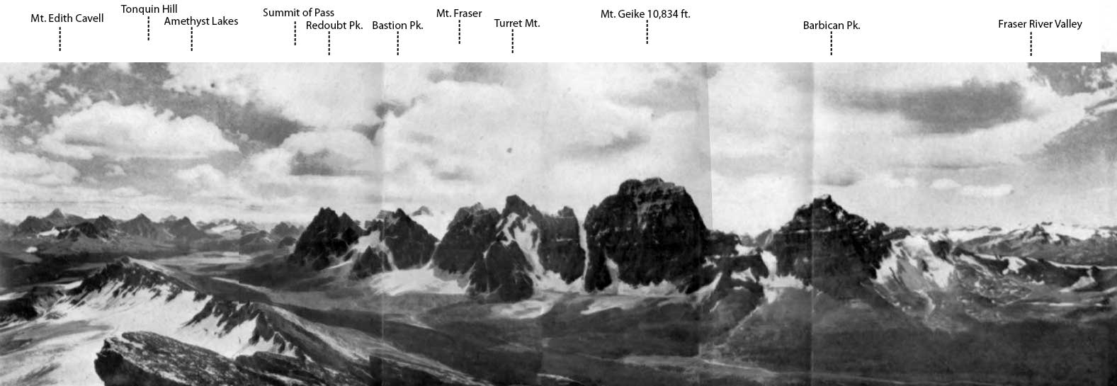
Comprising Bennington Peak, McDonnell Peak, and Simon Peak, the mountain honors Simon Fraser [1776–1862].
Also see: