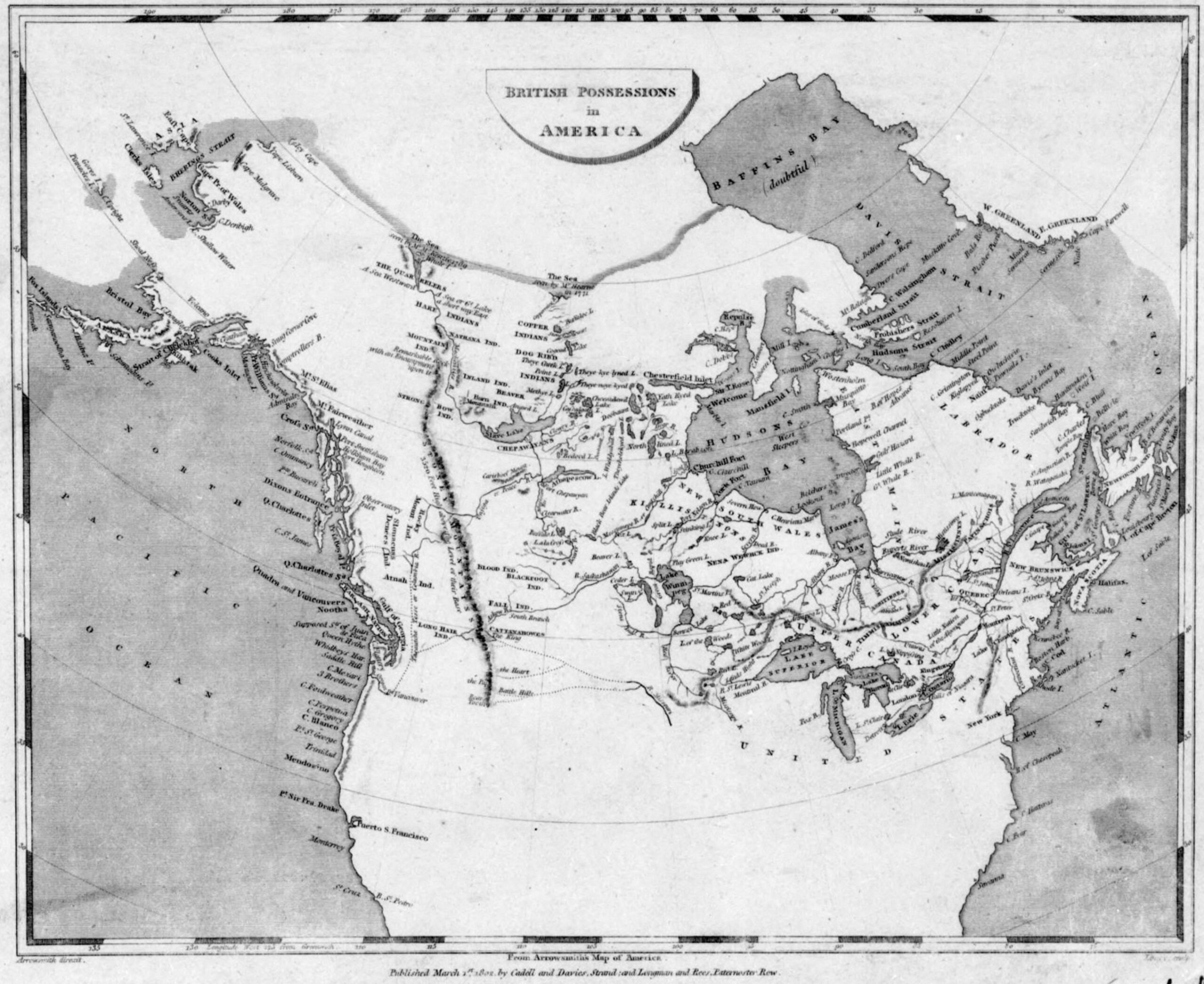
British possessions in America. Aaron Arrowsmith, 1795 Library and Archives Canada Historical Atlas of Canada
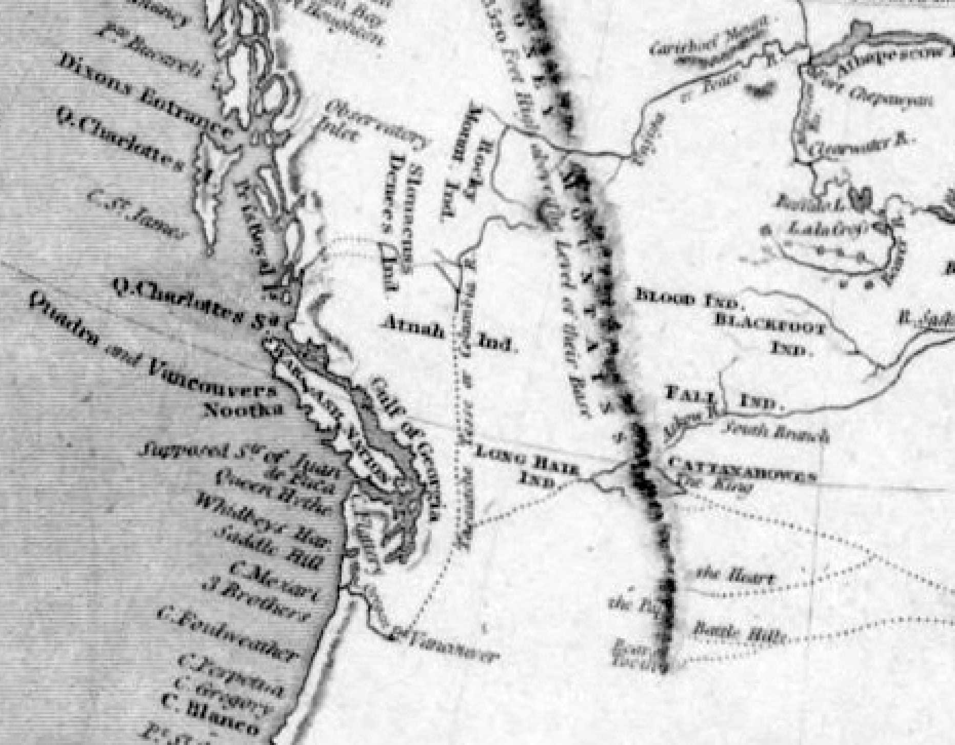
Arrowsmith, detail Historical Atlas of Canada
Aaron Arrowsmith [1750–1823] incorporated information from Hudson’s Bay Company manuscript maps and journals, the journals of Alexander Mackenzie [1764–1820] (which weren’t published until 1803), and the survey of the northwest coast by George Vancouver [1757–1798].
The general shape of northwestern North America south of the Arctic was now established, although innumerable details remained to be filled in, including the routes of Fraser River and Columbia River.
This map includes:
Lake Athabasca
Columbia River [as “Tacoutche Tesse or Columbia R.”]
Peace River
Rocky Mountains
Tacoutche Tesse
Lake Athabasca
Columbia River [as “Tacoutche Tesse or Columbia R.”]
Peace River
Rocky Mountains
Tacoutche Tesse
References:
- Historical Atlas of Canada. Historical Atlas online.
Also see: