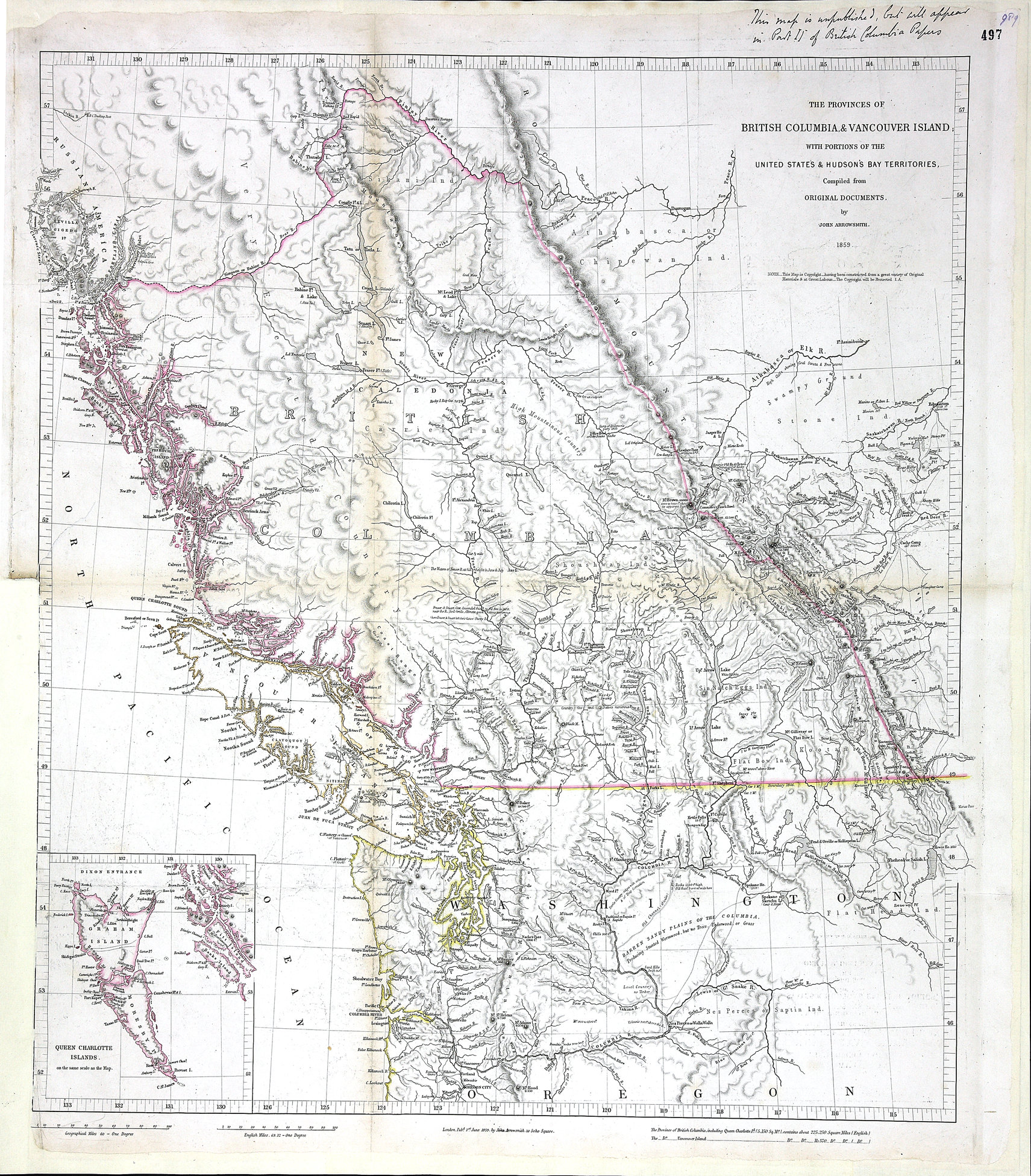
Provinces of British Columbia and Vancouver Island; with portions of the United States and Hudson’s Bay Territories. John Arrowsmith, 1859
Colonial Dispatches, Uvic
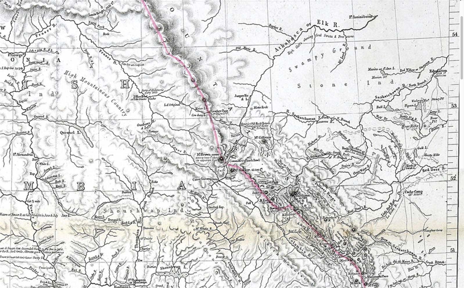
Detail of John Arrowsmith map,1859
Colonial Dispatches, Uvic
Detail of Tête Jaune Cache area, John Arrowsmith map,1859
Colonial Dispatches, Uvic
THE PROVINCES OF
BRITISH COLUMBIA & VANCOUVER ISLAND
WITH PORTIONS OF THE
UNITED STATE’S & HUDSONS BAY TERRITORIES.
Compiled from ORIGINAL DOCUMENTS.
by JOHN ARROWSMITH.
1859
Handwritten note on map sheet: This map is unpublished but will appear in Part II of British Columbia Papers
John Arrowsmith (1790–1873) was born at Winston, County Durham, England. In 1810 he joined his uncle Aaron Arrowsmith in the cartography business. After his uncle died in 1823, the family firm was carried on by his sons Aaron and Samuel Arrowsmith, and John began working on his own. The Arrowsmiths were founding members of the Geographical Society of London in 1830. The junior Aaron left the family firm in 1832, and upon the death of Samuel in 1839, John merged it into his own successful business.
The map includes the note “Camp of Anderson’s party 1835” near the site of “Yellow Head or Tete Jaune Cache.”
Lake Athabasca
Athabasca River
British Columbia
Mount Brown
Camp of Anderson’s party 1835
Canoe River
Canoe Encampment
Columbia River
Committee Punch Bowl
Cow Dung Lake
Cranberry Lake
Finlay River
Fraser River
Mount Hooker
Jasper Lake
Leather Pass
Miette River
Lac Orignal [as “Lac Original]
Moose Lake
Fraser River North Fork
North Thompson River
Peace River
Thompson River
Tête Jaune Cache
Yellowhead Pass
- Arrowsmith, John [1790–1873]. Provinces of British Columbia and Vancouver Island; with portions of the United States and Hudson’s Bay Territories. 1859. UVic