Athabasca Pass
52.3833 N 118.1889 W Google — GeoHack
Earliest known reference to this name is 2001
Official in Canada

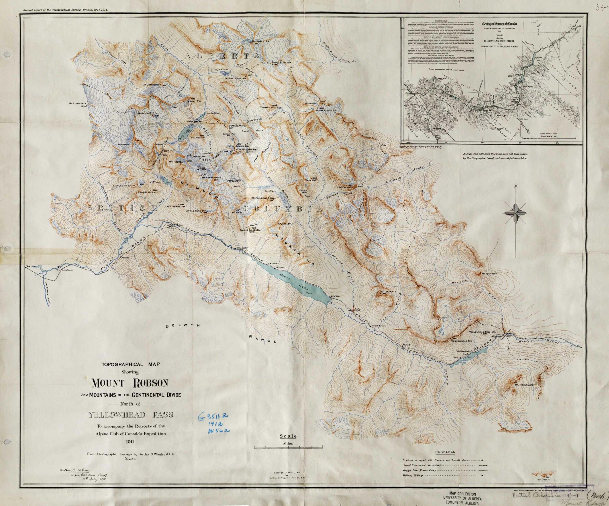
Topographical Map Showing Mount Robson and Mountains of the Continental Divide North of Yellowhead Pass. Arthur O. Wheeler, 1912 Victoria Library, University of Toronto

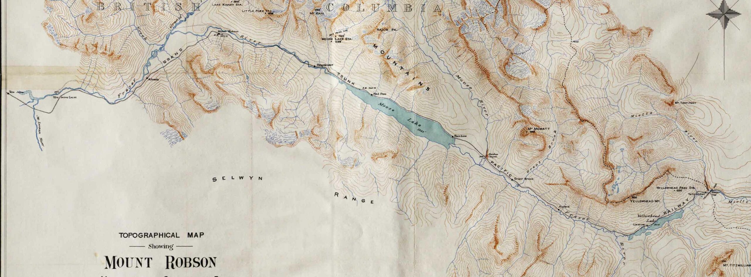
Detail showing stations on the Grand Trunk Pacific Railway. Victoria Library, University of Toronto
Topographical Map Showing Mount Robson and Mountains of the Continental Divide North of Yellowhead Pass
To accompany the Reports of the Alpine Club of Canada’s Expedition, 1911
From Photographic Surveys by Arthur Oliver Wheeler [1860–1945], A.C.C., Director
Annual report of the Topographical Surveys Branch, 1911-1912
With an inset showing a detail of the Geological Survey of Canada’s 1900 map of the Yellowhead Pass Route by James McEvoy [1862–1935] .
Adolphus Lake
Albreda (GTP railway point)
Alpland
Arctomys Valley
Berg Lake
Calumet Creek
Coleman Glacier
The Colonel
Colonel Creek
Emperor Falls
Extinguisher Tower [as “Extinguisher”]
Mount Fitzwilliam
Gendarme Mountain
Grant Brook
Grant Brook (GTP railway point)
Grand Trunk Pacific Railway
Mount Kain
Kinney Lake
Lazuli Lake
Little Grizzly
Mount Longstaff
Lynx Mountain
Miette River
Mount Robson (railway point)
Moose Pass
Moose River
Mount Mowat
Mumm Peak
Mural Glacier
Ptarmigan Mountain
Rainbow (GTP railway point)
Rainbow Canyon
Rainbow Canyon and Falls (Moose River)
Rainbow Range
Razor Peak
Rearguard Mountain
Red Pass Junction
Red Pass
Reef Icefield
Resplendent (GTP railway point)
Resplendent Valley
Mount Robson
Robson Glacier
Selwyn Range
Smoky River
Snowbird Pass
Stoney River [as Stony River]
Swiftcurrent Creek
Terrace Glacier
Terrace Creek
The Helmet
The Dome
Valley of a Thousand Falls
Mount Toot-toot
Trio Mountain [as Trios Pk.]
Upright Mountain
Whitehorn Mountain
Wolverine Creek
Yellowhead Mountain
Yellowhead Lake
Yellowhead (railway point)

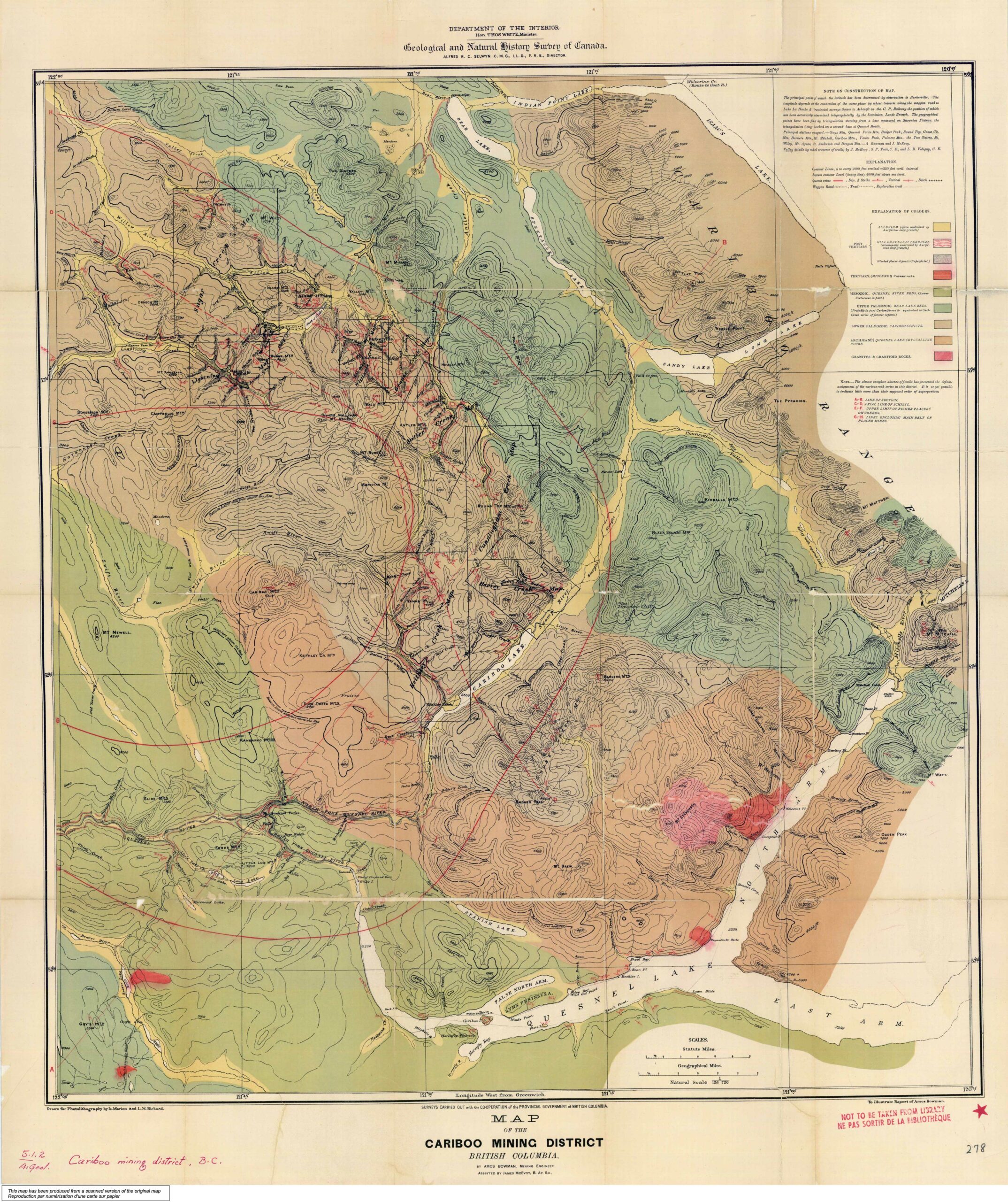
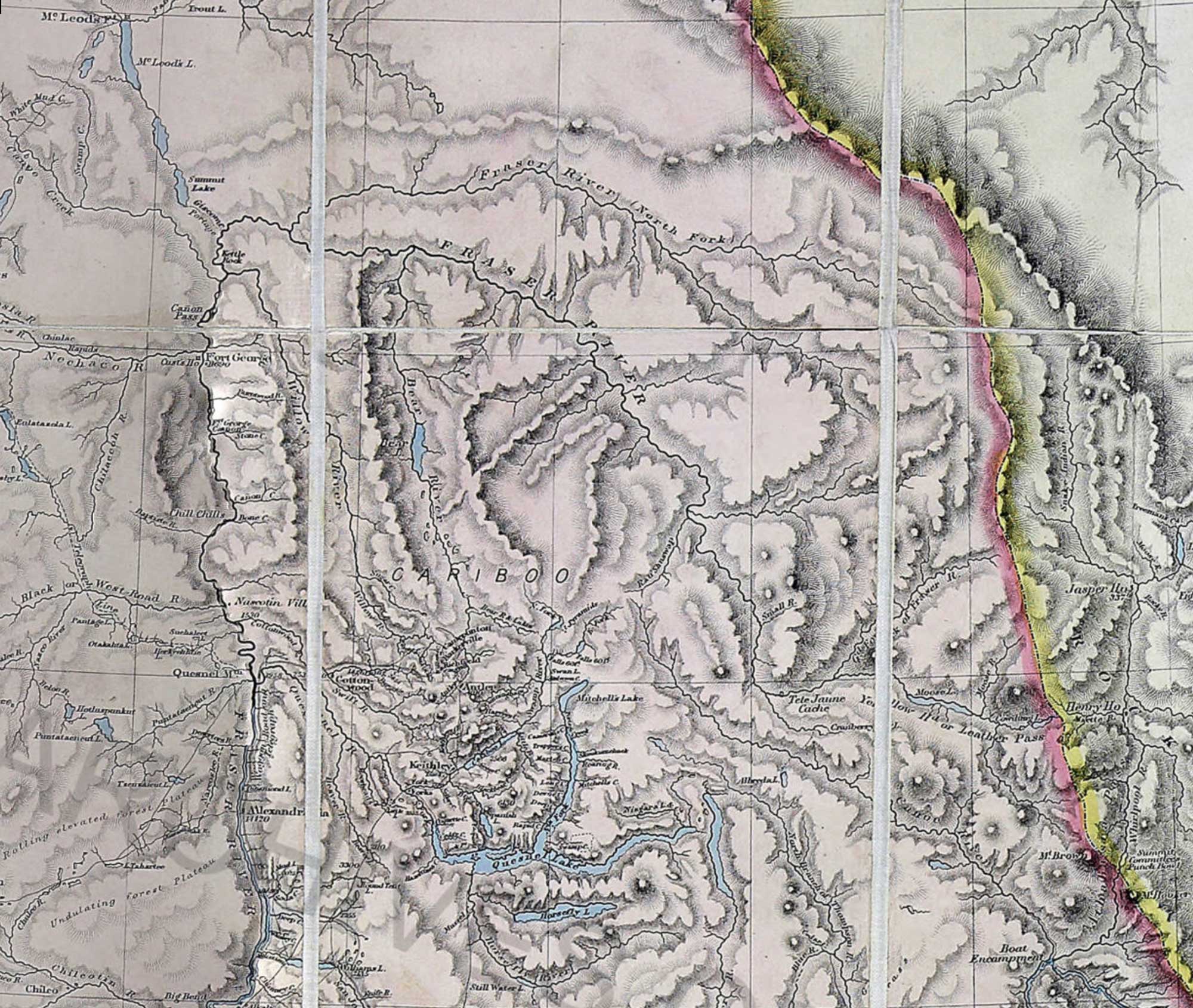
Map of the Cariboo Mining District to illustrate the report of Amos Bowman
Cariboo Gold Rush
In 1885 and 1886 Mr. Amos Bowman was engaged in geologically examining the Cariboo mining district of British Columbia, the expense of the undertaking being borne jointly by the Geological Survey of Canada and the Government of British Columbia. Mr. Bowman was assisted by Mr. James McEvoy, and for a part of the time by Messrs. S. P. Tuck and L. R. Voligny. The year 1885 was necessarily given chiefly to geographical and topographical work, but in the following year Mr. Bowman devoted most of his own time to the geological and mining features. His general report was published by the Geological Survey in the volume for 1887-88, together with a geological map of the district on a scale of two miles to an inch, and maps on a large scale of Hixon Creek and Island Mountain and Mosquito Creek.
It was intended to follow the report above mentioned by a second, in which detailed descriptions should be given of the principal auriferous creeks of the district. Maps of these creeks were prepared by Mr. Bowman and lithographed, but as he had in the meantime been obliged to sever his regular connection with the Survey in favour of urgent private business, the final correction and printing of these maps was only completed after long delays, and in June, 1894, Mr. Bowman died, without having written any descriptive matter to accompany these mining maps.
— George M. Dawson, Geological Survey of Canada, April, 1895
Amos B. Bowman was born at Blair, Ontario, but soon after, his parents moved to Ohio. Later he had a very distinguished career as a renowned scientist in Canada and the United States. Following university studies in Germany, he graduated as a civil and mining engineer, and traveled in Europe writing articles for the New York Tribune. An outstanding authority on geology, he had charge of a five-year California geological survey. He then joined an official Canadian geological survey, surveying the Cariboo mining region, and prepared reports on many sections of British Columbia.
Mr. Bowman promoted the interests of Fidalgo Island in British Columbia, whose possibilities impressed him. In recognition of his services, the town of Anacortes was named after his wife, Anna Curtis Bowman. He published a newspaper, and gave liberally in land to induce the building of a railroad up the Skagit Valley. It was said of this outstanding scientist that “he often impoverished himself to enrich others.”

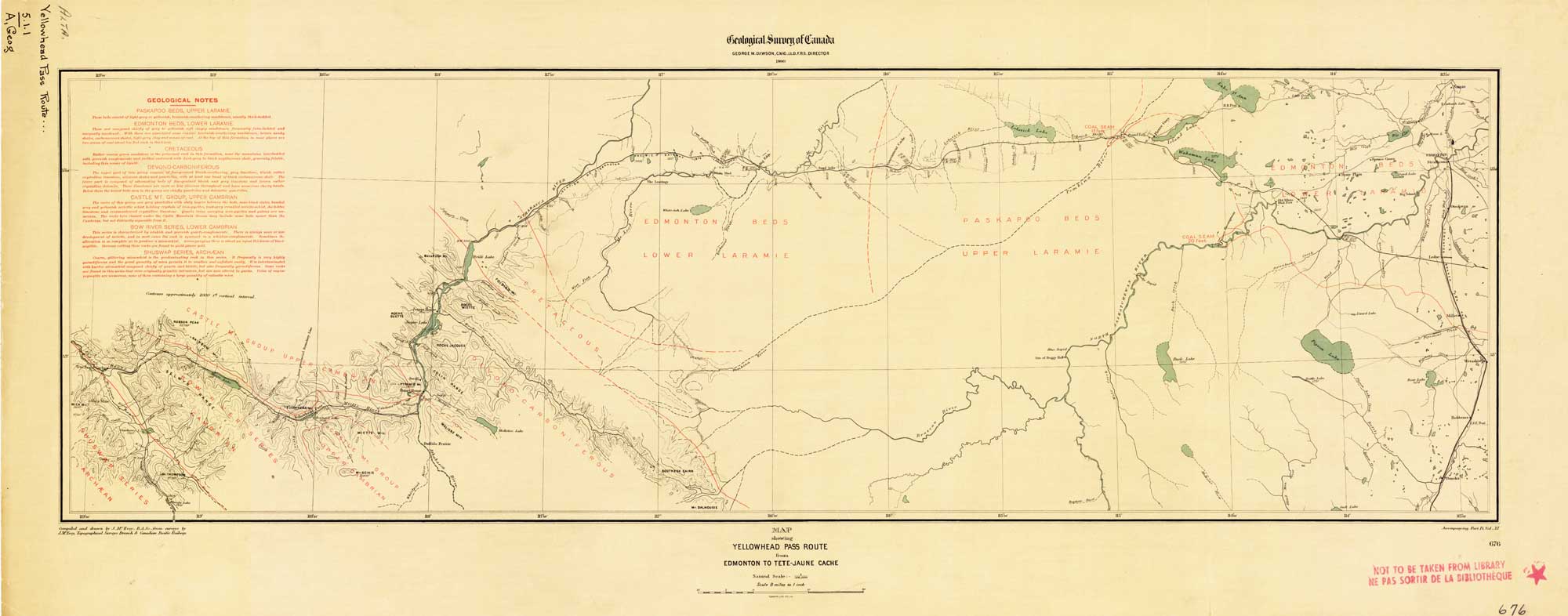
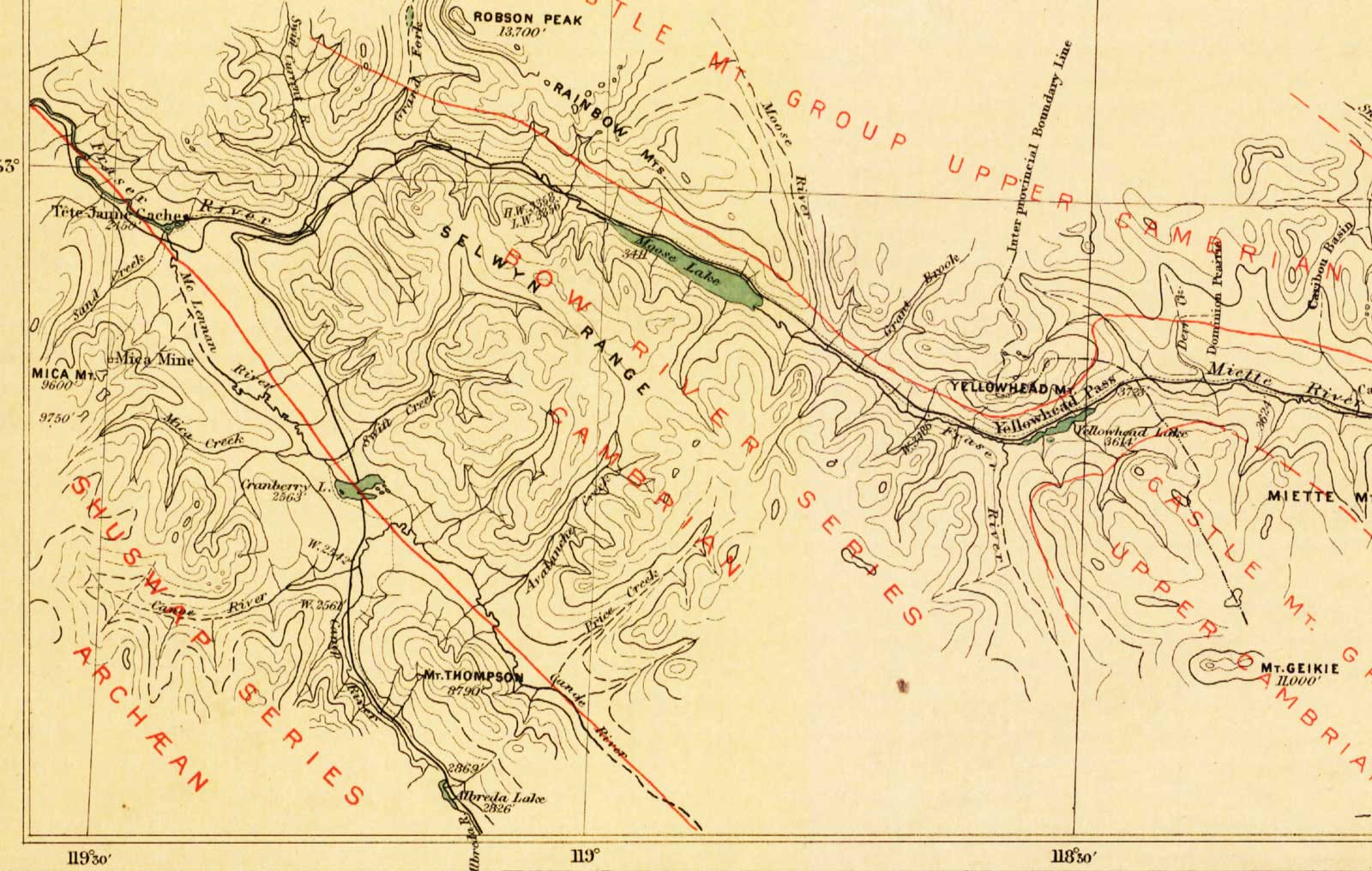
Map Showing Yellowhead Pass Route From Edmonton To Tête-Jaune Cache. James McEvoy, 1900.
Natural Resources Canada

Map Showing Yellowhead Pass Route From Edmonton To Tête-Jaune Cache.
James McEvoy, 1900. (Detail of Yellowhead Pass to Tête Jaune Cache)
Natural Resources Canada
In 1898 McEvoy surveyed the Athabasca River valley for about 240 kilometres east of the Yellowhead Pass, and down the Fraser River on the west side of the pass for another 120 kilometres.
The splendid report of James McEvoy, published by the Geological Survey of Canada in 1900, dealing with the geology and natural history resources of the country traversed by the Yellowhead Pass route from Edmonton to Tête-Jaune Cache, contains the most comprehensive and reliable geographical information that has yet been published, and also contains the only geographical map published of that route on a sufficiently large scale to be of value.
— Arthur Oliver Wheeler [1860–1945], 1912

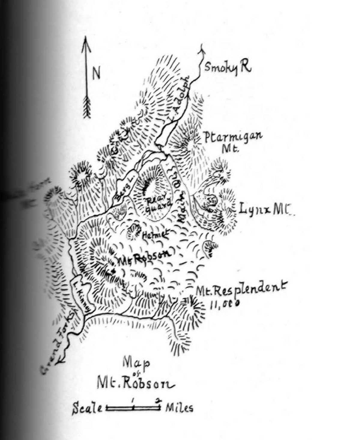
Map of Mount Robson based on expeditions in 1907 and 1908. By A. P. Coleman. Canadian Alpine Journal, 1910

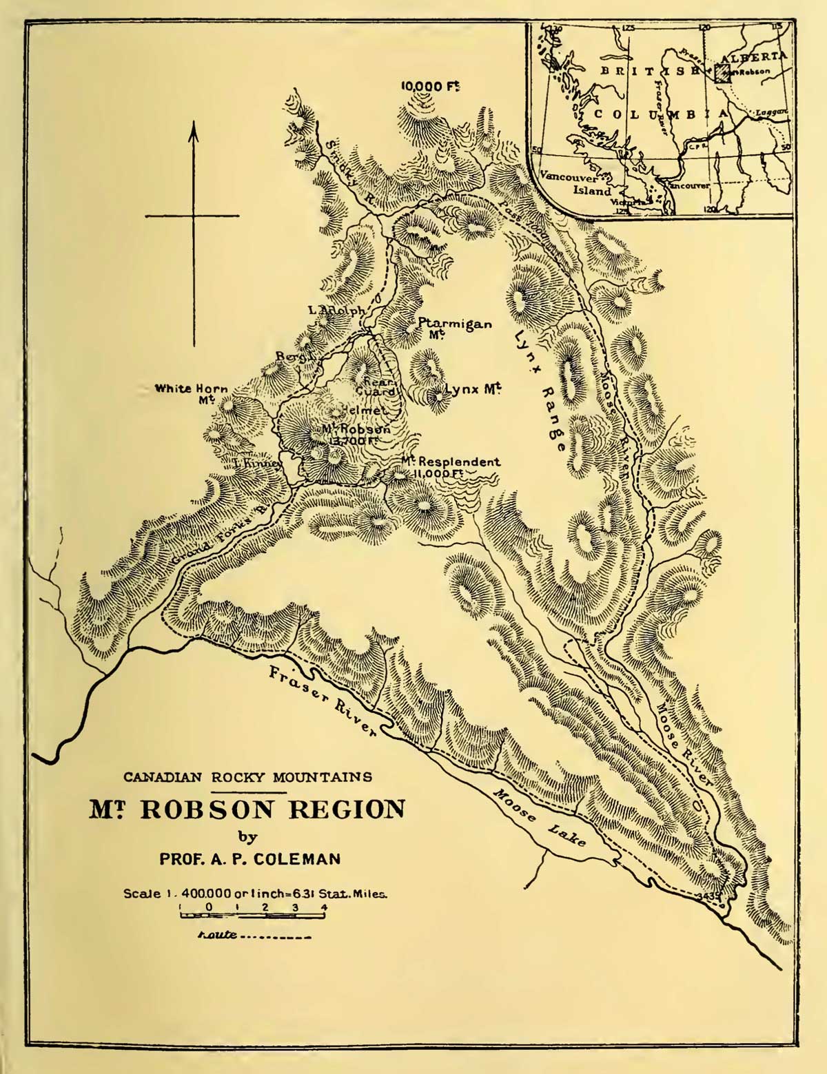
Mt. Robson Region map by A. P. Coleman, 1911 The Canadian Rockies : new and old trails, p. 264 [accessed 15 February 2025]

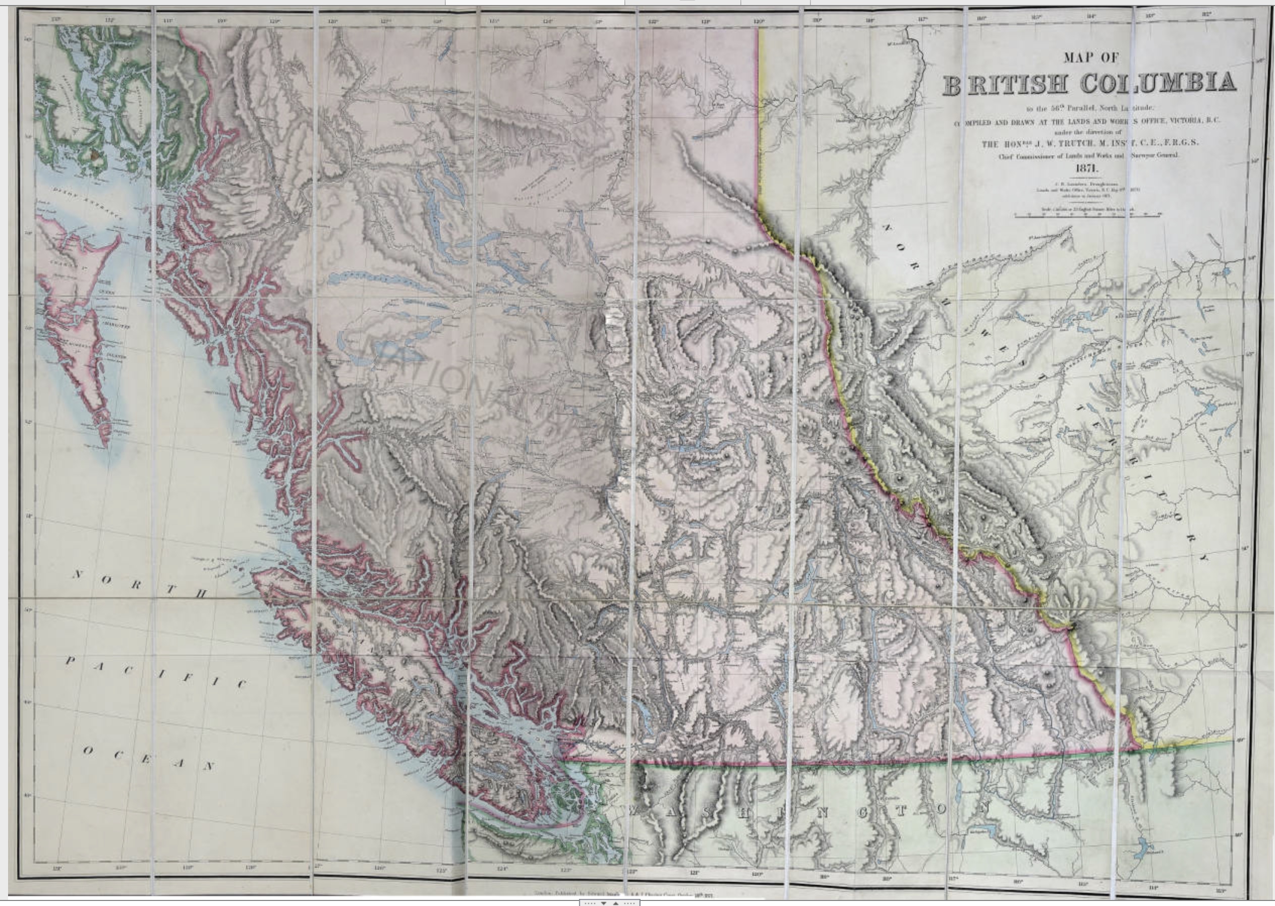
Trutch, Joseph William. Map of British Columbia to the 56th Parallel North Latitude, 1871
University of Victoria

Trutch, Joseph William. Map of British Columbia to the 56th Parallel North Latitude, 1871 (detail)
University of Victoria
The general shape of northwestern North America south of the Arctic was now established, although innumerable details remained to be filled in, including the routes of Fraser River and Columbia River.

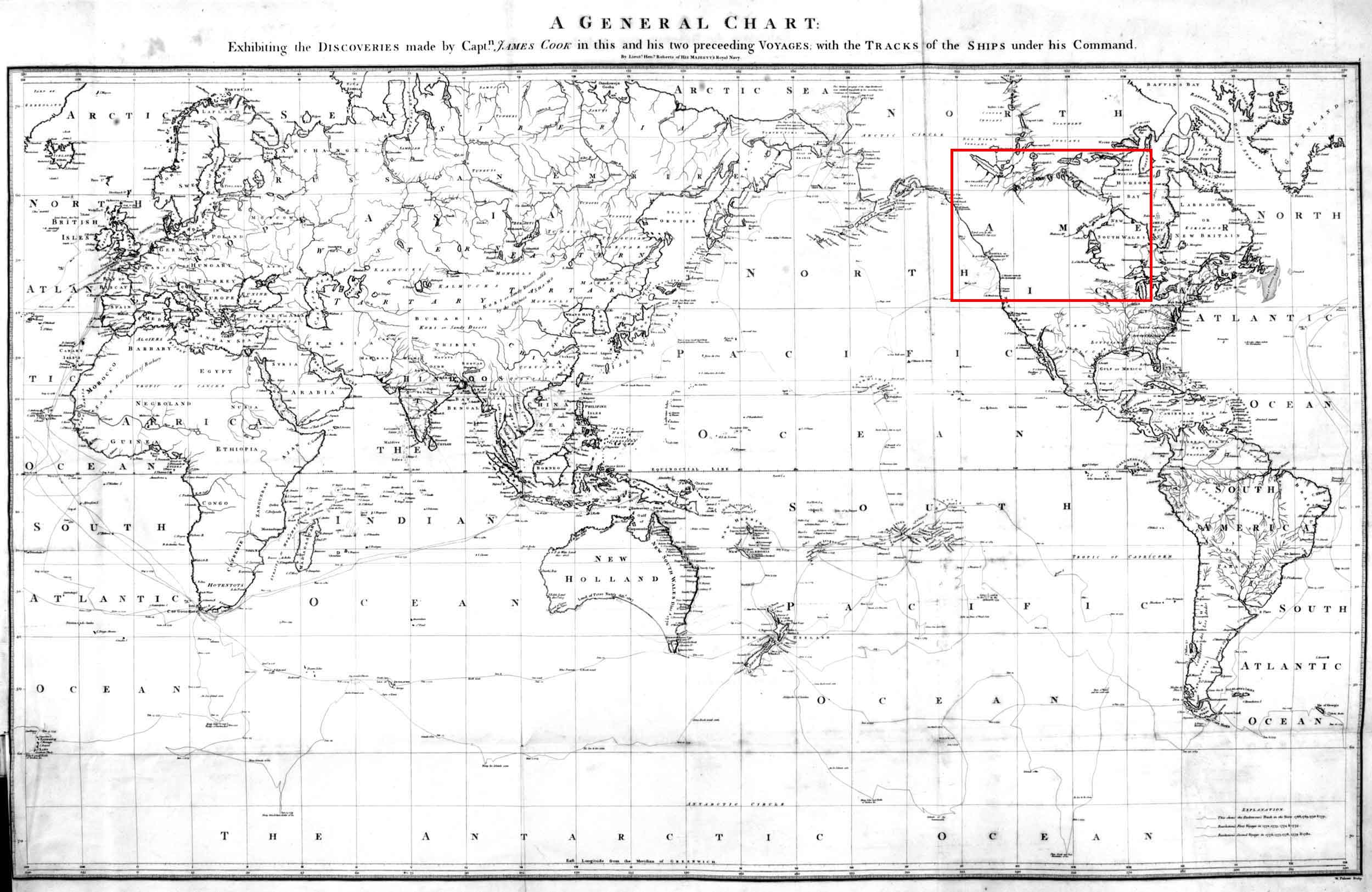
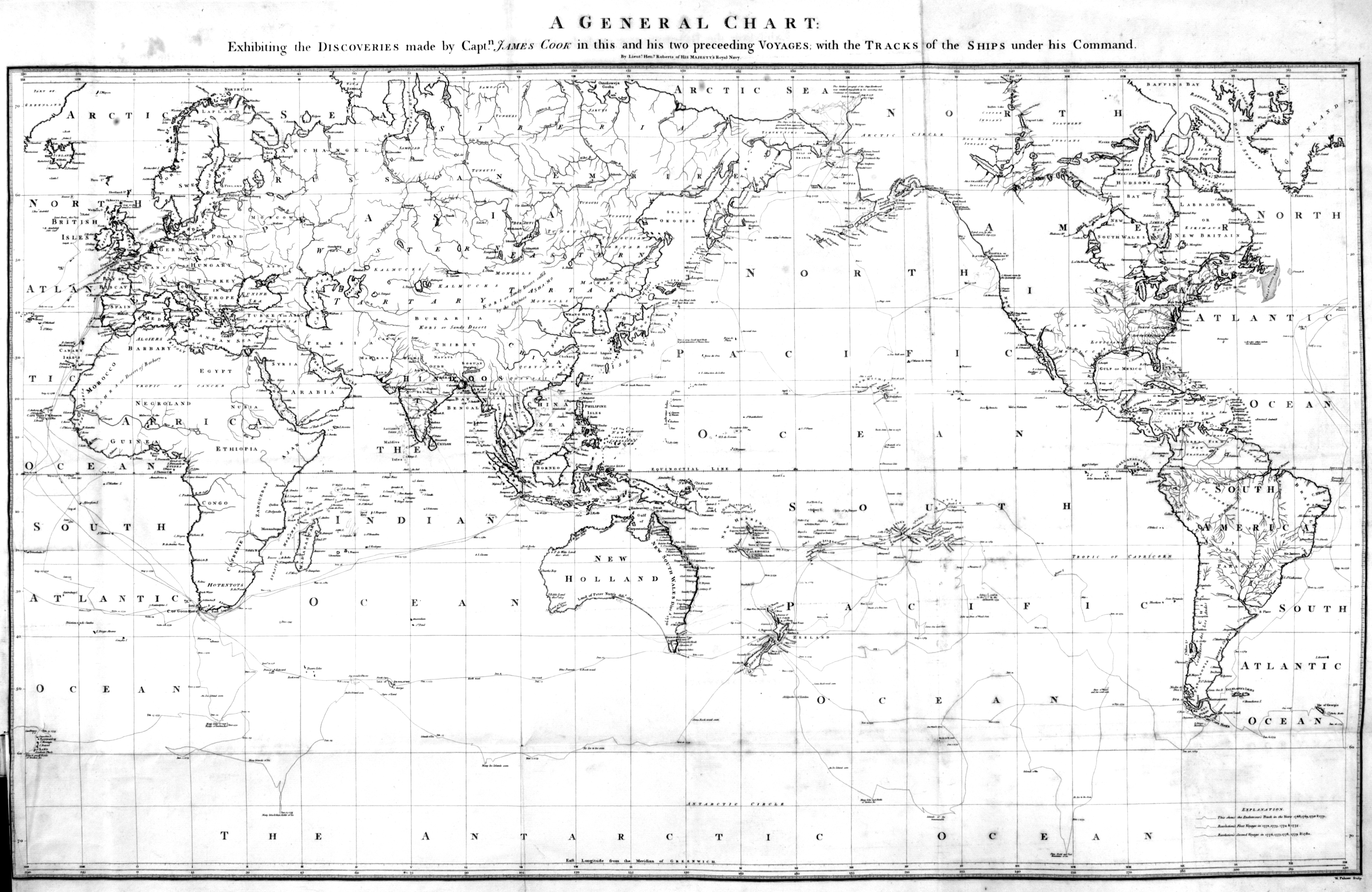
Map of the world in Cook’s “Third Voyage,” 1784.
By Henry Roberts, Lieutenant in His Majesty’s Navy
Princeton University Library

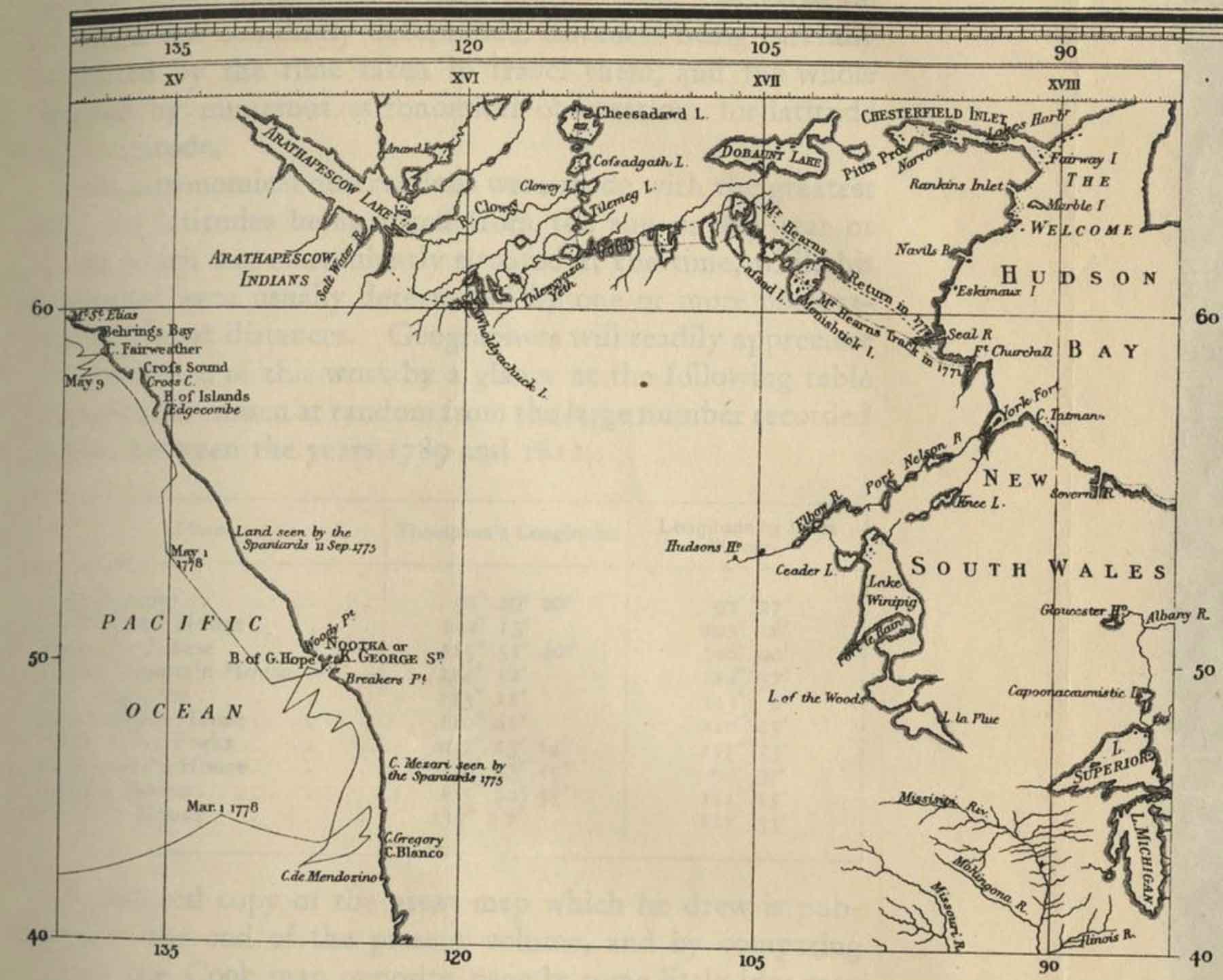
Detail of map of the world in Cook’s “Third Voyage,” 1784.
By Henry Roberts, Lieutenant in His Majesty’s Navy
UBC Library Digital Collections
A General Chart:
Exhibiting the Discoveries made by Captn. James Cook in this and his two preceeding Voyages with the Tracks of the Ships under his Command
.
The map was drawn by Henry Roberts [1756–1796], a native to Shoreham, Sussex, who was an officer in the Royal Navy who served with James Cook [1728–1779] on Cook’s last two voyages [1].
According to the Champlain Society edition of Samuel Hearne’s journeys, this map was the first to show Cook’s route [2].
The map does not seem to appear in the 1796 Cook’s Voyage to the Pacific Ocean [3].

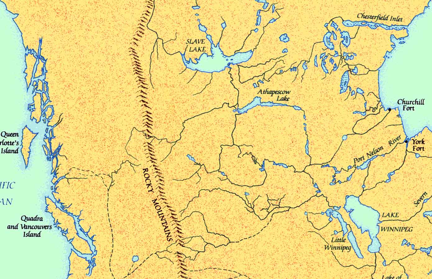
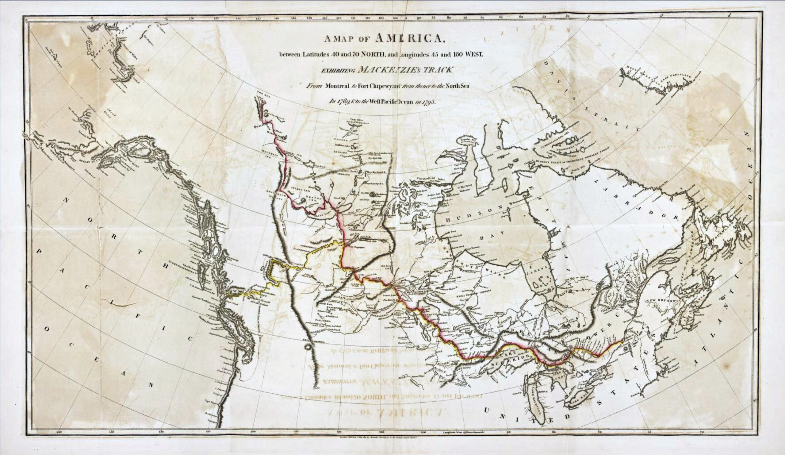
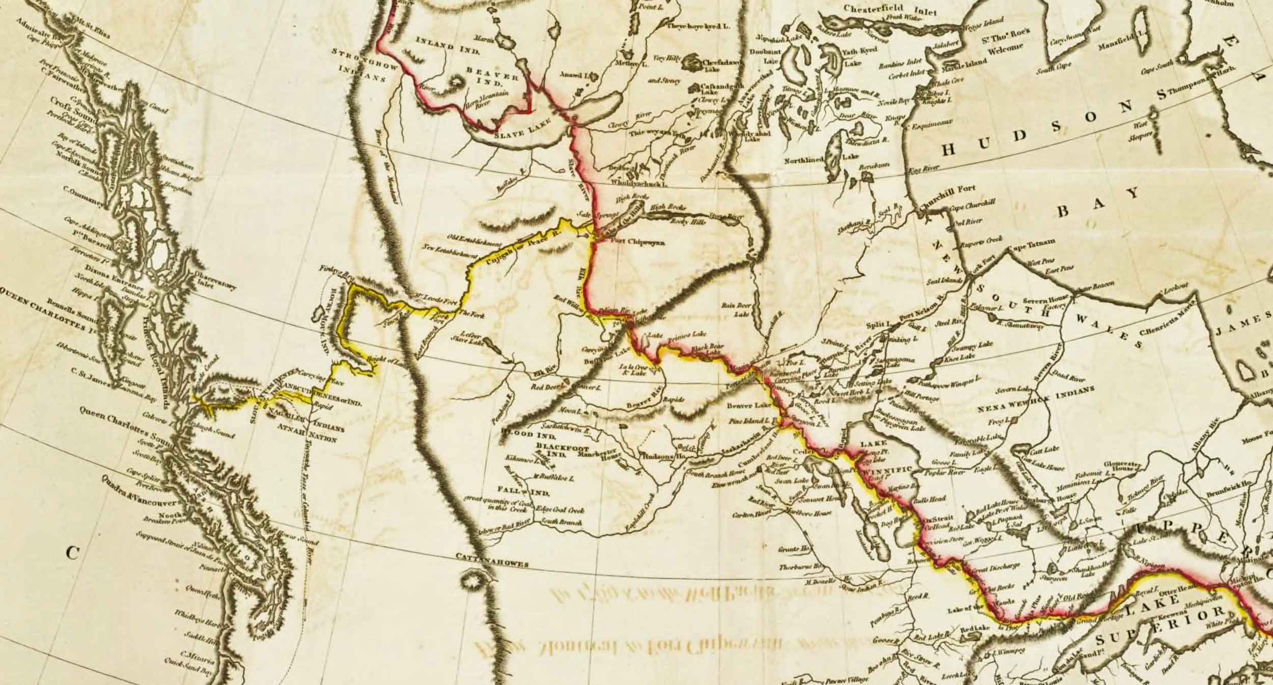
Map of Mackenzie’s 1789 and 1793 expeditions. Mackenzie’s Voyages 1803, p. 1

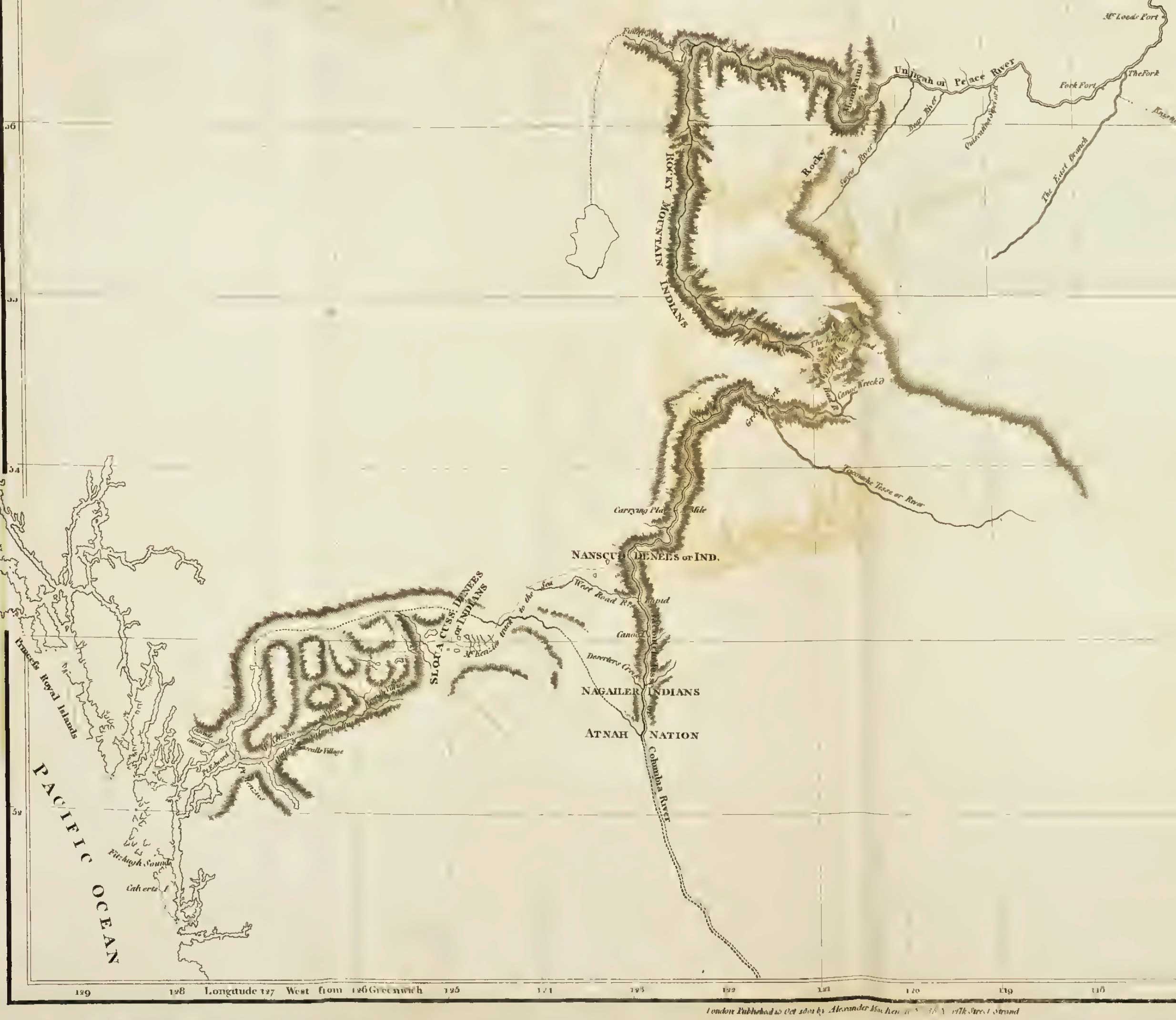
Map of Mackenzie’s 1789 and 1793 expeditions (detail) Mackenzie’s Voyages 1803, p. 1

A map of Mackenzie’s track from Fort Chipewan to the Pacific Ocean in 1793 (detail) Internet Archive
A Map of America
between Latitudes 40 and 70 North, and Longitudes 45 and 180 West
Exhibiting Mackenzie’s Track
From Montreal to Fort Chipewyan from thence
to the North Sea In 1789
and to the West Pacific Ocean in 1793
This map faces page 1 in the original version of Mackenzie’s Journals [1]
In 1793 Alexander Mackenzie [1764–1820] lead the first expedition of European descendants to cross the American continent north of Mexico.
He crossed the Continental Divide through a pass that remains unnamed, although a park has been created in its surroundings. The only name honouring Mackenzie in the Spiral Road region is Mount Sir Alexander, a mountain he never saw.
On the map of Mackenzie’s route across the Divide, the only original name that survives is Bad River, which appears next to his note, “Canoe Wreck’d.”
“Bad River” was superseded with the name “James Creek” by the Geographic Board of Canada in 1924; however, in 1976 to accommodate local usage, which dates to the earliest days of exploration in the northern Rocky Mountains, the name “Bad River (James Creek)” was established.
Considering the confluence of McGregor River and Fraser River to be a fork, then the South Fork of the Fraser River runs up from the fork though Tête Jaune Cache to the headwaters at the Continental Divide in Mount Robson Park.
This nomenclature was formally adopted by the Geographic Board of Canada in 1910, as long-identified on maps and in journals. But in 1915 the Board renamed North Fork of the Fraser River to McGregor River, and Fraser River proper became the main source of the channel, the old South Fork of the Fraser River.(1)
I left Vancouver on May 20th. 1912, with a party of twelve men to survey land within the reserve on the South Fork of the Fraser River, about fifty miles below Tete Jaune Cache. There are three different routes to get into this country, probably the most expeditious one being via Edmonton-the way we went. Taking from Edmonton, by special permission of the Railway Commission, we travelled over the Grand Trunk Pacific as far as the end of steel. which at that time was Resplendent, twenty-nine miles west of the British Columbia-Alberta boundary. Owing to the fact that the Grand Trunk has not been opened for traffic farther west than Hinton, 185 miles west of Edmonton, it was necessary to get this special permission before we were allowed to travel the remaining ninety-eight miles to the end of steel. (2)