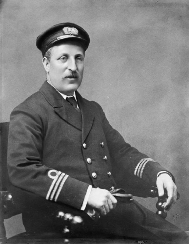
Morrison Parsons Bridgland
Morrison Parsons Bridgland
b. 1878 — Toronto, Ontario, Canada
d. 15 January 1948 — Toronto, Ontario, Canada
After graduation with honours from the University of Toronto in 1903, Bridgland, in company with
Arthur Oliver Wheeler [1860–1945], undertook the detailed survey of the Selkirk Range of the Rocky Mountains by photographic method of surveying which had been developed by Dr. Edouard Deville, the then Surveyor General of Canada.
Bridgland gave practically his whole active field of service to this class of surveying and became recognized as a world authority in photographic surveying. He was the author of several papers dealing with optics and the mathematical solution of problems pertaining to the application of photographic information translated at scale to the flat map.
Bridgland lived in Calgary until his retirement in 1935. He was survived by his wife, Mary, and two sons, Charles and Edgar.
Works pertinent to the Mount Robson region of which Bridgland was author or co-author:
- — “Report of the Chief Mountaineer [Yoho camp].” Canadian Alpine Journal, Vol. 1 (1907):131. Alpine Club of Canada [accessed 4/2/2025]
- — “Report of the Chief Mountaineer [Paradise Valley camp].” Canadian Alpine Journal, Vol. 1, No. 2 (1908):122. Alpine Club of Canada [accessed 4/2/2025]
- — “Report of the Chief Mountaineer [Rogers Pass camp 1908].” Canadian Alpine Journal, Vol. 2 (1909):118. Alpine Club of Canada [accessed 4/2/2025]
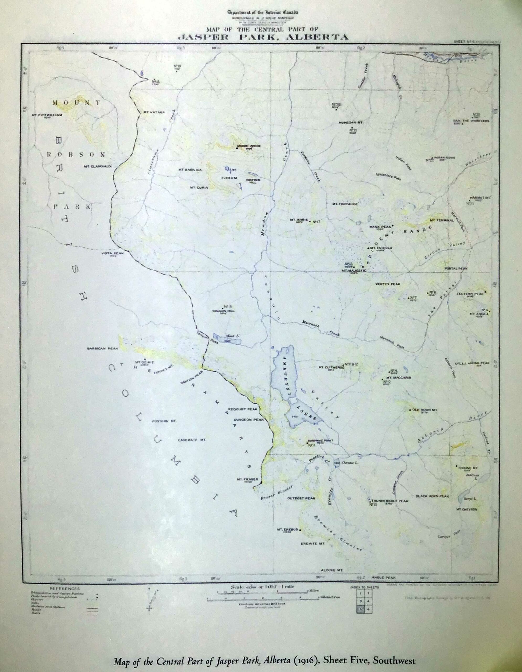
- — and Douglas, Robert [1881–1930]. Description of and Guide to Jasper Park. Ottawa: Department of the Interior, 1917. Parlks Canada History
- — “Jasper Park.” Canadian Alpine Journal, 10 (1919)
Bridgland is the namesake of the following place in the Mount Robson region:
Bridgland is credited with naming the following place:
Events in the Mount Robson region in which Bridgland was involved:
- 1906 ACC Camp – Yoho
- 1907 ACC Camp – Paradise Valley
- 1913 Interprovincial Boundary Commission
References:
- Anon. “List of Members.” Canadian Alpine Journal, Vol. 1 (1907):188. Alpine Club of Canada [accessed 2 April 2025]
- Sissons, Charles Bruce [1879–1965]. “Morrison P. Bridgland. In Memoriam.” Canadian Alpine Journal, Vol. 31 (1948):162-164
- MacLaren, Ian S. Mapper of Mountains. M. P. Bridgland in the Canadian Rockies, 1902-1930. University of Alberta Press, 2005. Google Books