British Columbia. Icefield: Fraser River drainage
E of Berg Lake, NE of Kinney Lake
53.1333 N 119.0167 W — Map 83E/3 — Google — GeoHack
Earliest known reference to this name is 1911 (Wheeler)
Official in BC – Topo map from Canadian Geographical Names
E of Berg Lake, NE of Kinney Lake
53.1333 N 119.0167 W — Map 83E/3 — Google — GeoHack
Earliest known reference to this name is 1911 (Wheeler)
Official in BC – Topo map from Canadian Geographical Names
This icefield appears on:
Wheeler’s map Mount Robson 1912
Boundary Commission Sheet 31 (surveyed in 1922)
Boundary Commission Sheet 32 (surveyed in 1922 &1924)
Wheeler’s map Mount Robson 1912
Boundary Commission Sheet 31 (surveyed in 1922)
Boundary Commission Sheet 32 (surveyed in 1922 &1924)
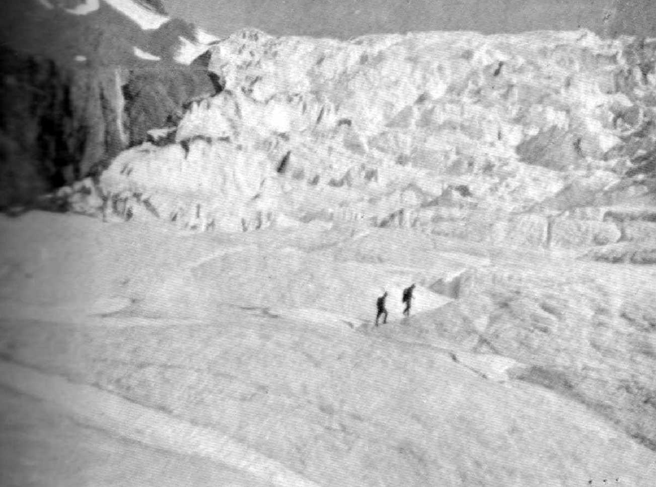
Icefall of Reef Glacier (Western flow). Photo, Byron Harmon, 1911. Canadian Alpine Journal 1912,p. 26
“The glacier at the head of the west branch of the Moose River was named Reef Glacier by Dr. A. P. Coleman on one of his expeditions to Mount Robson,” according to Arthur Oliver Wheeler [1860–1945]. “It is so called on account of the rock ridges, or nunataks, which appear like reefs rising from the snowfield.”
Arthur Philemon Coleman [1852–1939] visited Mount Robson in 1907 and 1908. There is no reference to Reef Glacier or Icefield in Coleman’s The Canadian Rockies: New and Old Trails, 1911.
References:
- Coleman, Arthur Philemon [1852–1939]. The Canadian Rockies: New and Old Trails. London: T. Fisher Unwin, 1911. Internet Archive [accessed 3 March 2025]
- Wheeler, Arthur Oliver Oliver [1860–1945]. “The Mountains of the Yellowhead Pass.” Alpine Journal, Vol. 26, No.198 (1912):382
- Wheeler, Arthur Oliver Oliver [1860–1945]. “The Alpine Club of Canada’s expedition to Jasper Park, Yellowhead Pass and Mount Robson region, 1911.” Canadian Alpine Journal, Vol. 4 (1912):9-80. Alpine Club of Canada
Also see: