NE of Moose Lake
53.0833 N 118.8 W — Map 83E/2 — Google — GeoHack
Earliest known reference to this name is 1911
Name officially adopted in 1923
Official in BC – Canada
Wheeler’s map Mount Robson 1912
Boundary Commission Sheet 30 (surveyed in 1924)
Boundary Commission Sheet 31 (surveyed in 1922)
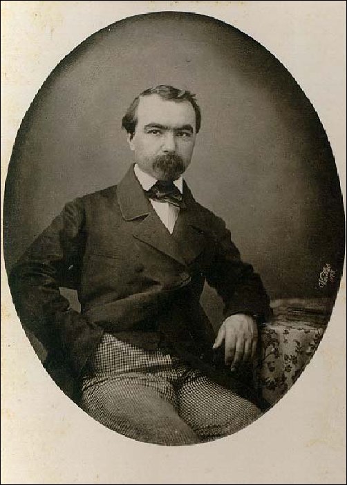
Colonel Aimé Laussedat
Wikipédia
Colonel Aimé Laussedat (1819-1907) was a French scientist who, because of his contributions to the field of aerial photography, is called the “father of photogrammetry.”
Arthur Oliver Wheeler [1860–1945] named the peak in 1911, during the 1911 Alpine Club of Canada–Smithsonian Robson Expedition:
“Across the valley from our camp a fine-looking peak stood out conspicuously. On a small scale the peak resembles one on the Blaeberry River, near its junction with the Columbia, named Mt. Laussedat, after Colonel Aimé Laussedat, a French scientist who first brought to notice the uses of photography in mountain surveying. The station is here referred to as ‘The Colonel.’ It is a very commanding peak and the view from its summit will repay the climb, which is nowhere difficult. It was a wondrous sight—seas of peaks does not express it—oceans of peaks rising high in every direction. The immensity of the view is astonishing—the immeasurable chaos of it all!”
- Deaville, E. “Colonel A. Laussedat. In memoriam.” Canadian Alpine Journal, Vol. 1, No. 2 (1908):98
- Wheeler, Arthur Oliver [1860–1945]. “The Mountains of the Yellowhead Pass.” Alpine Journal, Vol. 26, No.198 (1912):382
- Wikipédia (Fr.). Aimé Laussedat