British Columbia. Falls: Fraser River drainage
Robson River, between Berg Lake and Kinney Lake
53.1167 N 119.2 W — Map 83E/3 — Google — GeoHack
Earliest known reference to this name is 1911 (Wheeler)
Name officially adopted in 1956
Official in BC – Canada
Robson River, between Berg Lake and Kinney Lake
53.1167 N 119.2 W — Map 83E/3 — Google — GeoHack
Earliest known reference to this name is 1911 (Wheeler)
Name officially adopted in 1956
Official in BC – Canada
This falls appears on:
Boundary Commission Sheet 32 (surveyed in 1922 &1924)
Boundary Commission Sheet 32 (surveyed in 1922 &1924)
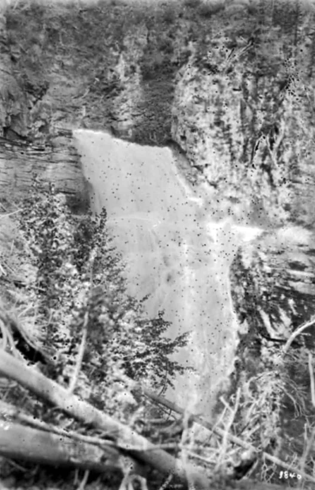
White Falls
William James Topley, 1914
Library and Archives Canada
Describing the course of the Robson River below the Falls of the Pool,
Arthur Oliver Wheeler [1860–1945] wrote, “the river proceeds on its way still deep in a rock canyon, to the last line of cliffs, down which it leaps in a great curve of foam. ‘The White Fall’ would be an appropriate name.”
Arthur Oliver Wheeler [1860–1945] wrote, “the river proceeds on its way still deep in a rock canyon, to the last line of cliffs, down which it leaps in a great curve of foam. ‘The White Fall’ would be an appropriate name.”
References:
- Wheeler, Arthur Oliver [1860–1945]. “The Alpine Club of Canada’s expedition to Jasper Park, Yellowhead Pass and Mount Robson region, 1911.” Canadian Alpine Journal, Vol. 4 (1912):9-80
- Cautley, Richard William [1873–1953], and Wheeler, Arthur Oliver [1860–1945]. Report of the Commission Appointed to Delimit the Boundary between the Provinces of Alberta and British Columbia. Parts IIIA & IIIB, 1918 to 1924. From Yellowhead Pass Northerly. Ottawa: Office of the Surveyor General, 1925. Whyte Museum
Also see: