Confluence of Canoe River and Columbia River
52.1167 N 118.4333 W — Map 083D01 — Google — GeoHack
Earliest known reference to this name is 1811 (David Thompson)
Topo map from Canadian Geographical Names
John Arrowsmith’s map British North America 1832
Palliser Map 1863
Trutch’s map of BC 1871
George Monro Grant’s map of Yellowhead Pass 1872
BC Lands Central BC 1892
Brownlee’s map Province of BC 1893
Jörgensen Map Province of BC 1895
Cram’s map British Columbia 1913
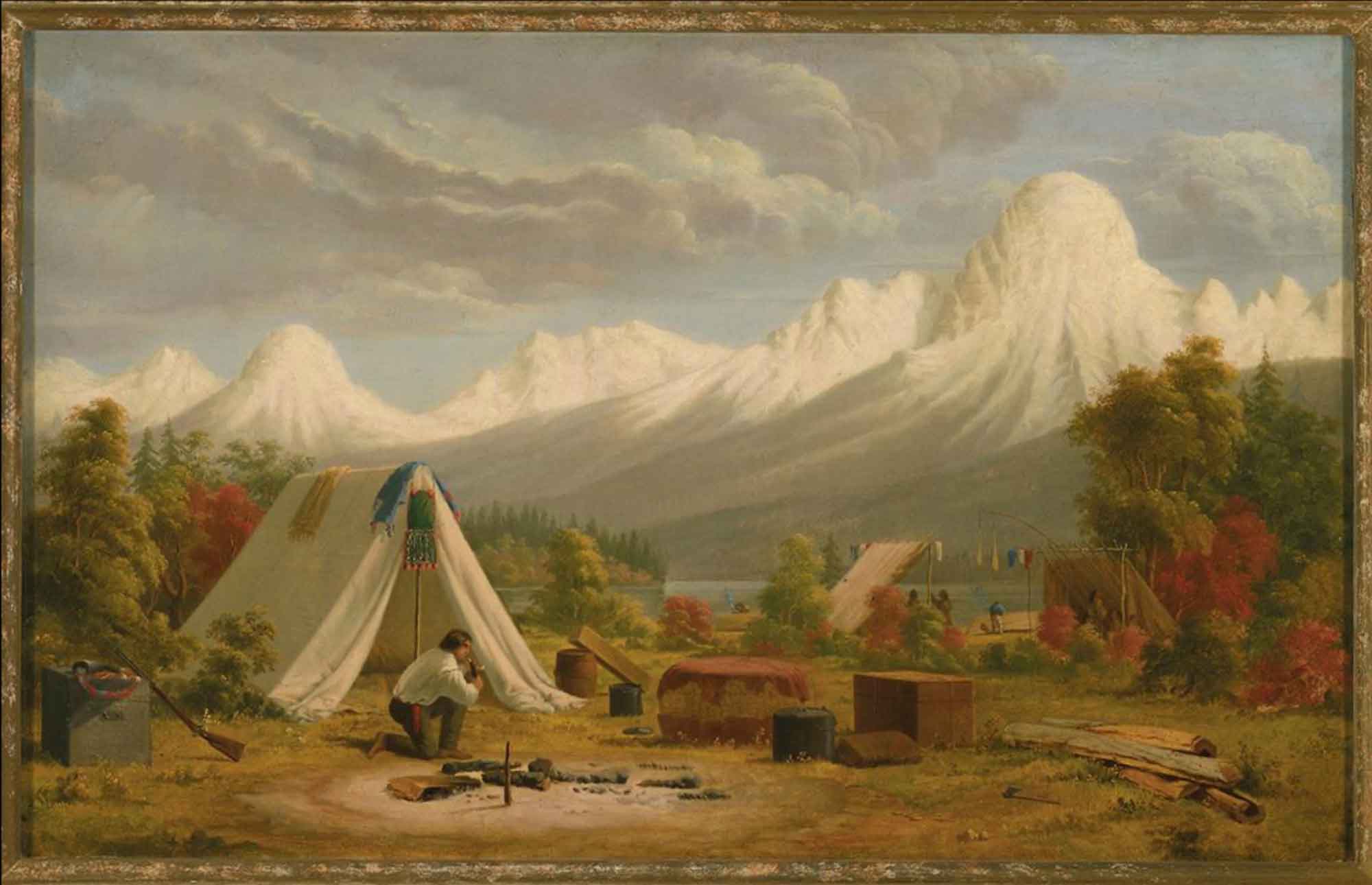
Paul Kane, “Boat Encampment,” Hudson’s Bay Company voyaguers, oil on canvas, 1849–1856 Royal Ontario Museum ROM2009_11209_41
Boat Encampment was designated a National Historic Site in 1943. The site was submerged by Kinbasket Lake, the reservoir of the Mica Dam, in 1973 [2]. “Boat Encampment,” previously an offical name, was cancelled in 1974.
Thus we continued day after day to march a few miles, as the Snow was too wet and too deep to allow the dogs to make any progress ; on the 26th we put up on the banks of the Columbia River, my Men had become so disheartened, sitting down every half mile, and perfectly lost at all they saw around them so utterly different from the east side of the Mountains, four of them deserted to return back ; and I was not sorry to be rid of them, as for more than a month. past they had been very useless, in short they became an incumbrance on me, and the other men were equally so to be rid of them; having now taken up my residence for the rest of the winter I may make my remarks on the countries and the climates we have passed.…
Our residence was near the junction of two Rivers from the Mountains with the Columbia: the upper Stream which forms the defile by which we came to the Columbia, I named the Flat Heart, from the Men being dispirited; it had nothing particular. The other was the Canoe River; which ran through a bold rude valley, of a steady descent, which gave to this River a very rapid descent without any falls.
— Thompson 1812 [3]
Thompson’s “Flat Heart River” is now Wood River. It is clear from his Narrative that both the Athabasca Pass and the Canoe River region had been visited earlier by his guide, Thomas the Iroquois, and by other Indigenous people.
On the 1859 Arrowsmith map it appears as “Canoe Encampment.”
- 1. Voorhis, Ernest [1859–1933]. Historic Forts and Trading Posts of the French Régime and of the English Fur Trading Companies. Ottawa: Department of the Interior, 1930. University of Britih Columbia Library [accessed 3 January 2026]
- 2. Wikipedia. Boat Encampment
- 3. Thompson, David [1770–1857], and Tyrrell, Joseph Burr [1858–1957], editor. David Thompson’s Narrative of His Explorations in Western America, 1784-1812. Joseph Burr Tyrrell, editor. Toronto: Champlain Society, 1916. University of British Columbia [accessed 10 March 2025]