SE of Yellowhead Lake
52.7139 N 118.3914 W — Map 083D09 — Google — GeoHack — Bivouac
Earliest known reference to this name is 1900 (McEvoy)
Name officially adopted in 1951
Official in BC – Canada
Elevation: 3298 m
McEvoy’s map Yellowhead Pass 1900
Frederick Talbot’s map GTP 1910
Collie’s map Yellowhead Pass 1912
Boundary Commission Sheet 28 (surveyed in 1921)
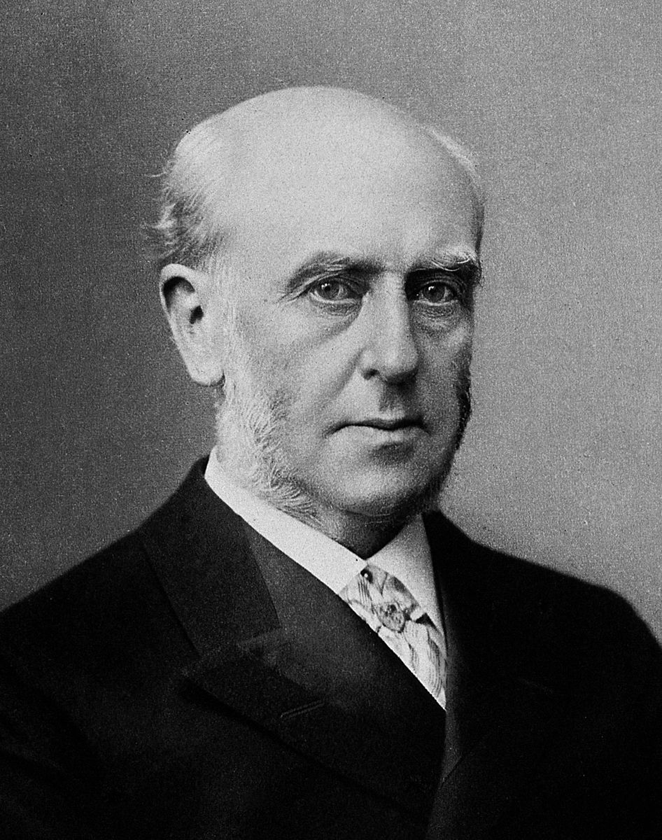
Sir Archibald Geikie
Cassell’s Universal Portrait Gallery
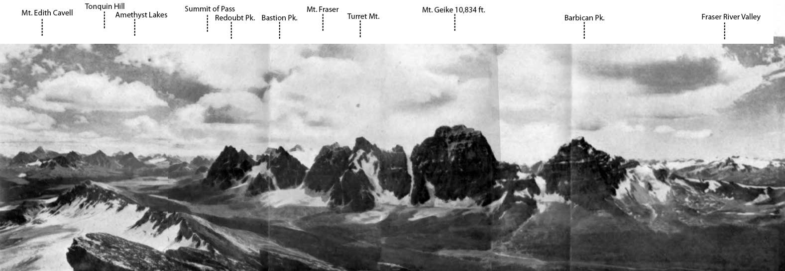
Tonquin Pass and Geikie Range from the North (Vista Peak).
Photo, A.0. Wheeler
Canadian Alpine Journal1922
“The kingpin of the famous Tonquin Valley” was named in 1898 by geologist James McEvoy [1862–1935] after Sir Archibald Geikie [1835–1924], the Scottish geologist who was director-general of the Geological Survey of Great Britain from 1882 to 1901.
The name was officially adopted in 1924 as labelled on the 1912 topographic map Mount Robson 1912 by Arthur Oliver Wheeler [1860–1945].
Alpinist Arnold Louis Mumm [1859–1927] said that the north face of Mount Geikie was composed of the most tremendous precipices he had ever seen.
In 1913 certain striking peaks immediately south of Yellowhead Pass were located and measured by Wheeler from a station on Yellowhead Mountain. Mt. Geikie (11,016 ft.) on the continental divide was reported upon by him as a “magnificent first climb in store for some enterprising mountaineer and one that would challenge the highest skill and perseverance,” and so its fame went forth. Unfortunately that name has been locally applied to another peak visible from the railway at Jasper station. It was this latter “Geikie” [identified in a note as “Mt. Fitzhugh,” renamed Mount Edith Cavell in 1916] which became the goal of Mr. Mumm in 1914, when making his fifth visit to these parts with his faithful Inderbinnen.
— Fay 1915
- Wheeler, Arthur Oliver [1860–1945]. “Topographical Map Showing Mount Robson and Mountains of the Continental Divide North of Yellowhead Pass to accompany the Report of the Alpine Club of Canada’s Expedition 1911. From Photographic Surveys by Arthur O. Wheeler; A.C.C. Director.” Canadian Alpine Journal, Vol. 4 (1912):8-81
- McEvoy, James [1862–1935]. “Map Showing Yellowhead Pass Route From Edmonton To Tête-Jaune Cache.” (1900). Natural Resources Canada
- White, James [1863–1928]. “Place names in the vicinity of Yellowhead Pass.” Canadian Alpine Journal, Vol. 6 (1914–1915):107-114
- Fay, Charles Ernest [1846–1923]. “Recent Mountaineering in the Canadian Alps.” Geographical Review, Vol. 2, No. 1 (1916):1. JSTOR
- Wates, Cyril G. [1883–1946]. “Mount Geikie.” Canadian Alpine Journal, Vol. 13 (1923):47-53
- Bulyea, H. E. “A trip to the Geikie valley.” Canadian Alpine Journal, Vol. 13 (1923):140
- Wates, Cyril G. [1883–1946]. “The Geikie Valley in 1923.” Canadian Alpine Journal, Vol. 14 (1924):51-59
- British Columbia Geographical Names. Mount Geikie
- Wikipedia. Archibald Geikie