Listed as post no. 227 in Ernest Voorhis [1859–1933], “Historic Forts” [1] :
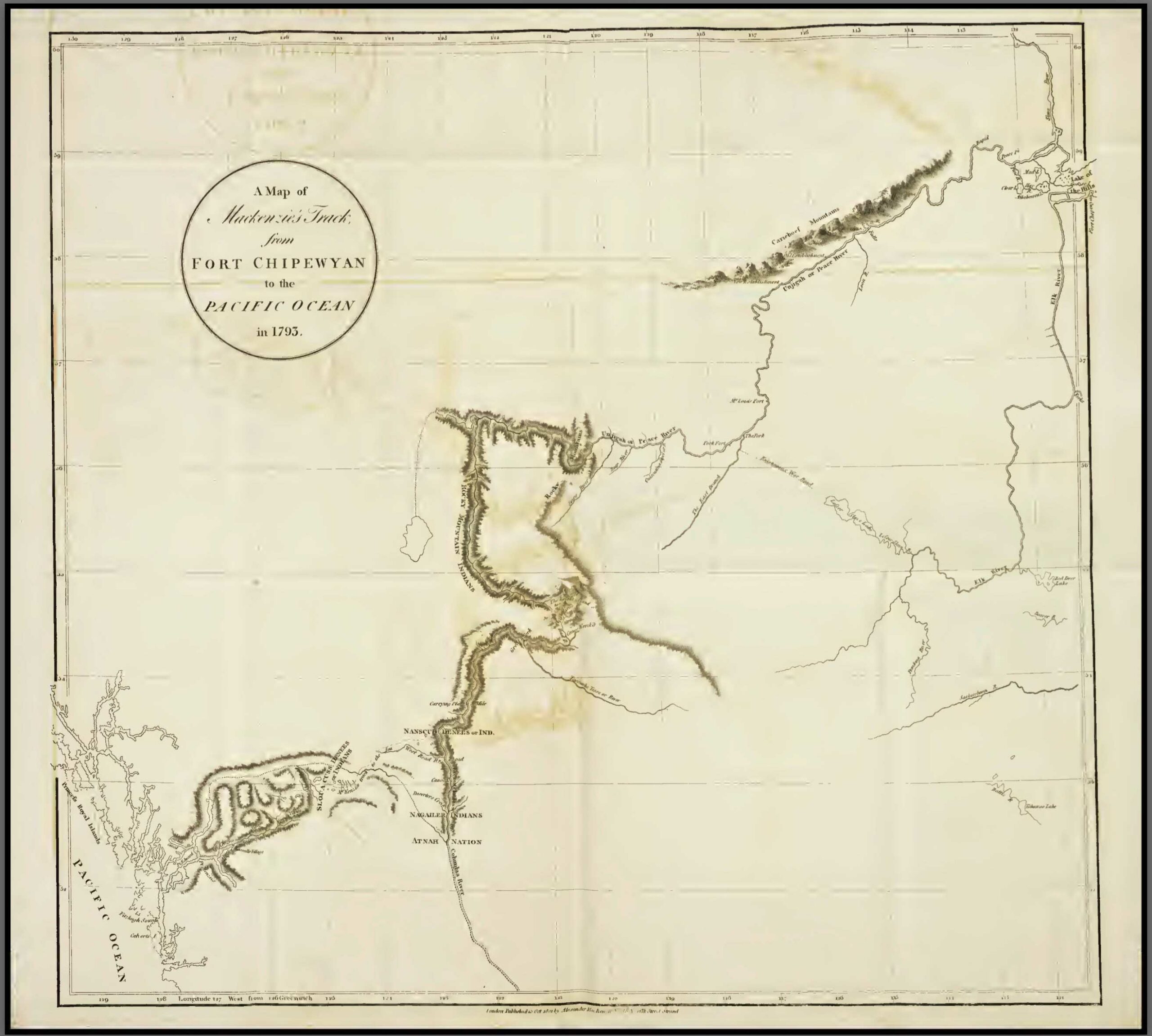
Originally this was a North West Co. fort on the north bank of Peace river at the mouth of Middle river. Built by Simon Fraser 1805 as a base for his British Columbia explorations. It was known as “Rocky Mountain House, or Fort”, also as “Old Hudson’s Hope”, and “Rocky Mountain Portage Fort”. This post was operated by the Hudson’s Bay Go. after the coalition of 1821. I was abandoned for a time in 1825 to punish the Indians for the massacre at St. John in 1823. New Hudson’s Hope was built about 1875 on the south bank about 12 miles further upstream from Old Hudson’s Hope, at the east end of the portage, near east end of Cañon at its foot. Sometime after 1880 this post was again moved to its present location on the north side. Harmon in his journal 1810, October 15th, calls Hudson’s Hope the “Rocky Mountain Portage Fort”. Cust’s House and an old Hudson’s Bay Co. post are shown on Arrowsmith map 1832 (No. 100) at the west end of the portage from Rocky Mountain House. The location of the original fort is shown on the Dawson map 1879 (No. 81) and marked “abandoned”.
References:
- 1. Voorhis, Ernest [1859–1933]. Historic Forts and Trading Posts of the French Régime and of the English Fur Trading Companies. Ottawa: Department of the Interior, 1930, P. 83. University of British Columbia Library [accessed 3 January 2026]