E of Berg Lake, NE of Mount Robson
53.1333 N 119.1 W — Map 83E/3 — Google — GeoHack
Earliest known reference to this name is 1910 (Coleman)
Name officially adopted in 1956
Official in BC – Topo map from Canadian Geographical Names
Wheeler’s map Mount Robson 1912
Boundary Commission Sheet 32 (surveyed in 1922 &1924)
Boundary Commission Sheet 32 A (surveyed in 1924)
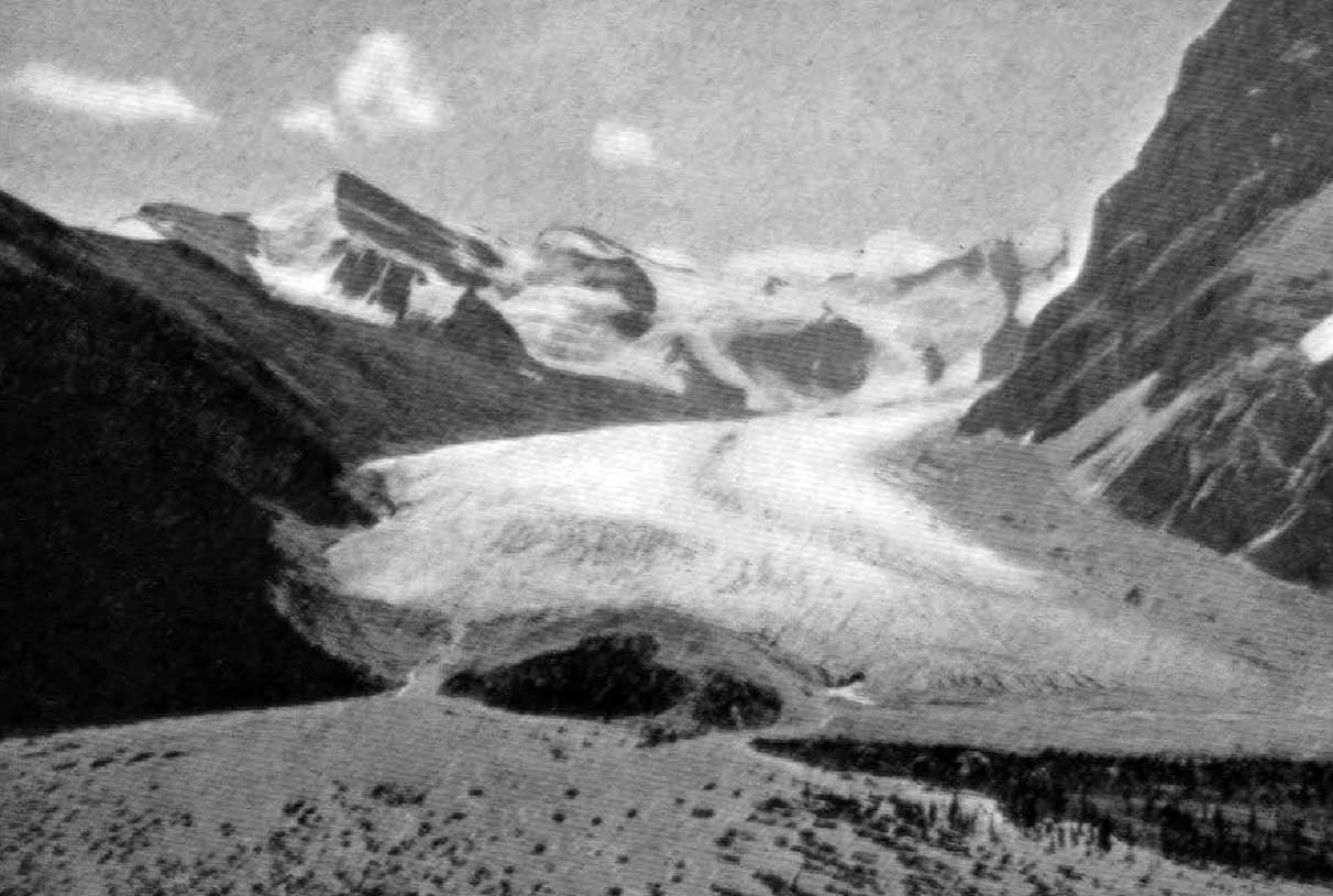
Robson Glacier six miles in length. The watershed between Alberta and British Columbia lies up its centre. Photo: George Kinney, 1908 Canadian Alpine Journal 1909
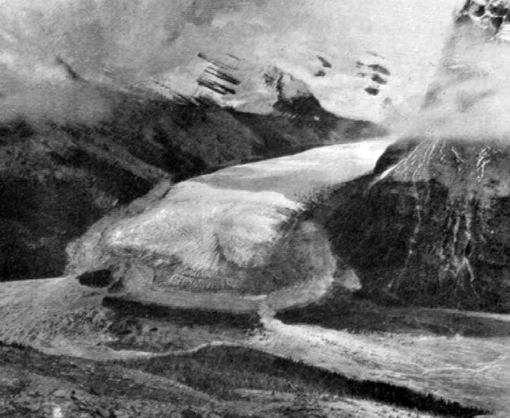
Shows forefoot of Robson Glacier sending its waters northward to Lake Adolphus and southward to Berg Lake. The Great Divide lies between. Photo: Rev G.B. Kinney, 1908 Canadian Alpine Journal 1910
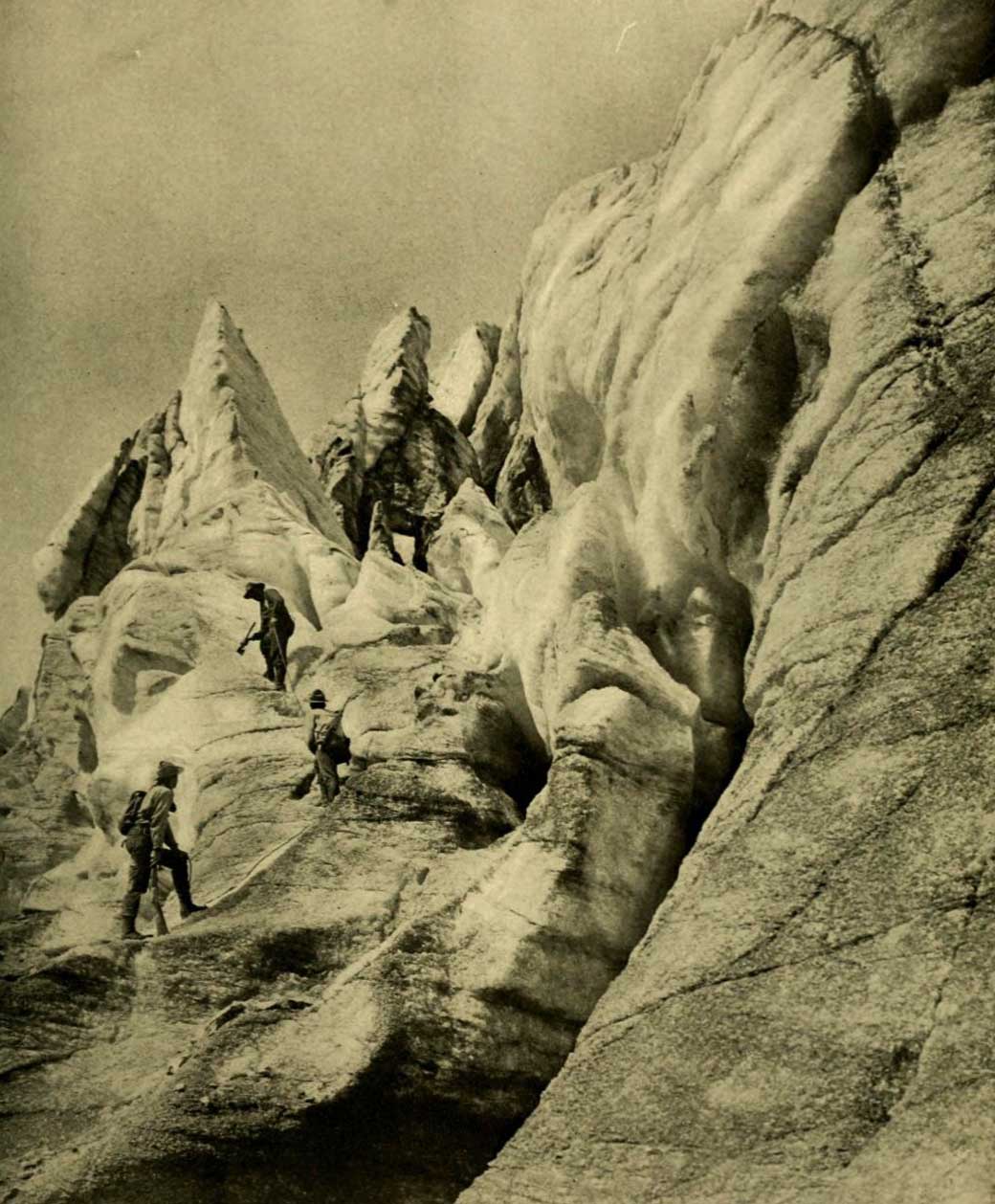
Working up through the vast and broken front of Hunga Glacier. Photo: R. C. W. Lett, 1911 National Geographic Magazine 1913
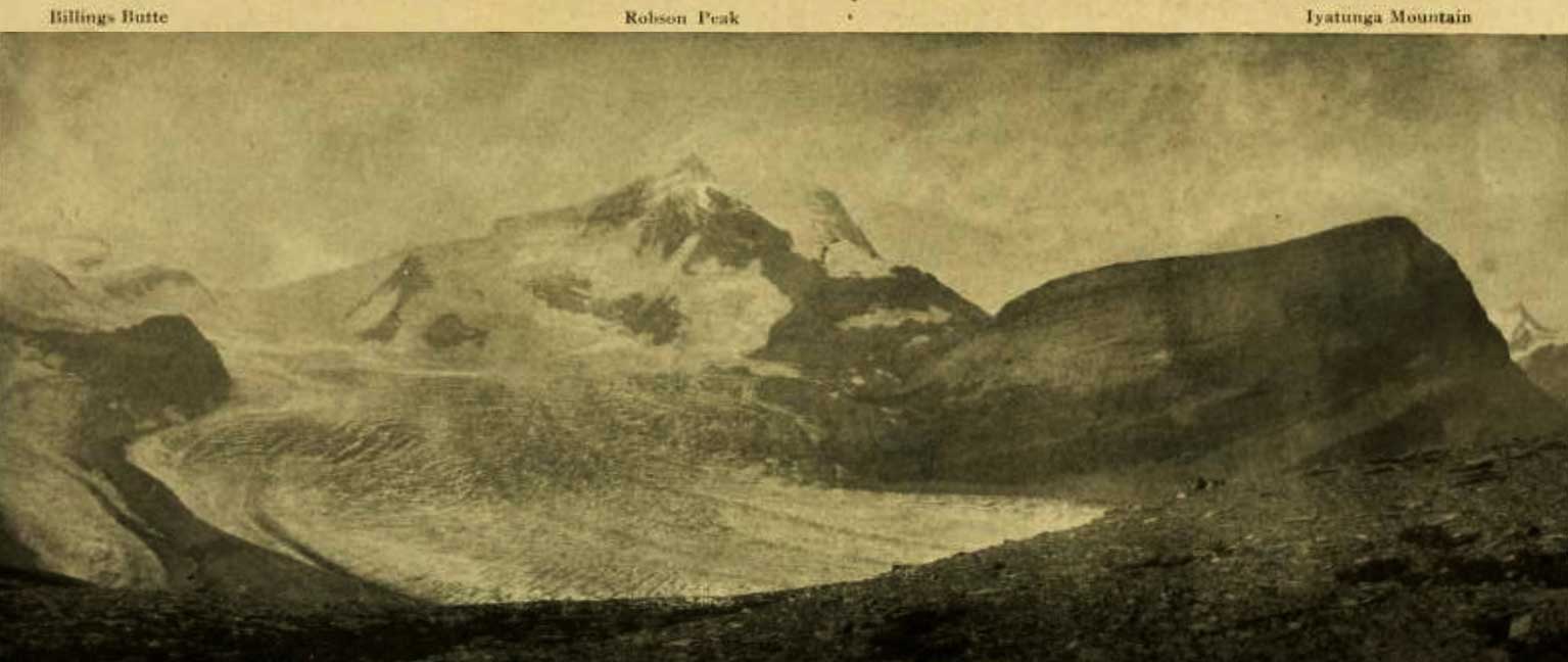
Billings Butte – Robson Peak – Iyatunga Mountain. Panonamic view of the Robson massif and adjoining mountains, with the great Hunga glacier in the foreground.
Photo: Charles D. Walcott, 1912 National Geographic Magazine 1913 [accessed 15 February 2025]
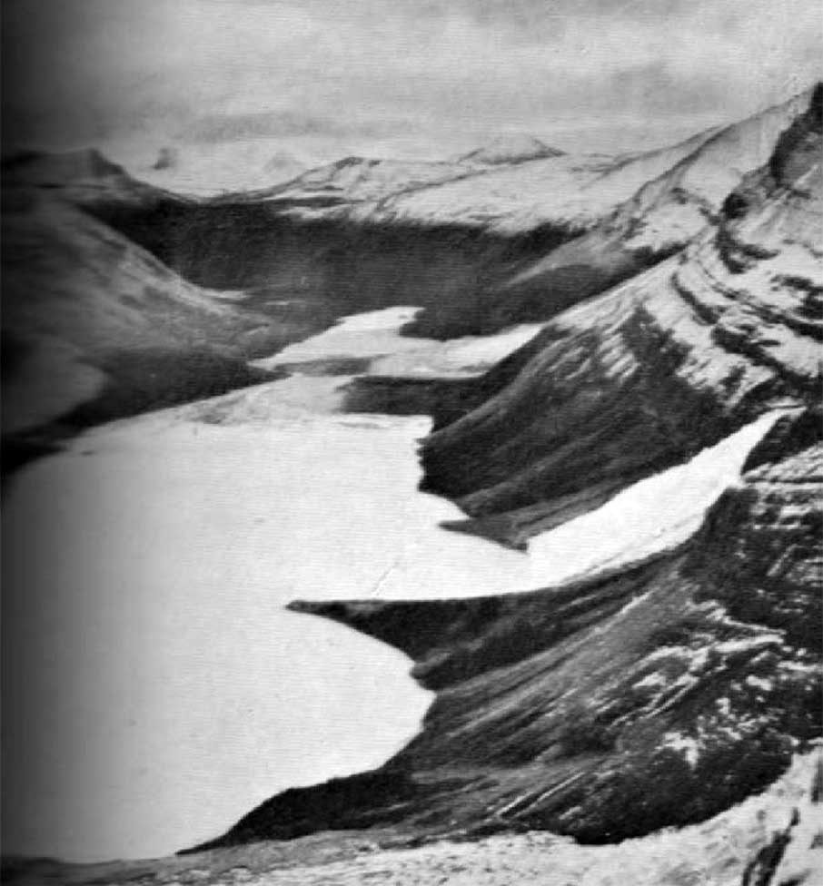
The Robson Glacier and Pass showing streams flowing east and west.
Photo: P.L. Tait, 1913 Canadian Alpine Journal 1915
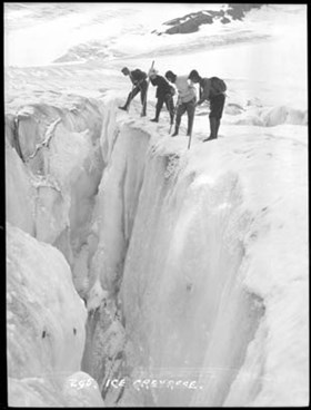
On Robson Glacier. Dr. P.M. Campbell, C. Greenway, Helena Walcott, Preston L. Tait. Mount Robson ACC Camp. Photo: Byron Harmon, 1913 Whyte Museum of the Canadian Rockies
Kinney accompanied Arthur Philemon Coleman [1852–1939] on his 1907 and 1908 mountaineering expeditions to Mount Robson, and claimed to have ascended Robson in 1909.
“Between Rearguard and Titkana Peak, leading from the wonderful snow-filled cirque, seen in its entirety from our station on the Lynx Range, flows the Robson Glacier,” wrote Arthur Oliver Wheeler [1860–1945] during the 1911 Alpine Club of Canada–Smithsonian Robson Expedition. “It describes a circular sweep around Rearguard, and, though much crevassed in its upper reaches, it generally easy to travel over.” [2]
Charles Doolittle Walcott, who visited the area in 1912, referred to Robson Glacier as “the great Hunga (Chief) glacier.” [3]
- 1. Kinney, George Rex Boyer [1872–1961]. London, England: Royal Geographical Society Archives. Letter to Arthur Hinks (1917).
- 2. Wheeler, Arthur Oliver Oliver [1860–1945]. “The Alpine Club of Canada’s expedition to Jasper Park, Yellowhead Pass and Mount Robson region, 1911.” Canadian Alpine Journal, Vol. 4 (1912):9-80
- 3. Walcott, Charles Doolittle D. [1850–1927]. “The monarch of the Canadian Rockies.” National Geographic Magazine, (1913):626. Internet Archive