Central section of British Columbia shewing the county served by the Grand Trunk Pacific Railway, 1911
University of Toronto Library
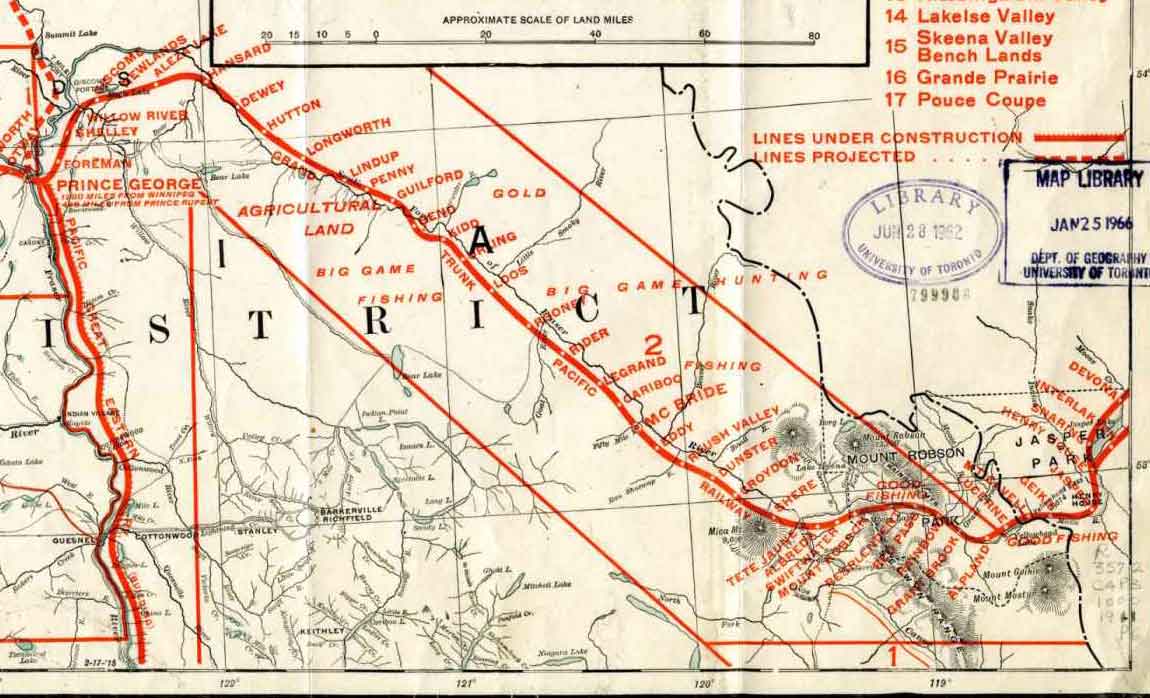
Central section of British Columbia shewing the county served by the Grand Trunk Pacific Railway, 1911 (detail)
University of Toronto Library
[1007]
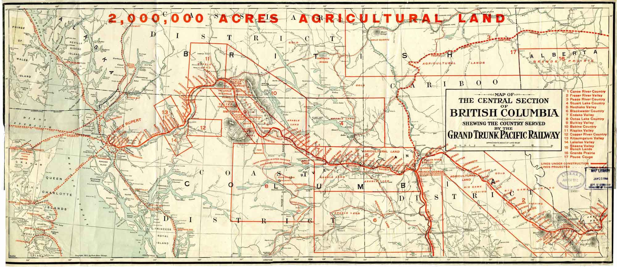
Map of the Central Section of British Columbia
Shewing the Country Served by the Grand Trunk Pacific Railway.
2,000,000 ACRES AGRICULTURAL LAND
Map of the Central Section of British Columbia
Shewing the Country Served by the Grand Trunk Pacific Railway.
2,000,000 ACRES AGRICULTURAL LAND
Promotional map showing land available for agriculture, hunting and fishing, fruit, and gold along the Grand Trunk Pacific Railway line, printed in red over a base map is copyright 1911 by Poole Bros., Chicago. The railway overlay was added after 1916, when the station at Knole was renamed Rider, but before 1920, when the Grand Trunk Pacific was absorbed into the Canadian National Railway, joining the Canadian Northern Railway.
This map includes:
Snaring
Interlaken
Henry House
Jasper
Geikie
Mt. Cavell
Lucerne (GTP railway point)
Alpland station
Grant Brook (GTP railway point)
Rainbow (GTP railway point)
Red Pass Junction
Resplendent (GTP railway point)
Mount Robson (railway point)
Swiftwater
Albreda (GTP railway point)
Tête Jaune station
Shere
Croydon
Dunster
Raush Valley (railway point)
Eddy
McBride
Cariboo (railway point)
Legrand
Rider
Rooney
Loos
Urling
Kidd
Bend
Guilford
Penny
Lindup
Longworth
Prince George
Also see: