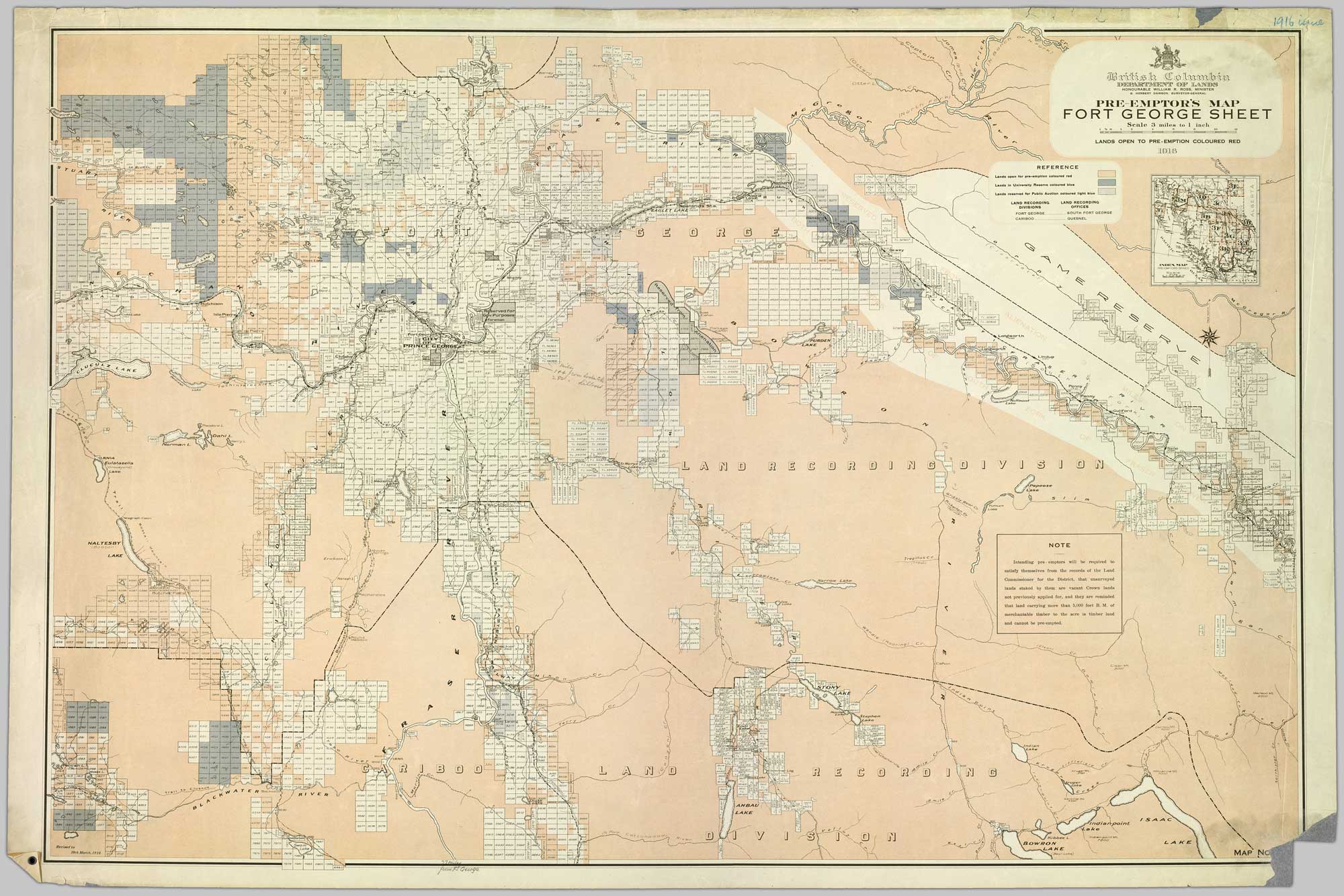
Depicting lands open for pre-emption. Department of Lands, British Columbia,1916
Northern British Columbia Archives Item 2008.2.1.02
British Columbia Department of Lands
Honourable William R. Ross, Minister
G. Herbert Dawson, Surveyor-General
Pre-Emptor’s Map Fort George Sheet
Lands Open to Pre-Emption Coloured Red
1916
Honourable William R. Ross, Minister
G. Herbert Dawson, Surveyor-General
Pre-Emptor’s Map Fort George Sheet
Lands Open to Pre-Emption Coloured Red
1916
Map 1G [?]
Colour-coded map depicting lands from Fort George to Urling open for pre-emption, lands in “University Reserve,” and lands reserved for public auction. Depicts land recording divisions, communities, bodies of water, transport routes, and game reserves.
This map includes:
Mount Bagg
Bend
Captain Creek
Don Creek
Evans Creek
Goat River
Guilford
Halfmoon Lake
Herrick Creek
James Creek (Bad River) [as “James (Bad) Creek”]
Kenneth Creek
Kidd
La Salle Creek [as “Lasalle C.”]
Lindup
Longworth
Mackenzie Creek
Macleod Creek
North Star Creek
Otter Lake
Otter Creek [as “(Otter) Cr.”]
Penny
Ptarmigan Creek
Slim Creek
Snowshoe Creek
Torpy River [as “Torpy (Clearwater) River”]
Urling