Approximately 12 km north of Jasper
52.9867 N 118.0628 W — Map 083D16 — Google — GeoHack
Name officially adopted in 1951
Official in Canada
Canadian Northern Railway station built in 1914
“Presently a gigantic mirror flashed through the trees. We were rounding the eastern arm of Yellowhead Lake, which from its idyllic situation, clear, transparent hue, and reflection of snow-capped battlements and pinnacles, may be aptly described as the Lucerne of British Columbia.” So wrote Frederick Arthur Ambrose Talbot [1880–1924] of his trip through the Yellowhead Pass in 1910, comparing the grandeur with that of Lucerne, Switzerland.
Talbot travelled with a party of Grand Trunk Pacific Railway executives, including Robert Chamberlain Westover Lett [1870-1957], passenger and colonization agent. The railroad laid its track north of Yellowhead Lake in 1912. A G.T.P. train ticket from 1914 shows Lucerne as a stop.
Between Edmonton and the Yellowhead Pass the Canadian Northern Railway and GTP built virtually parallel lines. Lucerne was CNoR division point, and at one time had a Second Class depot. With nationalization and the combining of the CNoR and GTP lines, Lucerne lost its status as a terminal and the depot was removed.
During the Second World War, about 100 Japanese nationals were interned at camps at Lucerne, Rainbow, Moose River, Fitzwilliam, and Red Pass. As forced labor, they cleared a new right-of-way on sections of the Yellowhead Highway. In different groups they cut the timber off much of the road toward Tête Jaune Cache and along the river toward McBride on the one hand and toward Blue River on the other. As a diversion from their other activities, they built a tea house in the Lucerne camp and for several years it remained as a curiosity shown off by the few local people.
The Lucerne Station post office was open from 1914 to 1926; less than ten cancellation marks are known in collections. A post office was also open at Lucerne from 1942 to 1945; no cancellation marks between those dates are known to exist.
The Canadian Northern Railway’s (CNoR) owned subsidiary running between the Alberta–British Columbia border and Vancouver was formally called the Canadian Northern Pacific Railway, but there were no cars or locomotives lettered “Canadian Northern Pacific”. As far as the public and most workers were concerned, it was just a part of the CNoR.
The Canadian Northern Pacific was incorporated in 1910. The last spike was driven at Basque, British Columbia, near Ashcroft, in January 1915. This event completed Canada’s third transcontinental railway, which ran from Quebec City to Vancouver.
The line from Edmonton to Vancouver was approved for operation in October 1915. The first westbound passenger train left Edmonton on November 23, 1915. The first eastbound passenger train left Vancouver on November 25, 1915. Initial main line through service was three trains per week in each direction.
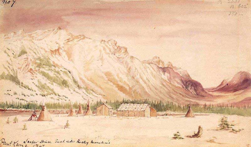
Jasper House East Side Rocky Mountains
Paul Kane. Field sketch, November 7, 1847
Wikipedia
On the 1912 map of Mount Robson by Arthur Oliver Wheeler [1860–1945] and a Grand Trunk Pacific Railway map from around 1912 there is an “Albreda” station between Tête Jaune Cache and Mount Robson.
The current Albreda railway point is on the North Thompson River.
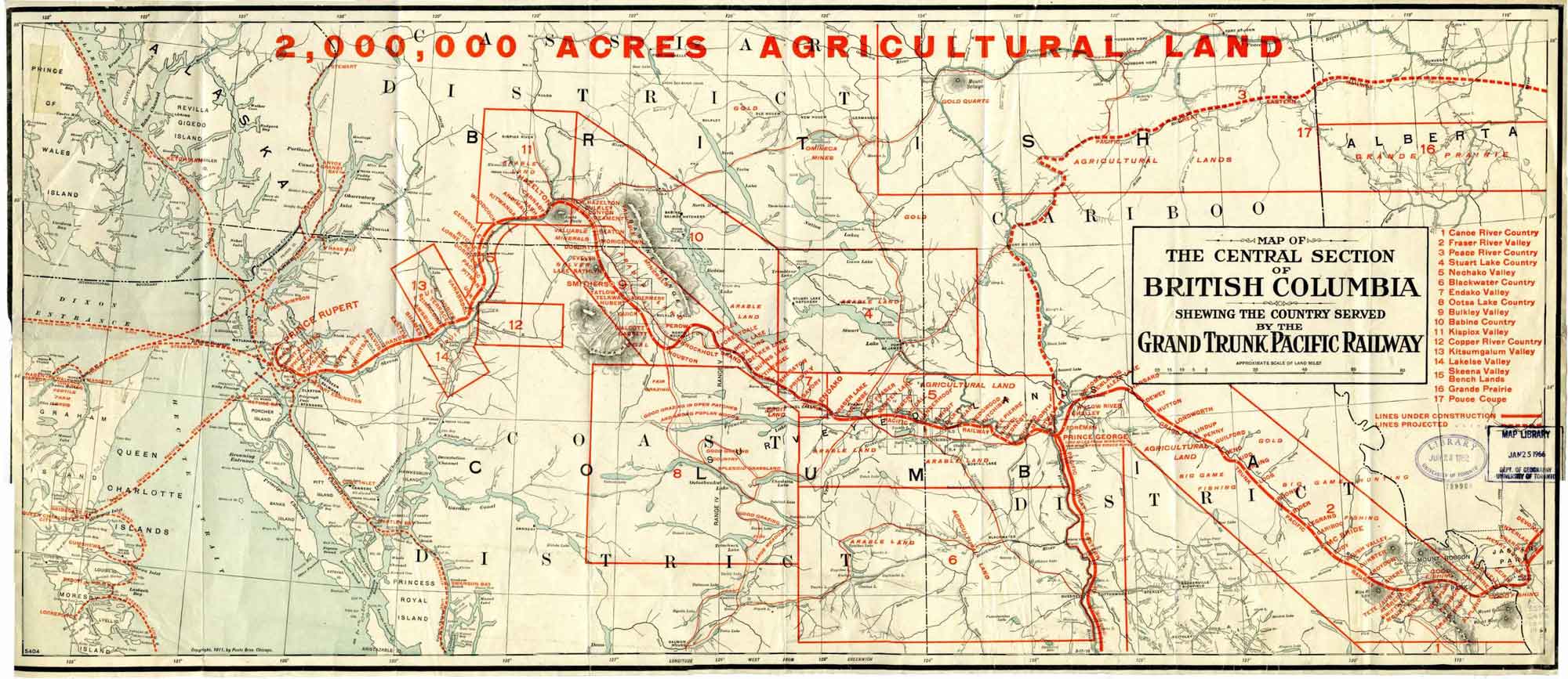
Central section of British Columbia shewing the county served by the Grand Trunk Pacific Railway, 1911
University of Toronto Library
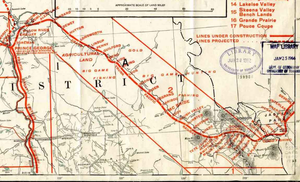
Central section of British Columbia shewing the county served by the Grand Trunk Pacific Railway, 1911 (detail)
University of Toronto Library
Promotional map showing land available for agriculture, hunting and fishing, fruit, and gold along the Grand Trunk Pacific Railway line, printed in red over a base map is copyright 1911 by Poole Bros., Chicago. The railway overlay was added after 1916, when the station at Knole was renamed Rider, but before 1920, when the Grand Trunk Pacific was absorbed into the Canadian National Railway, joining the Canadian Northern Railway.
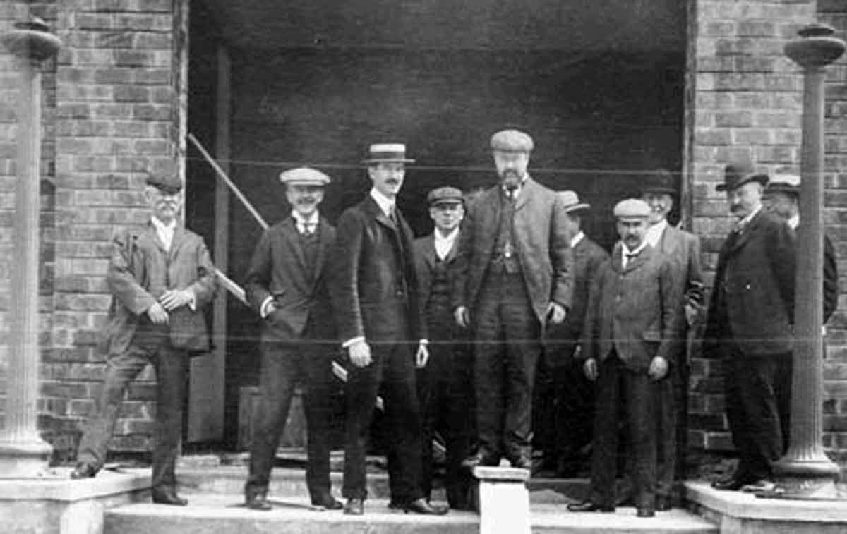
Messrs. E.H. Fitzhugh, Alfred W. Smithers, W.D. Robb, Charles M. Hays, H. Deer, A.B. Atwater and W.E. Davis, 1910
Charles Melville Hays Collection / Library and Archives Canada
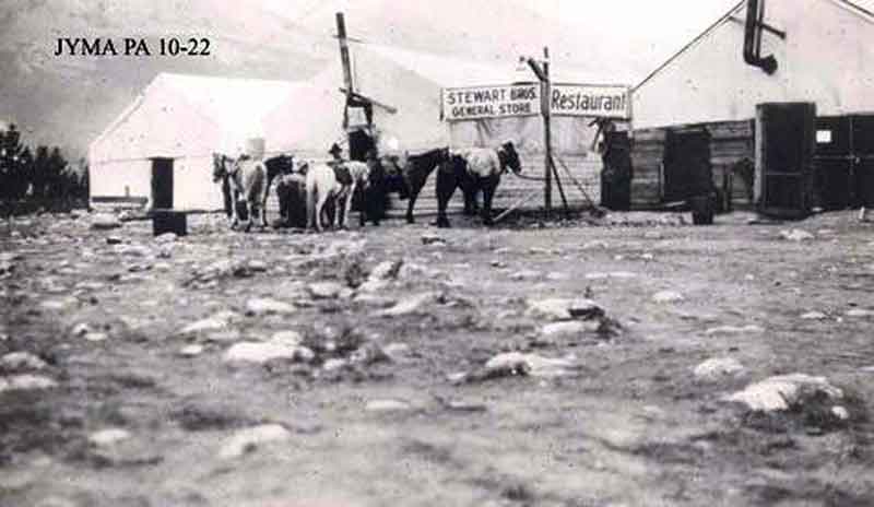
Fitzhugh before the arrival of the railroad, ca. 1911
Alberta on Record
Near the end of 1910 the Grand Trunk Pacific Railway established a divisional point at mile 112 (as measured from the McLeod River), near a plateau between the Miette and Athabasca Rivers. It was called Fitzhugh after the vice-president and general manager of the railway, Earl Hopkins Fitzhugh Jr. [1853–1930].
By 1911 the Canadian government had decided to make Fitzhugh the administration center for Jasper National Park. The town survey completed in 1913 was approved one year later. Development of the town began in earnest during the summer of 1913. The first change was to rename the town Jasper, the name by which it is known today.
The spring of 1912 [Donald Phillips] built his corrals and a shack in Fitzhugh (which was changed to Jasper the fall of 1913) right in the middle of what is known as Pyramid Drive now.
The trail from Fitzhugh to Maligne Lake is a good one, built by the Otto Bros, last spring. Ten miles out from Fitzhugh is Buffalo Prairie, which is on a low bench along the Athabaska River and through which several streams flow which head on the mountain
— Wilkins
Early in September, 1911, we swam our horses across the Athabaska River below Fitzhugh in the Jasper Park, on the line of the Grand Trunk Pacific Railway.
The trail from Fitzhugh to Maligne Lake is a good one, built by the Otto Bros, last spring. Ten miles out from Fitzhugh is Buffalo Prairie, which is on a low bench along the Athabaska River and through which several streams flow which head on the mountain.
— Phillips
Fitzhugh, named after vice-president of the Grand Trunk Railway, is, owing to its central position at the junction of the three valleys, bound to become an important centre. There is plenty of room for it to grow and expand in the park-like situation that has been chosen.
— Wheeler