SW of Moose Lake
52.9167 N 119.1667 W — Map 83D/14 — Google — GeoHack
Earliest known reference to this name is 1898 (McEvoy)
Name officially adopted in 1951
Official in BC – Canada
McEvoy’s map Yellowhead Pass 1900
Wheeler’s map Mount Robson 1912
Jobe’s map Jarvis Pass to Yellowhead 1915
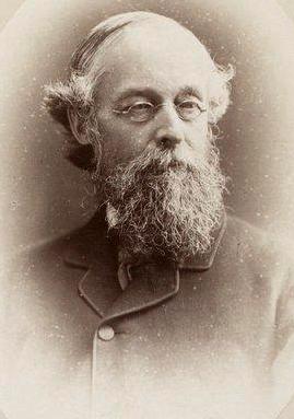
Alfred Richard Cecil Selwyn
Wikipedia
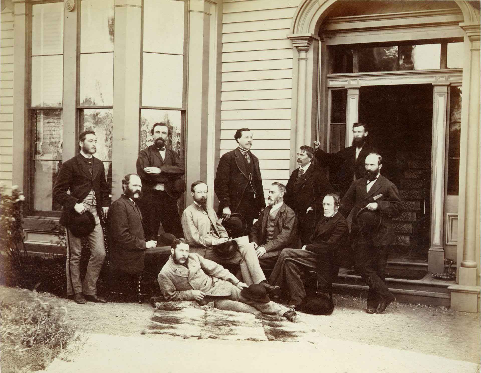
The First Canadian Pacific R.R. and Geological Survey parties for British Columbia, July 22 1871 Left to right : L. N. Rheaumis, Roderick McLennan, A. S. Hall, West West Ireland, Alfred Selwyn, Alex Maclennan, Walter Moberly, C. E. Gilette, James Richardson, — — McDonald, George Watt.
Toronto Public Library
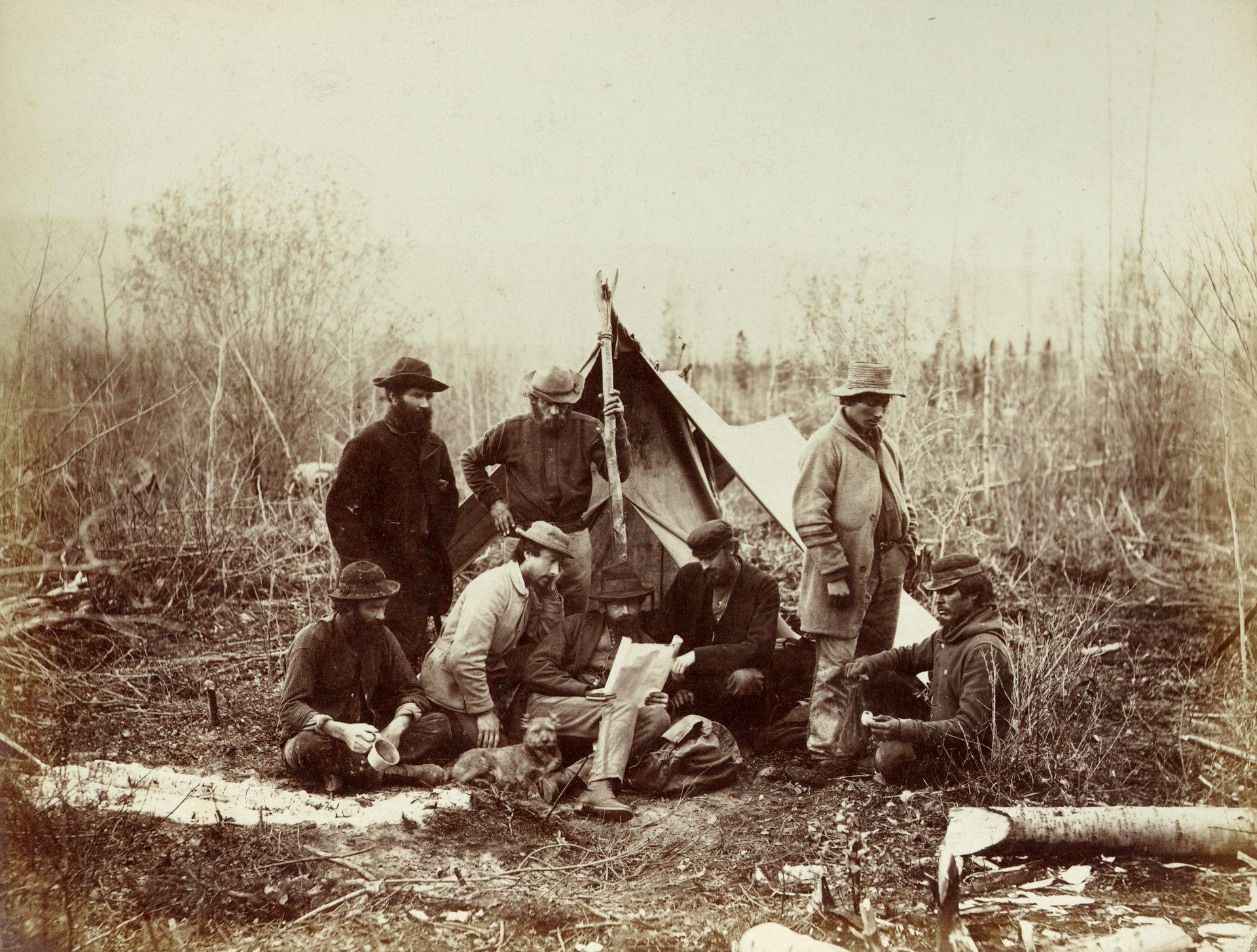
Geological Survey party in camp at Canoe River, October 14, 1871. Alfred Selwyn at centre with John Hammond (left centre) and Benjamin Baltzly (right centre)
Toronto Public Library
“At Moose Lake, the distance to Canoe River is only 18 miles south-westerly in a straight line,” wrote James McEvoy [1862–1935], who surveyed the area in 1898. “The intervening range of mountains, to which the name of Selywn Range is given, delivers most of its waters into the Canoe and McLennan rivers to the south-east, leaving a precipitous descent on the other side from the watershed to the Fraser River.”
In 1871, Alfred Richard Cecil Selwyn (1824-1902), then Director of the Geological Survey of Canada, made a journey from Kamloops to Tête Jaune Cache and ascended the Fraser River some distance above Moose Lake. Selwyn accompanied railway engineer Roderick McLennan on his survey of the Yellowhead Pass, coming along to study the strata of the area. Selwyn made careful notes of the geology in his field book until, somewhere in the Albreda River area, his horse ate the book. In 1875 Selwyn did field work for the Canadian Geological Survey on the Fraser and Peace Rivers.
Selwyn was born at Somerset, England. He was privately educated, and became assistant geologist on the staff of the Geological Survey of Great Britian. From 1852 to 1869 he was director of the Geological Survey of Victoria, Australia. From 1869 until his retirement in 1895 he was director of the Geological Survey of Canada. In 1852 he married Matilda. He was a fellow of the Royal Society, of the Geographical Society, and of the Royal Society of Canada, of which he was president in 1896. He died at Victoria, British Columbia.
- McEvoy, James [1862–1935]. Report on the geology and natural resources of the country traversed by the Yellowhead Pass route from Edmonton to Tête Jaune Cache comprising portions of Alberta and British Columbia. Ottawa: Geological Survey of Canada, 1900. Natural Resources Canada
- McEvoy, James [1862–1935]. “Map Showing Yellowhead Pass Route From Edmonton To Tête-Jaune Cache.” (1900). Natural Resources Canada
- White, James [1863–1928]. “Place names in the vicinity of Yellowhead Pass.” Canadian Alpine Journal, Vol. 6 (1914–1915):107-114
- MacGregor, James Grierson. Overland by the Yellowhead. Saskatoon: Western Producer, 1974. Internet Archive
- Wallace, W. Stewart. MacMillan Dictionary of Canadian biography. Toronto: MacMillan, 1978
- Andrews, Gerald Smedley [1903–2005]. Métis outpost. Memoirs of the first schoolmaster at the Métis settlement of Kelly Lake, B.C. 1923-1925. Victoria: G.S. Andrews, 1985. Internet Archive