Flows N into Fraser River at Tête Jaune Cache
52.9681 N 119.4611 W — Map 83D/14 — Google — GeoHack
Earliest known reference to this name is 1900 (McEvoy)
Name officially adopted in 1951
Official in BC – Canada
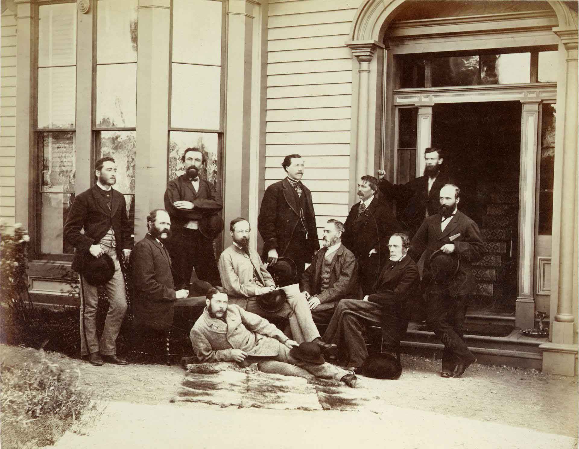
The First Canadian Pacific R.R. and Geological Survey parties for British Columbia, July 22 1871 Left to right : L. N. Rheaumis, Roderick McLennan, A. S. Hall, West West Ireland, Alfred Selwyn, Alex Maclennan, Walter Moberly, C. E. Gilette, James Richardson, — — McDonald, George Watt.
Toronto Public Library
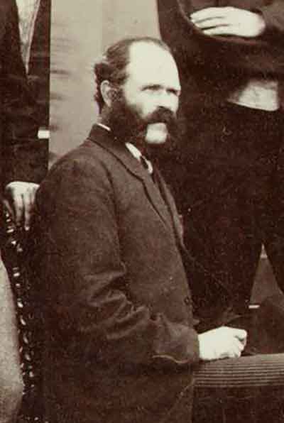
Detail: Roderick McLennan
Toronto Public Library
In 1871-72, Canadian Pacific Railway surveyors Roderick M. McLennan [1805–] and Charles Horetzky [1838–1900] made a reconnaisance from the Big Bend of the Columbia River up to the North Thompson River. McLennan left Kamloops on August 19, 1871, and in October decided to winter his party in the vicinity of Tête Jaune Cache. He built a camp four or five miles upstream from the Canoe River on what consequently came to be named Camp Creek. In 1872 he undertook an expedition to Moose Lake.
George Monro Grant mentions McLennan in his book Ocean to Ocean:
[South of Albreda] the trail was as bad as could well be, although a great amount of honest work had been expended on it. Before McCord [surveyor] had come through, it must havbe been simple impassable except for an Indian on foot, — worse than when Milton and Cheadle forced through with their one pack-horse at the rate of three miles a day; for the large Canadian party [Overlanders] had immediately preceded them, whereas no one attempted to follow in their steps till McLellan [McLennan ?] , in 1871, and in the intervening nine years much of the trail had been buried out of sight, or hopelessly blocked up by masses of timber, torrents, landslides, or debris.
“The stream here called McLennan River, its real source, is also known as Mica Creek,” reported Munday in 1925.
- Grant, George Monro [1835–1902]. Ocean to Ocean: Sandford Fleming’s Expedition through Canada in 1872. Being a Diary Kept During a Journey from the Atlantic to the Pacific with the Expedition of the Engineer-in-Chief of the Canadian Pacific and Intercolonial Railways. Toronto: James Campbell and Son, 1873, p. 265. Google Books
- Munday, Walter Alfred Don [1890–1950]. “In the Cariboo Range – Mt. David Thompson.” Canadian Alpine Journal, Vol. 15 (1925):130-136
- MacGregor, James Grierson [1905–]. Overland by the Yellowhead. Saskatoon: Western Producer, 1974. Internet Archive
- Andrews, Gerald Smedley [1903–2005]. Professional Land Surveyors of British Columbia. Cumulative nominal roll. Victoria: Corporation of Land Surveyors of British Columbia, 1978
- Fairhall, Charles. “Surveyors of the Past. Roderick M. McLennan, 1805–1908. Civil Engineer, Land Surveyor, Explorer.” Ontario Land Surveyor, Summer (1983):27-28. Krcmar