British Columbia. Creek: Fraser River drainage
Flows NE into Fraser River, NW of McBride
53.3833 N 120.3333 W — Map 093H08 — Google — GeoHack
Name officially adopted in 1965
Official in BC – Topo map from Canadian Geographical Names
Flows NE into Fraser River, NW of McBride
53.3833 N 120.3333 W — Map 093H08 — Google — GeoHack
Name officially adopted in 1965
Official in BC – Topo map from Canadian Geographical Names
This creek appears on:
Pre-emptor’s map Tête Jaune 3H 1919
Pre-emptor’s map Tête Jaune 3H 1919
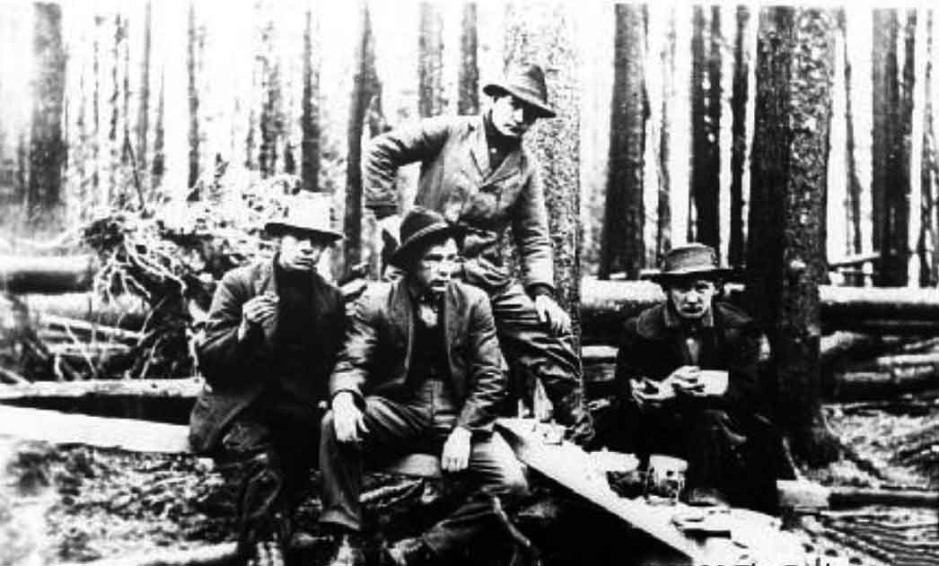
Grand Trunk Pacific Railway topographical crew of Elliot, Semple, Anderson, and McIntosh at an improvised table in the woods, 1912 (P986.5.80)
Exploration Place — Fraser Fort George Regional Museum
McIntosh Creek is shown on the 1931 Pre-emptor’s map (Tête Jaune Sheet) but not on the 1923 Sheet.
A McBride marriage registry shows “George Frederick Oettle [and] Mary Isabelle Mcintosh 1928.”(1)
The Robson Valley Chapter of the Back Country Horsemen of BC created an equestrian recreation site on Mcintosh Road (off Highway 16, 12 km west of McBride) around 2023.
References:
- 1. St. Paul’s United Church (McBride, B.C.) fonds (1921–1992). British Columbia Archival Information Network