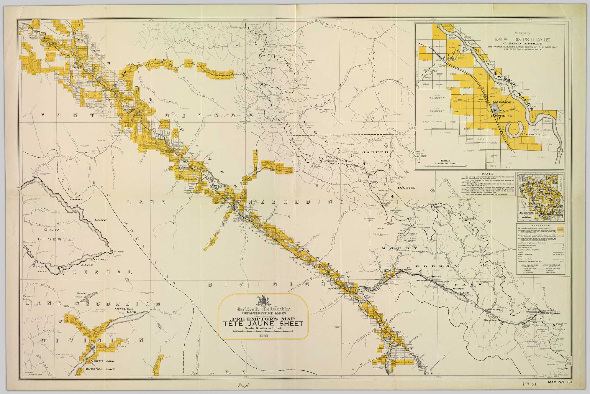
Depicting surveyed lands respectively open and closed to preemption. Department of Lands, British Columbia, 1931
Northern British Columbia Archives
Pre-emptor’s Map Tête Jaune Sheet 1931
British Columbia Department of Lands
N. S. Lougheed, Minister
F.C. Green, Surveyor-General
Map No. 3H
British Columbia Department of Lands
N. S. Lougheed, Minister
F.C. Green, Surveyor-General
Map No. 3H
Colour-coded map depicting surveyed lands respectively open and closed to preemption. Depicts land recording divisions, game reserves, communities, bodies of water, and transport routes. Includes inset of McBride townsite.
This list includes only places not shown on the Tête Jaune sheets of the 1919 or 1923 Pre-emptor’s maps. This is the first appearance of the railway points Valemount and Selwyn. The Alberta-British Columbia Boundary Commission was completed in the region of this map by 1931. Many of the names making their first appearance are along the Continental Divide.
This map includes:
Bastion Peak
Casket Pass
Casket Creek
Casket Mountain
Mount Clairvaux
Cushing Creek
Mount De Veber
Desolation Creek
Mount Fetherstonhaugh
Mount Forget
Goat River (railway point)
Hardscrabble Creek
Humbug Creek
Idol Creek
Intersection Mountain
Morkill Pass
No Luck Creek
Palu Mountain
Pauline Creek
Postern Mountain
Selwyn
Smoky River
Snowshoe
Souchez Creek
Mount Sprague
Swede Creek [as “West Twin (Swede)”]
Tonquin Creek
Tonquin Pass
Valemount
Waddington Peak
References:
- Sherwood, Jay. Surveying the 120th Meridian and the Great Divide: The Alberta/BC Boundary Survey, 1918–1924. Qualicum Beach, BC: Caitlin Press, 2019