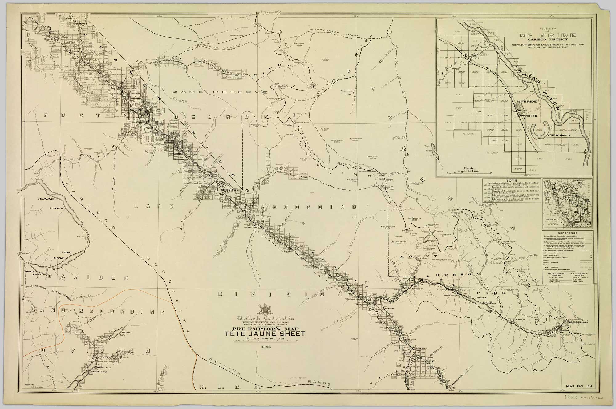
Map depicting surveyed lands, statutory timber lands, land recording divisions, game reserves, communities, bodies of water, and transport routes. Department of Lands, British Columbia
Northern British Columbia Archives
This map includes:
Avalanche Pass
Beaverdam Pass
Mount Calco [(Chalco Mountain)]
Cariboo (railway point)
Mount Chown
Clyde Creek
Coyote Creek [as “Curve Cr. (Coyote)”]
Mount Curley
Curve Creek [Curve Cr. (Coyote)]
Derr Creek
Mount Dinosaur
Mount Felix
Forgetmenot Creek
Foster
Gendarme Mountain
Mount Gilbert
Mount Haig
Hellroaring Creek
Mount Jess
Kataka Mountain
Laselle Creek
Last Hope Pass
McBride
Mount McNaughton
Milton Creek
Pamm Creek
Mount Pang
Rearguard (railway point)
Mount Renshaw
Mount Resthaven
Rockingham Creek
Mount Ross
Salient Mountain
Snake Indian River
Swede Creek [as “West Twin (Swede)”]
Tumbledick Creek
Twintree Lake
Upright Mountain
West Twin Creek [West Twin (Swede)]
Mount Whistler
Wolverine Pass