British Columbia. Mount
S of Canoe River, just SW of Valemount
52.7 N 119.5333 W — Map 83D/12 — Google — GeoHack
Earliest known reference to this name is 1949
Name officially adopted in 1963
Official in BC – Topo map from Canadian Geographical Names
S of Canoe River, just SW of Valemount
52.7 N 119.5333 W — Map 83D/12 — Google — GeoHack
Earliest known reference to this name is 1949
Name officially adopted in 1963
Official in BC – Topo map from Canadian Geographical Names
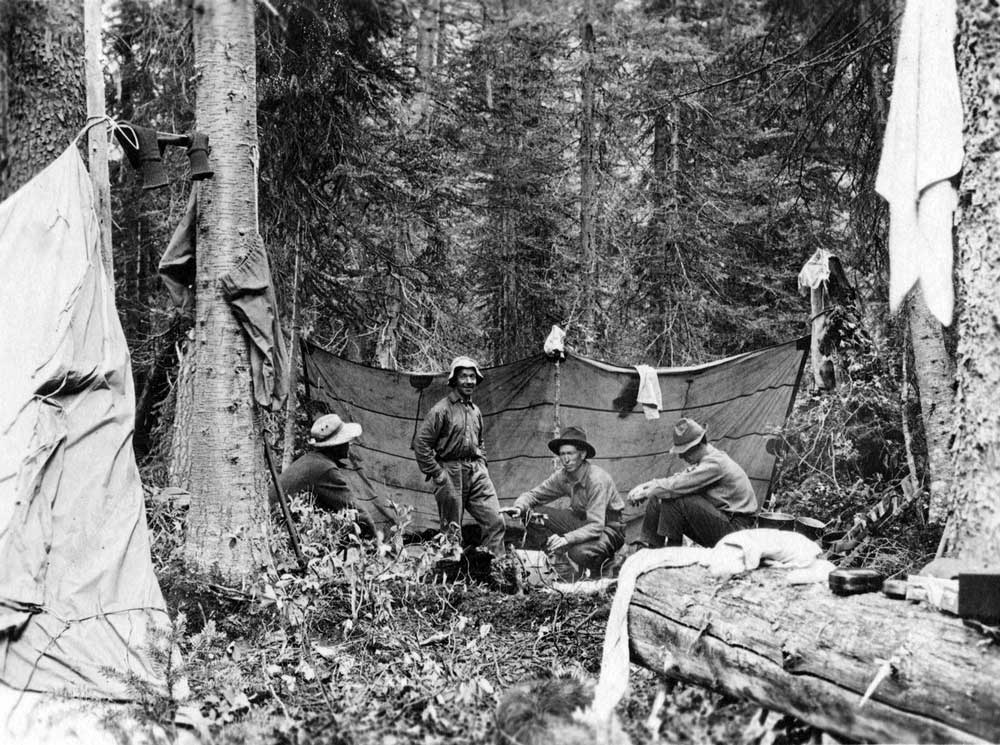
Rollin T. Chamberlin, L. E. “Slim” Goodell, Allen Carpe, A. L. Withers. Photo George Burns
University of Chicago
Allen Carpé [1894–1932] was an American engineer and mountaineer who in 1924, along with Rollin Thomas Chamberlin [1881–1948], and A. L. (Pete) Withers, went up Tête Creek “and made some fine climbs, among them Mount Sir Wilfrid Laurier.” (1) Carpé was a member of the Alpine Club of Canada since 1920. He lost his life on Mount McKinley in May 1932, as the leader of a party making scientific observations relating to cosmic rays.
The name was adopted at the suggestion of the Alpine Club of Canada following a proposal by the 1949 mountaineering party of Sterling Brown Hendricks [1902–1981] and Andrew John Kauffman [1920–2002].(2)
References:
- 1. Zillmer, Raymond T. [1887–1960]. “Explorations in the Southern Cariboos.” Canadian Alpine Journal, Vol. 27 (1939):48-61
- 2. Hendricks, Sterling Brown [1902–1981], and Kauffman, Andrew John [1920–2002]. “Cariboo Climbing.” American Alpine Journal, 7:2 (1950). American Alpine Club