Yellow Head Pass to Kamloops. George Monro Grant, plate 34
Ocean to Ocean: Sandford Fleming’s Expedition through Canada in 1872
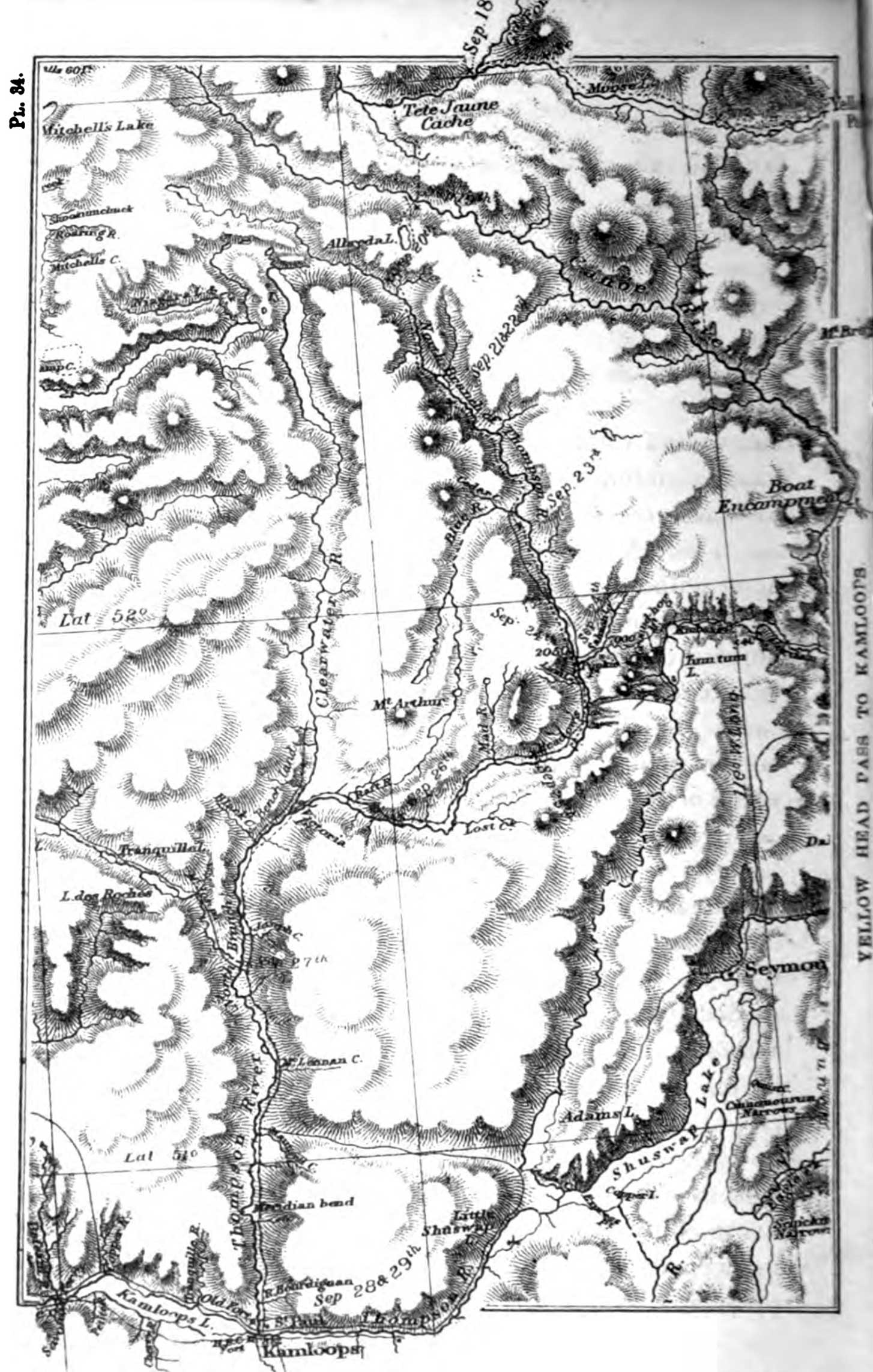
Our maps of the country, east of the Rocky Mountains, are mainly from Captain Palliser’s; those of the Pacific slope from Governor Trutch’s map of British Columbia. For a number of the plates illustrating the Dawson route we are indebted to Mr. Desbarats and his artists; to the latter and to a kind lady in Ottawa, for making pictures out of our own rude but, we believe, faithful outlines.
George-Paschal Desbarats [1808–1864] was a French-Canadian printer, publisher, businessman, and landowner. In September 1841 Desbarats and Stewart Derbishire received an appointment as “Her Majesty’s Printer and Law Printer in and for the Province of Canada”; as the Queen’s printers they had an exclusive contract to print and distribute government publications in the Province of Canada, a contract Desbarats maintained throughout his life.
- Grant, George Monro [1835–1902]. Ocean to Ocean: Sandford Fleming’s Expedition through Canada in 1872. Being a Diary Kept During a Journey from the Atlantic to the Pacific with the Expedition of the Engineer-in-Chief of the Canadian Pacific and Intercolonial Railways. Toronto: James Campbell and Son, 1873. Google Books