Sketch map of part of the Cariboo Mountains
W.A.D. Munday Canadian Alpine Journal 1925
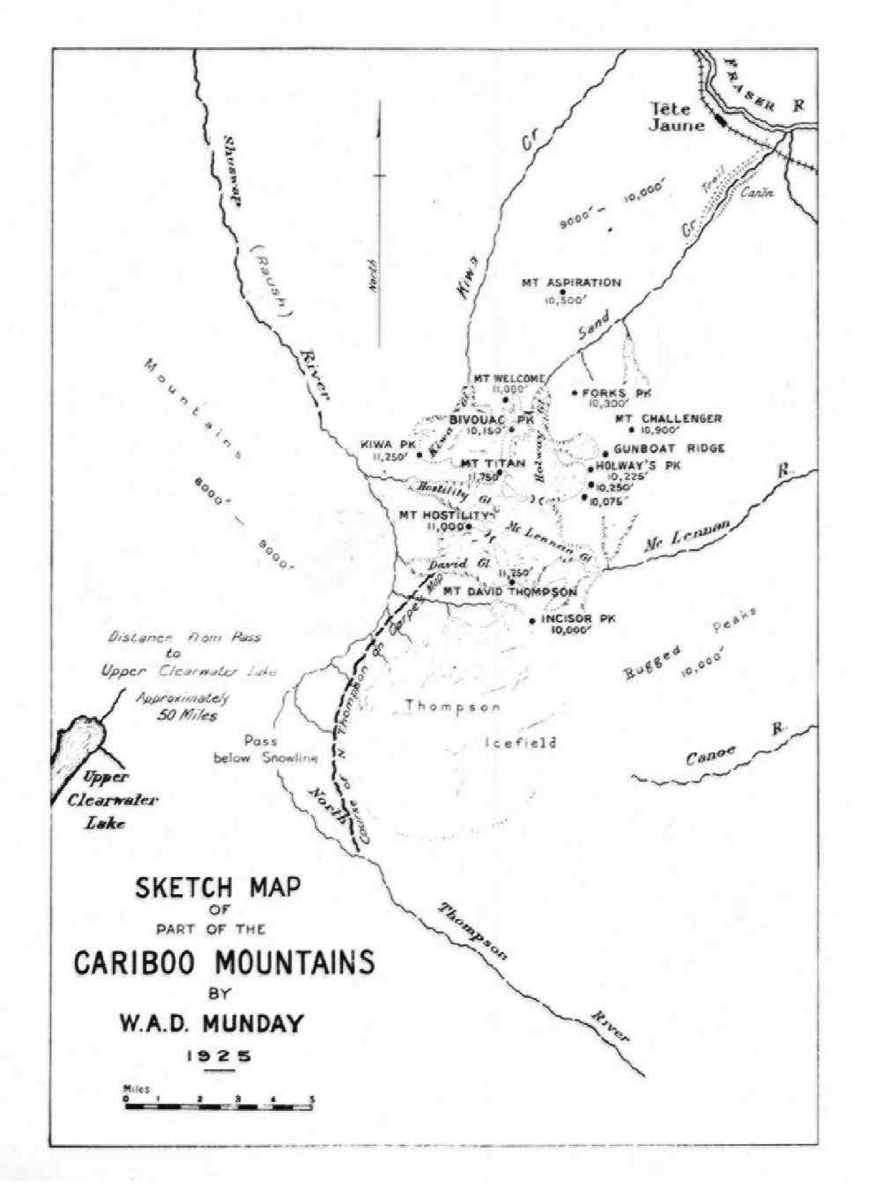
Most of the names on this map that are still in use were proposed previous to Munday, except perhaps “Thompson Icefield,” now “Thompson Glacier.” Many of the names were superseded in 1927 by the Order in Council that created the Premier Range.
Mount Aspiration [now Mount John Oliver]
Bivouac Peak [former name]
Cariboo Mountains
Mount Challenger [now Mount Stanley Baldwin]
Mount David Thompson [now Mount Sir John Thompson]
David Glacier
Gunboat Mountain [as Gunboat Ridge]
Holways Peak [now Penny Mountain]
Mount Hostility [now Mount Mackenzie King]
Incisor Peak [former name]
Kiwa Creek
Kiwa Peak [former name]
Sand Creek [now Tête Creek]
Thompson Glacier [as Thompson Icefield]
Mount Titan [now Mount Sir Wilfrid Laurier]
Mount Welcome [former name]
- Munday, Walter Alfred Don [1890–1950]. “In the Cariboo Range – Mt. David Thompson.” Canadian Alpine Journal, Vol. 15 (1925):130-136
- Munday, Walter Alfred Don [1890–1950]. “River Sources in Cariboo Mountains.” Canadian Alpine Journal, Vol. 17 (1928):76
- Munday, Walter Alfred Don [1890–1950]. “The Cariboo Range. Canadian Pacific Railway surveyors and modern climbers.” Canadian Alpine Journal, Vol. 28 (1940)
- Munday, Walter Alfred Don [1890–1950]. “Correspondence – The Cariboo Range.” American Alpine Journal, Vol. 4, No. 2 (1941). American Alpine Club
- Munday, Walter Alfred Don [1890–1950]. “That terrible snow-peaked range.” Canadian Alpine Journal, Vol. 31 (1948):77-80