Category Archives: People

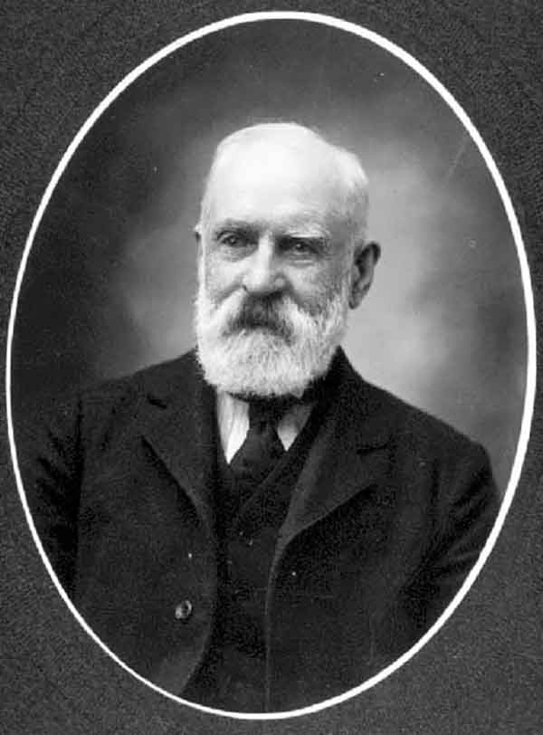
Hugh Drummond Allan

Hugh Drummond Allan [1887–1917]

b. 1887 — Partick, Lanarkshire, Scotland
d. 1917 — Croiselles, France

Hugh Drummond Allan was born in Scotland and came to Canada around 1907. He became a British Columbia Land Surveyor in 1912. His professional work was carried on mainly in the Kamloops district and the North Thompson River valley. In 1913 he surveyed in the Canoe River area. “From Mile 49 on the Grand Trunk Pacific I proceeded with my party by wagon and reached the Canoe River in one day,” he reported.

After the start of the first World War he returned to Scotland and enlisted in Princess Louise’s (Argyll and Sutherland Highlanders). In 1916 he was wounded, and in 1917 he was killed leading his company at Croiselles, France. Lieutenant (or Captain) Allan was shortly predeceased by his wife and infant child.

The British Columbia Archives has the following items related to Hugh Drummond Allan (none available online as of 2022):

Photograph, ca. 1890
Photograph of Captain Hugh Drummond Allan, ca. 1914
Probate record from Kamloops Supreme Court, 1918

The National Archives of the U.K. has officer service records pertaining to Lieutenant Hugh Drummond Allan of Princess Louise’s (Argyll and Sutherland Highlanders).

There is another Canadian figure of Scottish birth named Hugh Allan [1810–1882], a shipping magnate.

Sources of biographical information about Allan:

  • Corporation of Land Surveyors of the Province of British Columbia. Annual Reports (1956).
  • Andrews, Gerald Smedley [1903–2005]. Métis outpost. Memoirs of the first schoolmaster at the Métis settlement of Kelly Lake, B.C. 1923-1925. Victoria: G.S. Andrews, 1985
Allan is the namesake of the following places in the Mount Robson region:

Works pertinent to the Mount Robson region of which Allan was author or co-author:

  • —   “Canoe River Valley.” Report of the Minister of Lands, (1914)

A. L. Withers

A. L. (Pete) Withers

Sources of biographical information about Withers:

  • Bennett, Russell H. “The Ski Ascent of Snow Dome.” Canadian Alpine Journal, Vol 20 (1931):100-101
  • Scott, Chic. “Jasper to Banff on skis.” Mountain Heritage Magazine, Vol. 2, No. 1 (1999) Whyte Museum
Withers is the namesake of the following places in the Mount Robson region:

Events in the Mount Robson region in which Withers was involved:

  • 1924 Chamberlin party Cariboos

Rollin Thomas Chamberlin

Rollin Thomas Chamberlin [1881–1948]

b. 1881 — Beloit, Wisconsin, USA
d. 1948

Rollin Thomas Chamberlin, 1881-1948, was a geologist and mountaineer at Chicago, Illinois. Chamberlin was an eminent Professor of Geology at the University of Chicago who, in 1910, made numerous guided climbs in the Rocky and Selkirk Mountains, including the Lake Louise, Lake O’Hara, Field and Glacier areas. In 1924, Chamberlin, Allen Carpe and A. L. Withers made a number of first ascents in the Cariboo Mountains, including Mount Titan (now Mount Sir Wilfred Laurier) and Mount Challenger.

Sources of biographical information about Chamberlin:

  • Pettijohn, F. J. “Rollin Thomas Chamberlin: a Biographical Memoir.” (1970) National Academy of Sciences
  • Chamberlin, Rollin Thomas [1881–1948]. Rollin T. Chamberlin fonds V22. 1910–1927 Whyte Museum
Chamberlin is the namesake of the following places in the Mount Robson region:

Events in the Mount Robson region in which Chamberlin was involved:

  • 1924 Chamberlin party Cariboos
Works pertinent to the Mount Robson region of which Chamberlin was author or co-author:

  • —   Rollin T. Chamberlin fonds. V22 (1910–1927).
  • —   Rollin T. Chamberlin fonds V22. 1910–1927
  • —   “Exploration of the Cariboo Mountains of British Columbia.” Bulletin of the Geographical Society of Philadelphia, 25 (1925):59-76

Allen Carpé

Allen Carpé [1894–1932]

b. 1894 — Chicago,
d. 1932

Sources of biographical information about Carpé:

  • Annual Report of the Director of the National Park Service to the Secretary of the Interior for the Fiscal Year Ended June 30, 1932, and the Travel Season, 1932. Washington: United States Government Printing Office, 1932 Google Books
  • Wikipedia. Alen Carpé
Carpé is the namesake of the following places in the Mount Robson region:

Events in the Mount Robson region in which Carpé was involved:

  • 1924 Chamberlin party Cariboos
Works pertinent to the Mount Robson region of which Carpé was author or co-author:

  • —   “Climbs in Cariboo Mts. and Northern Gold Range, Interior Ranges of British Columbia.” Alpine Journal, Vol. 37 (1925):63
  • —   “Albreda Mountain.” Canadian Alpine Journal, Vol. 16 (1927–1927):177
  • —   “The Cariboo Mountains – Correction.” Canadian Alpine Journal, Vol. 16 (1927–1927):177

Dalby Brooks Morkill

Dalby Brooks Morkill [1880–1955]

b. 1880 — Sherbrooke, Québec, Canada
d. 1955 — Vancouver, B.C., Canada

Morkill came to British Columbia in 1898. He received his commission as a British Columbia Land Surveyor in 1910. Morkill was employed in 1912 by the British Columbia government making surveys on the Fraser River between Horsey Creek and Holmes River. In 1913, with Alan S. Thompson, Morkill surveyed between the Goat River and Catfish Creek. Morkill worked on the Alberta-British Columbia Boundary Commission surveys north of Yellowhead Pass in the early 1920s. Subsequently Morkill surveyed in several other areas of the Province. During his last years he spent summers at his residence at Barkerville and winters in Vancouver. He was president of the Association of BC Land Surveyors in 1928.

Sources of biographical information about Morkill:

  • Andrews, Gerald Smedley [1903–2005]. Professional Land Surveyors of British Columbia. Cumulative nominal roll. Victoria: Corporation of Land Surveyors of British Columbia, 1978
  • Corporation of Land Surveyors of the Province of British Columbia. Annual Reports.
Morkill is the namesake of the following places in the Mount Robson region:

Events in the Mount Robson region in which Morkill was involved:

  • 1912 Morkill Surveys
Works pertinent to the Mount Robson region of which Morkill was author or co-author:

  • —   “Report on survey on the south fork of the Fraser River, between Horsey Creek and Holmes River. December 28, 1912.” Report of the Minister of Lands, (1913). Google Books
  • —   Report on Survey of the south fork of Fraser River from Horse Creek to Beaver River, Cariboo District. December 28, 1912. Victoria: Government of British Columbia, 1913. Google Books
  • —   “Report on survey on south fork of the Fraser River, between Goat River and Catfish Creek. December 15, 1913.” Report of the Minister of Lands for the Province of British Columbia for the Year Ending 31st December 1913, (1914):423. Google Books

Samuel Prescott Fay

Samuel Prescott Fay [1884–1971]

b. 1884
d. 1971

“Pete” Fay as he was known to his friends had been a member of the [American Alpine] Club for 59 years at the time of his death last August [1971]. His qualifications for election in 1912 were four seasons in the Canadian Rockies beginning in 1906. In 1914 he joined a Smithsonian expedition which left Jasper, Alberta in June for the purposes of exploration, mapping and the collection of birds and mammals in the northern Rockies. Reports were filed with the Biological Survey in Washington. In mid-October the party met a trapper who showed them an old newspaper with reports of the first weeks of World War I of which they had no inkling. For the next three or four days they traveled non-stop to reach Hudson Hope on the Peace River.
Pete graduated from Harvard in 1907. During World War I he joined the American Field Service to drive an ambulance in France and later served with the Air Force in France and Belgium. Afterwards he was associated with an investment counseling firm in Boston for many years. Aside from two years on the Council (1930-1932), he did not take an active part in Club affairs, though he attended frequent meetings. Frail health confined him to his home for the last ten or more years.

Sources of biographical information about Fay:

  • Fay, Samuel Prescott [1884–1971]. The Forgotten Explorer: Samuel Prescott Fay’s 1914 Expedition to the Northern Rockies. Edited by Charles Helm and Mike Murtha. Victoria, B.C.: Rocky Mountain Books, 2009
  • Hall, Henry S. “Samuel Prescott Fay, 1884–1971.” American Alpine Journal, (1972) American Alpine Club
Events in the Mount Robson region in which Fay was involved:

  • 1912 SP Fay Mt. Sir Alexander
  • 1914 SP Fay Jasper to Hudsons Hope
Works pertinent to the Mount Robson region of which Fay was author or co-author:

  • —   Jasper-Yellowhead Historical Society. Album of pictures accompanying S.P. Fay journal of trip through Rockies from Yellowhead, Alberta, Pass, to Peace River at Hudsons Hope, B.C, 1914. JYHS No. 84 or 91 (1912–1914).
  • —   “Mount Alexander.” Canadian Alpine Journal, Vol. 6 (1914–1915):121
  • —   “Note on Mount Alexander Mackenzie and Mount Ida.” Alpine Journal, Vol. 36 (1924):421
  • —   The Forgotten Explorer: Samuel Prescott Fay’s 1914 Expedition to the Northern Rockies. Edited by Charles Helm and Mike Murtha. Victoria, B.C.: Rocky Mountain Books, 2009

Charles Doolittle Walcott

Charles Doolittle Walcott [1850–1927]

b. 1850
d. 1927

Charles Doolittle Walcott (March 31, 1850 – February 9, 1927) was an American paleontologist, administrator of the Smithsonian Institution from 1907 to 1927, and director of the United States Geological Survey.[1][2] He is famous for his discovery in 1909 of well-preserved fossils, including some of the oldest soft-part imprints, in the Burgess Shale of British Columbia, Canada.

Sources of biographical information about Walcott:

Events in the Mount Robson region in which Walcott was involved:

  • 1912 Walcott Smithsonian
  • 1913 ACC Camp – Mount Robson
Works pertinent to the Mount Robson region of which Walcott was author or co-author:

  • Walcott Jr., Charles D., and —   “A geologist’s paradise.” National Geographic Magazine, 22, no. 6 (1911):WM 03.2 W14ge
  • —   “The monarch of the Canadian Rockies.” National Geographic Magazine, (1913):626. Internet Archive

Gabriel Franchère

Gabriel Franchère

Gabriel Franchère
Wikipedia

Gabriel Franchère [1786–1863]

b. 1786
d. 1863

Sources of biographical information about Franchère:

Works pertinent to the Mount Robson region of which Franchère was author or co-author:

  • —   Relation d’un voyage à la Côte du Nord-Ouest de l’Amerique Septentrionale. Montréal: 1820
  • —   Narrative of a Voyage to the Northwest Coast of America, in the years 1811, 1812, 1813, and 1814, or the First American Settlement on the Pacific. Translated and edited by J. V. Huntington. New York: Bedfield, 1854. Gutenberg

Paul Kane

Paul Kane
Self-portrait, 1846-1848

Paul Kane
Self-portrait, 1846-1848
Wikipedia


Jasper House East Side Rocky Mountains
Field sketch, 1847

Jasper House East Side Rocky Mountains
Field sketch, 1847
Wikipedia


Paul Kane, “Boat Encampment,” Hudson’s Bay Company voyaguers, oil on canvas, 1849–1856

Paul Kane, “Boat Encampment,” Hudson’s Bay Company voyaguers, oil on canvas, 1849–1856
Royal Ontario Museum ROM2009_11209_41

Paul Kane [1810–1871]

b. 1810 — Mallow, County Cork, Ireland
d. 1871 — Toronto, Ontario, Canada

Kane was an Irish-born Canadian painter, famous for his paintings of First Nations peoples in the Canadian West and other Native Americans in the Columbia Departmentof the fur trade.

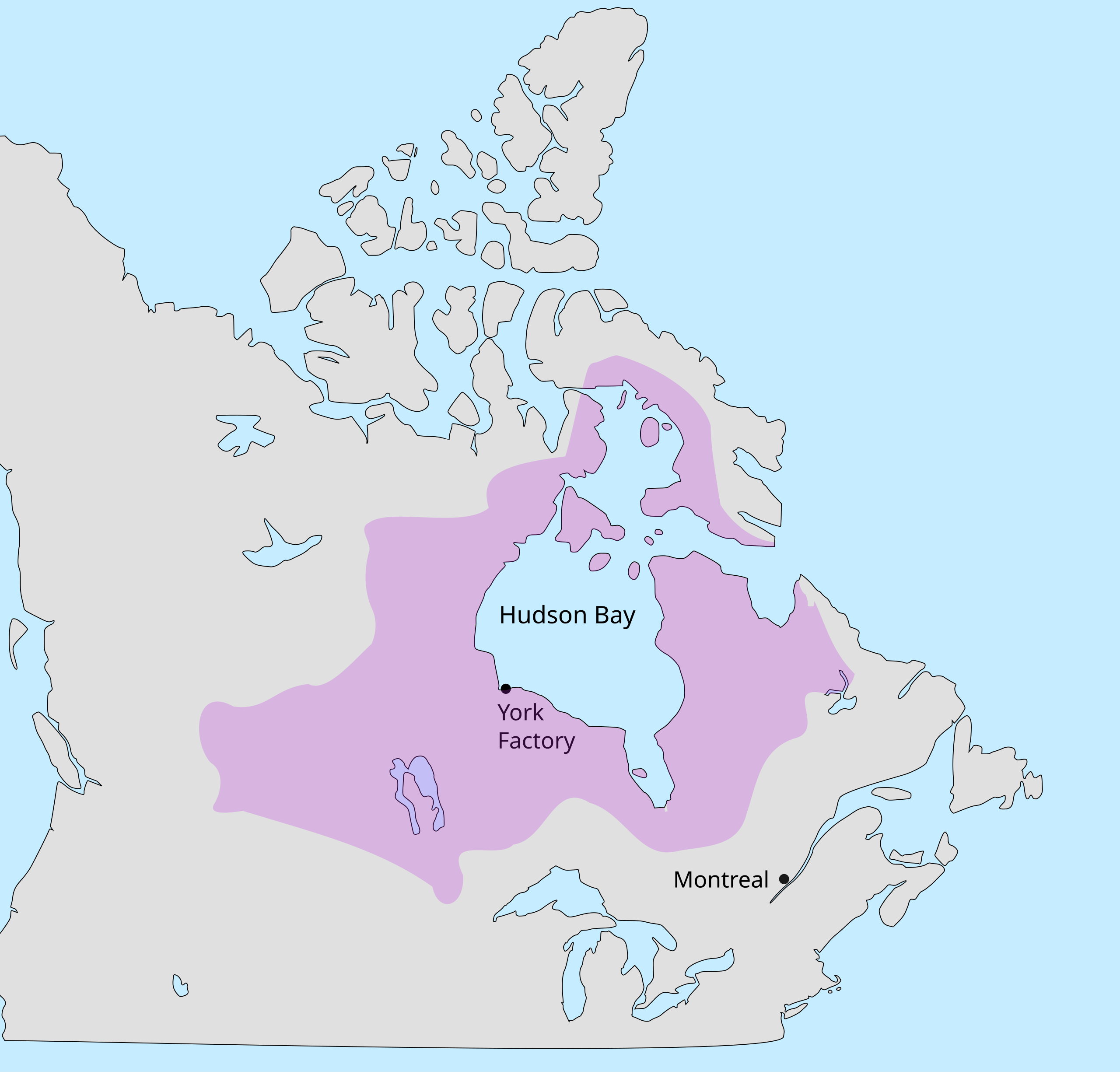
A largely self-educated artist, Paul Kane grew up in York, Upper Canada (now Toronto), and trained himself by copying European masters on a “Grand Tour” study trip through Europe. He undertook two voyages through the Canadian northwest in 1845 and from 1846 to 1848. The first trip took him from Toronto to Sault Ste. Marie and back. Having secured the support of the Hudson’s Bay Company, he set out on a second, much longer voyage from Toronto across the Rocky Mountains. On October 6, 1846, Kane left Edmonton for Fort Assiniboine, where he again embarked with a canoe brigade up the Athabasca River to Jasper House, arriving on November 3. Here he joined a large horse troop bound west, but the party soon had to send the horses back to Jasper’s House and continue on snowshoes, taking only the essentials with them, because Athabasca Pass was already too deeply snowed in that late in the year. They crossed the pass on November 12 and three days later joined a canoe brigade that had been waiting to take them down the Columbia River to Fort Vancouver (present-day Vancouver, Washington) and Fort Victoria (present day Victoria, British Columbia).

On both trips Kane sketched and painted First Nations and Métis peoples. Upon his return to Toronto, he produced more than one hundred oil paintings from these sketches. The oil paintings he completed in his studio are considered a part of the Canadian heritage, although he often embellished them considerably, departing from the accuracy of his field sketches in favour of more dramatic scenes.

Sources of biographical information about Kane:

Kane is the namesake of the following places in the Mount Robson region:

Events in the Mount Robson region in which Kane was involved:

  • 1846 Kane through Athabasca Pass
Works pertinent to the Mount Robson region of which Kane was author or co-author:

  • —   Wanderings of an artist among the Indians of North America. From Canada to Vancouver’s Island and Oregon through the Hudson’s Bay Company’s territory and back again. London: Longman, Brown, 1859

Richard William Cautley

Richard William Cautley [1873–1953]

b. 1873 — Ipswich, England
d. 1953 — Victoria, BC, Canada

Richard William Cautley [1873–1953]

Sources of biographical information about Cautley:

  • Sherwood, Jay. Surveying the Great Divide. The Alberta/BC Boundary Survey, 1913-1917. Qualicum Beach, BC: Caitlin Press, 2017
Events in the Mount Robson region in which Cautley was involved:

  • 1917 Boundary Comission Survey Yellowhead Pass
  • 1923 Boundary Comission Survey completed to Robson
  • 1924 ACC Camp – Mount Robson (guide)
Works pertinent to the Mount Robson region of which Cautley was author or co-author:

  • — and Wallace, James Nevin [d. 1941]; Wheeler, Arthur Oliver [1860–1945]. Report of the Commission Appointed to Delimit the Boundary between the Provinces of Alberta and British Columbia. Part I: From 1913 to 1916. Ottawa: Office of the Surveyor General, 1917
  • —   “Characteristics of passes in the Canadian Rockies..” Canadian Alpine Journal, Vol. 12 (1921–1922):117-123
  • —  and Wheeler, Arthur Oliver [1860–1945]. Report of the Commission appointed to delimit the boundary between the Provinces of Alberta and British Columbia. Part II. 1917 to 1921. From Kicking Horse Pass to Yellowhead Pass.. Ottawa: Office of the Surveyor General, 1924. Whyte Museum
  • —  and Wheeler, Arthur Oliver [1860–1945]. Report of the Commission Appointed to Delimit the Boundary between the Provinces of Alberta and British Columbia – Part III – from 1918 to 1924. Atlas. Ottawa: Office of the Surveyor General, 1925
  • —  and Wheeler, Arthur Oliver [1860–1945]. Report of the Commission Appointed to Delimit the Boundary between the Provinces of Alberta and British Columbia. Parts IIIA & IIIB, 1918 to 1924. From Yellowhead Pass Northerly. Ottawa: Office of the Surveyor General, 1925. Whyte Museum
  • —   High lights of memory : incidents in the life of a Canadian surveyor. 1950. Whyte Museum